Category:United Kingdom photographs taken on 2020-05-11
Jump to navigation
Jump to search
Countries of Europe: Austria · Belgium · Denmark · Finland · France‡ · Germany · Greece · Italy · Netherlands‡ · Norway · Poland · Portugal‡ · Romania · Russia‡ · Spain‡ · Sweden · Switzerland · Turkey‡ · Ukraine · United Kingdom
‡: partly located in Europe
‡: partly located in Europe
| ← | 11 May 2020 | → | ||
| ← | May 2020 | → | ||

United Kingdom photographs taken on 11 May 2020.
Image files should be categorized here automatically using {{taken on}} template. Direct categorisation is also possible, if automatic is impossible.
Media in category "United Kingdom photographs taken on 2020-05-11"
The following 77 files are in this category, out of 77 total.
-
 2013 Vauxhall Insignia Techline CDTi Ecoflex 2.0 Front.jpg 2,757 × 1,995; 1.31 MB
-
 2013 Vauxhall Insignia Techline CDTi Ecoflex 2.0 Rear.jpg 3,119 × 1,821; 1.44 MB
-
 A64 bridge - geograph.org.uk - 6470735.jpg 1,024 × 683; 507 KB
-
 A64 from above - geograph.org.uk - 6470738.jpg 1,024 × 683; 482 KB
-
 Across Walmgate Stray - geograph.org.uk - 6470713.jpg 1,024 × 683; 505 KB
-
 Barley near Lodge Farm - geograph.org.uk - 6470731.jpg 1,024 × 683; 474 KB
-
 Bernhard Langer's Oak - geograph.org.uk - 6470827.jpg 1,024 × 683; 569 KB
-
 Black Dyke Band Room.jpg 2,514 × 3,520; 6.45 MB
-
 Boots in a skip - 2020-05-11 - Andy Mabbett.jpg 3,872 × 2,592; 4.11 MB
-
 Bright pink carnation cultivar - 2020-05-11 - Andy Mabbett - 01.jpg 3,872 × 2,592; 3.72 MB
-
 Bright pink carnation cultivar - 2020-05-11 - Andy Mabbett - 02.jpg 3,872 × 2,592; 3.59 MB
-
 Bright pink carnation cultivar - 2020-05-11 - Andy Mabbett - 03.jpg 3,872 × 2,592; 3.97 MB
-
 Bright pink carnation cultivar - 2020-05-11 - Andy Mabbett - 04.jpg 3,872 × 2,592; 3.94 MB
-
 Bright pink carnation cultivar - 2020-05-11 - Andy Mabbett - 05.jpg 3,872 × 2,592; 4.02 MB
-
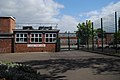
 Calshot Primary School - 2020-05-11 - Andy Mabbett - 01.jpg 3,872 × 2,592; 4.45 MB
-
 Calshot Primary School - 2020-05-11 - Andy Mabbett - 02.jpg 3,872 × 2,592; 4.36 MB
-
 Calshot Primary School - 2020-05-11 - Andy Mabbett - 03.jpg 3,872 × 2,592; 4.41 MB
-
 Club house at Fulford Golf Course - geograph.org.uk - 6470832.jpg 1,024 × 683; 437 KB
-
 Cross Flatts Park, Beeston.jpg 3,120 × 4,160; 4.01 MB
-
 Descending from the bridge - geograph.org.uk - 6470740.jpg 1,024 × 683; 591 KB
-
 Drain on Low Moor - geograph.org.uk - 6470710.jpg 1,024 × 683; 398 KB
-
 Edge of a barley field - geograph.org.uk - 6470798.jpg 1,024 × 683; 621 KB
-
 Family of sheep - geograph.org.uk - 6470771.jpg 1,024 × 683; 480 KB
-
 Farmland beside the golf course - geograph.org.uk - 6470793.jpg 1,024 × 683; 466 KB
-
 Field irrigation - geograph.org.uk - 6470753.jpg 1,024 × 683; 671 KB
-
 Footpath approaching the Tillmire - geograph.org.uk - 6470759.jpg 1,024 × 683; 592 KB
-
 Footpath to Heslington Tillmire - geograph.org.uk - 6470758.jpg 1,024 × 683; 613 KB
-
 Fulford Golf Course - geograph.org.uk - 6470787.jpg 1,024 × 683; 480 KB
-
 Fulford Golf Course - geograph.org.uk - 6470788.jpg 1,024 × 683; 502 KB
-
 Fulford golf course - geograph.org.uk - 6470825.jpg 1,024 × 683; 477 KB
-
 Germany Lane - geograph.org.uk - 6470725.jpg 1,024 × 683; 498 KB
-
 Halfway House, Queensbury.jpg 3,500 × 3,390; 7.55 MB
-
 Heslington Tillmire - geograph.org.uk - 6470777.jpg 1,024 × 683; 458 KB
-
 Joggers on Forest Lane - geograph.org.uk - 6470750.jpg 1,024 × 683; 512 KB
-
 Land beside Germany Lane - geograph.org.uk - 6470724.jpg 1,024 × 683; 510 KB
-
 Low Moor - geograph.org.uk - 6470714.jpg 1,024 × 683; 507 KB
-

-
 Part of Fulford Golf Course - geograph.org.uk - 6470783.jpg 1,024 × 683; 495 KB
-
 Path from Low Moor - geograph.org.uk - 6470716.jpg 1,024 × 683; 688 KB
-
 Path from Tillmire Farm - geograph.org.uk - 6470757.jpg 1,024 × 683; 558 KB
-
 Path near Tillmire Farm - geograph.org.uk - 6470754.jpg 1,024 × 683; 583 KB
-
 Path on East Moor - geograph.org.uk - 6470719.jpg 1,024 × 683; 611 KB
-
 Path to Heslington Tillmire - geograph.org.uk - 6470756.jpg 1,024 × 683; 508 KB
-
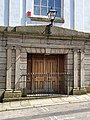 Penzance - Masonic Hall entrance.jpg 3,024 × 4,032; 3.74 MB
-
 Penzance - Masonic Hall.jpg 3,456 × 4,608; 4.12 MB
-
 Perrywood Road substation, Birmingham - 2020-05-11 - Andy Mabbett - 01 (rectified).png 3,856 × 2,580; 13.85 MB
-
 Perrywood Road substation, Birmingham - 2020-05-11 - Andy Mabbett - 01.jpg 3,872 × 2,592; 4.62 MB
-
 Perrywood Road substation, Birmingham - 2020-05-11 - Andy Mabbett - 02.jpg 3,872 × 2,592; 3.88 MB
-
 Perrywood Road substation, Birmingham - 2020-05-11 - Andy Mabbett - 03.jpg 3,872 × 2,592; 4.04 MB
-
 Pond near Germany Beck - geograph.org.uk - 6470722.jpg 1,024 × 683; 630 KB
-
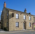
 Queensbury Post Office (Cottage Stores).jpg 3,081 × 3,106; 7.3 MB
-
 Red edged cream carnation cultivar - 2020-05-11 - Andy Mabbett - 01.jpg 3,872 × 2,592; 3.47 MB
-
 Red edged cream carnation cultivar - 2020-05-11 - Andy Mabbett - 02.jpg 3,872 × 2,592; 3.36 MB
-
 Red edged cream carnation cultivar - 2020-05-11 - Andy Mabbett - 03.jpg 3,872 × 2,592; 3.37 MB
-
 Red edged cream carnation cultivar - 2020-05-11 - Andy Mabbett - 04.jpg 3,872 × 2,592; 3.34 MB
-
 Red edged cream carnation cultivar - 2020-05-11 - Andy Mabbett - 05.jpg 3,872 × 2,592; 3.6 MB
-
 Red edged cream carnation cultivar - 2020-05-11 - Andy Mabbett - 06.jpg 3,872 × 2,592; 3.36 MB
-
 Red edged cream carnation cultivar - 2020-05-11 - Andy Mabbett - 07.jpg 3,872 × 2,592; 3.35 MB
-
 Red Paeony flower - 2020-05-11 - Andy Mabbett - 01.jpg 3,872 × 2,592; 4.04 MB
-
 Red Paeony flower - 2020-05-11 - Andy Mabbett - 02.jpg 3,872 × 2,592; 3.93 MB
-
 Red Paeony flower - 2020-05-11 - Andy Mabbett - 03.jpg 3,872 × 2,592; 4.25 MB
-
 Red Paeony flower - 2020-05-11 - Andy Mabbett - 04.jpg 3,872 × 2,592; 4.34 MB
-
 Red Paeony flower - 2020-05-11 - Andy Mabbett - 05.jpg 3,872 × 2,592; 4.44 MB
-
 Red Paeony flower - 2020-05-11 - Andy Mabbett - 06.jpg 3,872 × 2,592; 4.22 MB
-
 Red Paeony flower - 2020-05-11 - Andy Mabbett - 07.jpg 3,872 × 2,592; 4.2 MB
-
 Sheep on the edge of the Tillmire - geograph.org.uk - 6470775.jpg 1,024 × 683; 530 KB
-
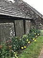 St Vigean churchyard wall Left.jpg 3,024 × 4,032; 4.06 MB
-
 Through the hedgerow - geograph.org.uk - 6470726.jpg 1,024 × 683; 634 KB
-
 Tillmire and golf course - geograph.org.uk - 6470781.jpg 1,024 × 683; 487 KB
-
 Track over the A64 - geograph.org.uk - 6470734.jpg 1,024 × 683; 576 KB
-
 Tree on Low Moor - geograph.org.uk - 6470712.jpg 1,024 × 683; 565 KB
-
 Trees amongst the barley - geograph.org.uk - 6470791.jpg 1,024 × 683; 593 KB
-
 Trees behind Bray Road - geograph.org.uk - 6470717.jpg 1,024 × 683; 804 KB
-
 Trees beside Newton Way - geograph.org.uk - 6470836.jpg 1,024 × 683; 674 KB
-
 Winter barley fields - geograph.org.uk - 6470796.jpg 1,024 × 683; 524 KB
-
 Winter Barley near Germany Lane - geograph.org.uk - 6470730.jpg 1,024 × 683; 553 KB
-
 Young trees and Germany Beck - geograph.org.uk - 6470720.jpg 1,024 × 683; 563 KB


.jpg)


.png)


.jpg)


