Category:United States Senate election maps of South Dakota
Jump to navigation
Jump to search
States of the United States: Alabama · Alaska · Arizona · Arkansas · California · Colorado · Connecticut · Delaware · Florida · Hawaii · Idaho · Illinois · Indiana · Iowa · Kansas · Kentucky · Louisiana · Maine · Maryland · Massachusetts · Michigan · Minnesota · Mississippi · Missouri · Montana · Nebraska · Nevada · New Hampshire · New Jersey · New Mexico · New York · North Carolina · North Dakota · Ohio · Oklahoma · Oregon · Pennsylvania · Rhode Island · South Carolina · South Dakota · Tennessee · Texas · Utah · Vermont · Virginia · Washington · West Virginia · Wisconsin · Wyoming
Subcategories
This category has only the following subcategory.
Media in category "United States Senate election maps of South Dakota"
The following 14 files are in this category, out of 14 total.
-
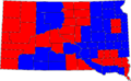
 02SDsenatecounties.PNG 800 × 492; 53 KB
-
 04SDsenatecounties.PNG 800 × 492; 77 KB
-
 08SDSenateCounties.PNG 800 × 492; 76 KB
-
 1968 senate election in SD.svg 744 × 474; 203 KB
-
 2008 US Senate election in South Dakota by precinct.svg 810 × 573; 3.89 MB
-
-
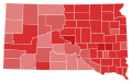
 80SDSenateCounties.PNG 800 × 492; 76 KB
-
 86SDSenateCounties.PNG 800 × 492; 77 KB
-
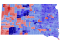
 96SDSenateCounties.PNG 800 × 492; 76 KB
-
 98Daschle.png 324 × 294; 5 KB
-
 South Dakota Senate Election Results by County, 1962.svg 243 × 152; 26 KB
-
 South Dakota Senate Election Results by County, 1968.svg 243 × 152; 26 KB
-
 South Dakota Senate Election Results by County, 1972.svg 243 × 152; 26 KB
-
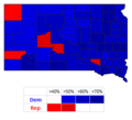
 South Dakota Senate Election Results by County, 2014 (Howie).svg 243 × 152; 38 KB


.svg)