Category:Upperthong
Jump to navigation
Jump to search
village in West Yorkshire, England, UK  | |||||
| Upload media | |||||
| Instance of | |||||
|---|---|---|---|---|---|
| Location | Holme Valley, Kirklees, West Yorkshire, Yorkshire and the Humber, England | ||||
 | |||||
English: Upperthong is a village approximately above sea level near the town of Holmfirth in the Holme Valley, approximately seven miles south of Huddersfield, West Yorkshire, England.
Subcategories
This category has only the following subcategory.
J
Media in category "Upperthong"
The following 44 files are in this category, out of 44 total.
-
 Binns Lane - Upperthong Lane - geograph.org.uk - 2007342.jpg 640 × 476; 84 KB
-
 Broad Lane - Upperthong Lane - geograph.org.uk - 2007335.jpg 640 × 480; 61 KB
-
 Bunker, Greenfield Road, Upperthong - geograph.org.uk - 503238.jpg 640 × 471; 94 KB
-
 Burnlee Road - Greenfield Road - geograph.org.uk - 2007946.jpg 640 × 480; 66 KB
-
 Footpath - Upperthong Lane - geograph.org.uk - 2007289.jpg 480 × 640; 123 KB
-

-

-

-
 Greenfield Road A635, Upperthong - geograph.org.uk - 1340026.jpg 640 × 424; 87 KB
-
 Harden Hill Road, Upperthong - geograph.org.uk - 494054.jpg 640 × 448; 68 KB
-
 Harden Moss Road, Upperthong - geograph.org.uk - 1340068.jpg 640 × 480; 154 KB
-
 Hillock Farm Upperthong, 1963 - geograph.org.uk - 3008488.jpg 3,104 × 1,927; 1.05 MB
-
 In Upperthong - geograph.org.uk - 3478267.jpg 1,600 × 1,067; 443 KB
-
 Little Lane - Greenfield Road - geograph.org.uk - 2007960.jpg 480 × 640; 74 KB
-
 Little Lane - Upperthong Lane - geograph.org.uk - 2007292.jpg 640 × 480; 82 KB
-
 Looking down Cliff Road, Holme - geograph.org.uk - 5518735.jpg 2,000 × 1,500; 927 KB
-

-
 Milepost 2, Greenfield Road, Upperthong (geograph 4474789).jpg 1,536 × 2,048; 1.02 MB
-
 Milepost 3, Greenfield Road, Upperthong (geograph 4474786).jpg 1,536 × 2,048; 1.1 MB
-
 Mill Pond, Holmfirh - geograph.org.uk - 2571861.jpg 4,320 × 3,240; 2.98 MB
-
 Modd Lane - Greenfield Road - geograph.org.uk - 2007952.jpg 640 × 480; 72 KB
-
 Moorland on Great Hill, Upperthong - geograph.org.uk - 5518649.jpg 2,000 × 1,500; 1.07 MB
-
 Newlands Lane, near Upperthong - geograph.org.uk - 3414786.jpg 3,240 × 4,320; 2.9 MB
-

-

-
 Peat block on Great Hill, Upperthong - geograph.org.uk - 5518655.jpg 2,000 × 1,475; 939 KB
-

-
 Shed - geograph.org.uk - 594334.jpg 640 × 464; 157 KB
-
 Slow for the Ford Inn - geograph.org.uk - 1400131.jpg 640 × 480; 65 KB
-
 The Ford Inn - geograph.org.uk - 1804232.jpg 3,648 × 2,736; 3.94 MB
-

-
 The Shepherd's Rest - geograph.org.uk - 34725.jpg 640 × 480; 75 KB
-
 Trees over Hart Holes Clough - geograph.org.uk - 1439251.jpg 640 × 480; 43 KB
-
 Upperthong (5747292391).jpg 3,755 × 2,503; 5.76 MB
-
 Upperthong - geograph.org.uk - 39612.jpg 640 × 421; 91 KB
-
 Upperthong Cricket Pitch - geograph.org.uk - 128450.jpg 640 × 480; 109 KB
-
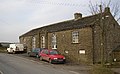 Upperthong School - geograph.org.uk - 39622.jpg 640 × 395; 86 KB
-
 Upperthong, Holmfirth, West Yorkshire, UK (RLH) 2007-03-21.jpg 3,216 × 1,216; 665 KB
-
 Upperthong, Holmfirth, West Yorkshire, UK.gif 1,168 × 756; 864 KB
-
 Upperthongsignwithcycleroute.jpg 400 × 300; 47 KB
-
 View down the valley from Ellentree Head, Upperthong - geograph.org.uk - 5518678.jpg 2,000 × 1,500; 1.1 MB
-
 Footpath to Netherthong - geograph.org.uk - 102738.jpg 640 × 480; 110 KB
-
 Hill Lane - geograph.org.uk - 102730.jpg 640 × 480; 119 KB
-
 Town Gate, Upperthong - geograph.org.uk - 102732.jpg 480 × 640; 91 KB


.jpg)
.jpg)


.jpg)


_2007-03-21.jpg)