Category:Uppingham
Jump to navigation
Jump to search
market town in the county of Rutland in the East Midlands of England  | |||||
| Upload media | |||||
| Instance of | |||||
|---|---|---|---|---|---|
| Location | Rutland, East Midlands, England | ||||
 | |||||
Cymraeg: Tref farchnad fechan yn sir Rutland yn Nwyrain Canolbarth Lloegr yw Uppingham. Mae'n gorwedd ar yr A47 rhwng Caerlyr a Peterborough, tua 6 milltir i'r de o Oakham, tref sirol Rutland.
Deutsch: Uppingham ist eine Gemeinde (civil parish) in der englischen Unitary Authority Rutland in der Region East Midlands. Im Jahr 2001 zählte sie 3.947 Einwohner.
English: Disambiguation: "Uppingham" is the colloquial name for Uppingham School
Nederlands: Uppingham is een plaats in het bestuurlijke gebied Rutland. De plaats telt 3.781 inwoners.
Polski: Uppingham - miasto w Wielkiej Brytanii, w Anglii, w regionie East Midlands, w hrabstwie Rutland, W 2001r. miasto to zamieszkiwało 3 781 osób.
Subcategories
This category has the following 8 subcategories, out of 8 total.
8
F
- The Falcon Hotel, Uppingham (5 F)
S
U
- Uppingham Community College (4 F)
- Uppingham Methodist Church (5 F)
- Uppingham railway station (2 F)
- Uppingham War Memorial (1 F)
Media in category "Uppingham"
The following 200 files are in this category, out of 276 total.
(previous page) (next page)-
 16th century Mullioned window - geograph.org.uk - 5945484.jpg 4,014 × 6,032; 5.82 MB
-
 2 High Street East, Uppingham - geograph.org.uk - 6176862.jpg 2,432 × 3,648; 2.62 MB
-
 3 storey house in Uppingham - geograph.org.uk - 3411505.jpg 3,648 × 2,736; 2.73 MB
-
 5 & 7, High Street East, Uppingham-geograph-3341980.jpg 1,005 × 915; 1.07 MB
-
 A jumble of walls - geograph.org.uk - 5970675.jpg 6,032 × 4,014; 5.39 MB
-
 A mix of building materials - geograph.org.uk - 5945518.jpg 7,952 × 6,698; 7.53 MB
-
 A modern shopfront - geograph.org.uk - 5940430.jpg 6,032 × 4,014; 5.36 MB
-
 A Trio of homes - geograph.org.uk - 5940453.jpg 10,013 × 5,500; 7.86 MB
-
 A47 approaching the A6003 roundabout - geograph.org.uk - 3586407.jpg 640 × 480; 59 KB
-
 A47 near Uppingham - geograph.org.uk - 45181.jpg 480 × 640; 95 KB
-
 A47 towards Peterborough - geograph.org.uk - 3017823.jpg 640 × 480; 66 KB
-
 Aberdeen House Care Home - geograph.org.uk - 2903796.jpg 640 × 471; 84 KB
-
 Aberdeen House name plate - geograph.org.uk - 2903797.jpg 640 × 482; 75 KB
-
 Aglais io (4223808470).jpg 3,000 × 1,959; 5.71 MB
-
 Aglais io (4230199102).jpg 3,000 × 2,000; 5.52 MB
-

-
 Allotments in Uppingham - geograph.org.uk - 1819425.jpg 640 × 480; 115 KB
-

-
 Ancient notice - geograph.org.uk - 5945475.jpg 6,032 × 4,014; 4.93 MB
-
 Approach to Uppingham - geograph.org.uk - 2904432.jpg 640 × 451; 78 KB
-
 Archway of HopeYard alleyway - geograph.org.uk - 5945503.jpg 4,014 × 6,032; 5.89 MB
-
 Art Gallery - geograph.org.uk - 5632709.jpg 6,032 × 4,014; 5.67 MB
-
 Ashdale Pharmacy, Uppingham - geograph.org.uk - 1828793.jpg 640 × 480; 118 KB
-
 Autumn Churchyard Scene - geograph.org.uk - 344192.jpg 640 × 428; 115 KB
-
 Available property - geograph.org.uk - 5946500.jpg 6,032 × 4,014; 4.19 MB
-
 Ayston Road Uppingham - geograph.org.uk - 1301642.jpg 640 × 480; 69 KB
-
 Barclays Bank, High Street West, Uppingham - geograph.org.uk - 6176841.jpg 3,648 × 2,432; 2.49 MB
-
 Bloor Homes, 'The Elms at Uppingham' - geograph.org.uk - 5883570.jpg 3,776 × 2,520; 4.03 MB
-
 Boloria sp. (4229493239).jpg 3,000 × 1,959; 4.85 MB
-
 Boloria sp. (4230219330).jpg 3,000 × 1,962; 4.44 MB
-
 Bookshops and School - geograph.org.uk - 5632741.jpg 6,032 × 4,014; 6.69 MB
-
 Brick Arch of Nelson's Court - geograph.org.uk - 5945493.jpg 6,032 × 4,014; 3.42 MB
-

-
 Buildings on High Street West, Uppingham - geograph.org.uk - 6176857.jpg 3,648 × 2,432; 2.71 MB
-
 Cake shop - geograph.org.uk - 5632915.jpg 4,014 × 6,032; 5.31 MB
-
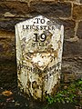
 Cast Iron Milepost - geograph.org.uk - 3274212.jpg 768 × 1,024; 358 KB
-
 Corner of market place, Uppingham.jpg 3,888 × 5,184; 4.55 MB
-
 Council housing - The Quadrant - geograph.org.uk - 3446710.jpg 1,600 × 1,200; 372 KB
-
 Courtyard shops - geograph.org.uk - 5632733.jpg 4,014 × 6,032; 6.35 MB
-
 Crossroads, Uppingham - geograph.org.uk - 4514725.jpg 1,024 × 768; 159 KB
-
 Crown Passage - Flickr - It's No Game.jpg 2,969 × 1,655; 2.2 MB
-
 Crown Passage - geograph.org.uk - 5945474.jpg 4,014 × 6,032; 4.56 MB
-
 D Norton and Son, Uppingham - geograph.org.uk - 6176837.jpg 3,648 × 2,432; 2.35 MB
-

-

-
 Entering Uppingham from the south - geograph.org.uk - 4135497.jpg 640 × 480; 51 KB
-
 Entering Uppingham on Seaton Road - geograph.org.uk - 5969858.jpg 3,776 × 2,520; 2.97 MB
-
 Erstwhile Inn - geograph.org.uk - 5632721.jpg 4,014 × 6,032; 6.46 MB
-
 Extravagant Ironstone building - geograph.org.uk - 5940447.jpg 5,870 × 8,923; 7.99 MB
-
 Farmland off Glaston Road - geograph.org.uk - 1819416.jpg 640 × 480; 95 KB
-
 Farmyard by the Seaton Road - geograph.org.uk - 3885794.jpg 640 × 480; 562 KB
-

-
 Field entrance off the A47 - geograph.org.uk - 3017821.jpg 640 × 480; 118 KB
-
 Former railway viaduct at Valley Farm - geograph.org.uk - 6196987.jpg 1,024 × 768; 137 KB
-
 Glasshouses on Glaston Road, Uppingham - geograph.org.uk - 45176.jpg 640 × 480; 114 KB
-
 Glaston Road entering Uppingham - geograph.org.uk - 5970190.jpg 3,776 × 2,520; 3.2 MB
-
 Hidden architecture - geograph.org.uk - 5940417.jpg 6,032 × 4,014; 4.16 MB
-
 Hidden front door - geograph.org.uk - 5970647.jpg 4,014 × 6,032; 5.81 MB
-
 Hidden trees - geograph.org.uk - 5940420.jpg 6,032 × 4,014; 5.36 MB
-
 High Street East, Uppingham (geograph 3341980).jpg 1,200 × 1,200; 1.45 MB
-
 High Street East, Uppingham - geograph.org.uk - 1822861.jpg 480 × 640; 67 KB
-
 High Street East, Uppingham - geograph.org.uk - 3885689.jpg 598 × 448; 351 KB
-
 High Street Shops - geograph.org.uk - 5632737.jpg 6,032 × 4,014; 6.01 MB
-
 High Street West - geograph.org.uk - 5633084.jpg 6,032 × 4,014; 5.1 MB
-
 High Street West in Uppingham - geograph.org.uk - 833050.jpg 480 × 640; 79 KB
-
 High Street West, Uppingham - geograph.org.uk - 3885673.jpg 640 × 480; 359 KB
-
 High Street, Uppingham - geograph.org.uk - 3574344.jpg 1,280 × 854; 245 KB
-
 Highfield House, Uppingham School - geograph.org.uk - 3885712.jpg 640 × 480; 537 KB
-

-
 House at Uppingham by Percy Morley Horder.png 977 × 729; 1.06 MB
-
 House in High Street West, Uppingham - geograph.org.uk - 3885284.jpg 549 × 412; 269 KB
-
 House in Nelson's Court - geograph.org.uk - 5945497.jpg 6,032 × 4,014; 4.86 MB
-
 House on Stockerstone Road - geograph.org.uk - 2903800.jpg 603 × 640; 75 KB
-
 Interior of the Falcon - geograph.org.uk - 5940377.jpg 6,032 × 4,014; 4.69 MB
-

-
 Last remnants of Winter - geograph.org.uk - 3411533.jpg 3,648 × 2,736; 2.66 MB
-
 Lay-by on the westbound A47 - geograph.org.uk - 3586402.jpg 640 × 480; 58 KB
-
 Leicester Road away from Uppingham - geograph.org.uk - 2904439.jpg 640 × 483; 86 KB
-
 Leicester Road towards Uppingham - geograph.org.uk - 2904440.jpg 640 × 484; 91 KB
-
 Lintel and notice at entrance to Reeve's Yard - geograph.org.uk - 5945467.jpg 6,032 × 4,014; 2.82 MB
-
 London Road, Uppingham - geograph.org.uk - 2995877.jpg 800 × 600; 127 KB
-
 London Road, Uppingham - geograph.org.uk - 3885709.jpg 640 × 480; 594 KB
-
 London Road, Uppingham - geograph.org.uk - 4944144.jpg 1,280 × 960; 552 KB
-
 London Road, Uppingham - geograph.org.uk - 6291022.jpg 1,600 × 1,067; 339 KB
-

-
 Lorne House, Uppingham School - geograph.org.uk - 6176849.jpg 3,648 × 2,432; 2.38 MB
-
 Market day, Uppingham - geograph.org.uk - 1289502.jpg 640 × 480; 80 KB
-
 Market Place, Uppingham - geograph.org.uk - 1594311.jpg 640 × 415; 93 KB
-
 Market Square, Uppingham - geograph.org.uk - 2213573.jpg 640 × 432; 62 KB
-
 Mercer's Yard - geograph.org.uk - 5940408.jpg 6,032 × 4,014; 4.12 MB
-
 Mercer's yard - geograph.org.uk - 5940413.jpg 4,014 × 6,032; 4.05 MB
-
 Mercer's Yard, Uppingham - geograph.org.uk - 6197062.jpg 1,024 × 768; 290 KB
-
 Milepost near Uppingham - geograph.org.uk - 4944145.jpg 960 × 1,280; 476 KB
-
 Milestone in Uppingham - geograph.org.uk - 3411497.jpg 3,648 × 2,736; 2.69 MB
-
 Morris Dancers in Uppingham Market Place - geograph.org.uk - 5170045.jpg 1,944 × 2,592; 955 KB
-
 Nelson's court - geograph.org.uk - 5945489.jpg 4,014 × 6,032; 4.05 MB
-
 Nelsons, Uppingham - geograph.org.uk - 6176865.jpg 3,648 × 2,432; 2.52 MB
-

-

-
 No cycling Sign - geograph.org.uk - 5945476.jpg 6,032 × 4,014; 4.65 MB
-
 Old Cast Iron Milepost - geograph.org.uk - 3274214.jpg 1,024 × 768; 325 KB
-
-
 Old Milepost by the B664, North Street West, (geograph 6037419).jpg 600 × 800; 162 KB
-
 Ordnance Survey Trig Pillar S2086 - geograph.org.uk - 3293148.jpg 4,000 × 3,000; 4.58 MB
-
 Path running SSE from Uppingham towards Redgate - geograph.org.uk - 5245378.jpg 5,184 × 2,920; 1.23 MB
-

-

-
 Pub sign - geograph.org.uk - 5632718.jpg 4,014 × 6,032; 6.26 MB
-
 Queen Street car park, Uppingham - geograph.org.uk - 3885717.jpg 556 × 417; 302 KB
-
 Reconstruction work - geograph.org.uk - 5632920.jpg 6,032 × 4,014; 6.48 MB
-
 Reeves Yard - geograph.org.uk - 5945464.jpg 4,014 × 6,032; 4.01 MB
-

-
 Reversal on Leicester Road - geograph.org.uk - 2903801.jpg 640 × 443; 69 KB
-
 Reves yard - geograph.org.uk - 5945502.jpg 6,032 × 4,014; 4.34 MB
-
 Road Junction, Uppingham - geograph.org.uk - 45167.jpg 640 × 480; 107 KB
-
 Road to Stoke Dry - geograph.org.uk - 300798.jpg 640 × 480; 78 KB
-
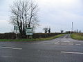
 Roadsign at Junction - geograph.org.uk - 2035518.jpg 1,600 × 1,200; 261 KB
-
 School Lane, Uppingham - geograph.org.uk - 3885683.jpg 640 × 480; 379 KB
-
 Seaton Road - geograph.org.uk - 4135518.jpg 640 × 480; 94 KB
-
 Shops in the Market Place - geograph.org.uk - 5633097.jpg 6,032 × 4,014; 5.62 MB
-

-

-

-

-
 Steep Hill - geograph.org.uk - 168401.jpg 640 × 480; 91 KB
-
 Stockerston Road - geograph.org.uk - 2903802.jpg 640 × 450; 107 KB
-
 Stockerston Road towards Stockerston - geograph.org.uk - 2903776.jpg 640 × 499; 78 KB
-
 Stockerston Road towards Uppingham - geograph.org.uk - 2903777.jpg 640 × 472; 52 KB
-
 Stockerston Triangulation Pillar - geograph.org.uk - 2903774.jpg 640 × 475; 92 KB
-

-
 Stockerstone Road - geograph.org.uk - 2903803.jpg 640 × 524; 75 KB
-

-

-
 Stone Carving, Ss Peter ^ Paul church, Uppingham - geograph.org.uk - 5762834.jpg 3,093 × 2,881; 7.11 MB
-
 Street scene, Uppingham - geograph.org.uk - 1289494.jpg 640 × 480; 72 KB
-
 Sundown on the sports field - geograph.org.uk - 2158370.jpg 2,592 × 1,944; 1.65 MB
-
 The A6003 from Uppingham approaching the A47 - geograph.org.uk - 5883585.jpg 3,776 × 2,520; 4.35 MB
-

-

-
 The covers are on - geograph.org.uk - 1289467.jpg 640 × 480; 70 KB
-
 The Crown - geograph.org.uk - 5632715.jpg 6,032 × 4,014; 6.97 MB
-
 The end of High Street West - geograph.org.uk - 2903804.jpg 640 × 434; 62 KB
-
 The entrance to Reeve's Yard - geograph.org.uk - 5945463.jpg 6,032 × 4,014; 4.87 MB
-
 The Exeter Arms - geograph.org.uk - 3446746.jpg 2,592 × 1,944; 1.07 MB
-
 The Falcon Inn - geograph.org.uk - 5633089.jpg 6,032 × 4,014; 5.12 MB
-
 The Fountain (geograph 5940440).jpg 4,014 × 6,032; 5.13 MB
-
 The Hairdresser's in Hope's Yard - geograph.org.uk - 5940464.jpg 10,015 × 6,086; 7.7 MB
-
 The Ironmonger's window, Uppingham - geograph.org.uk - 2715144.jpg 640 × 480; 92 KB
-
 The Lake Isle hotel - geograph.org.uk - 5945481.jpg 6,253 × 6,743; 6.67 MB
-
 The Market Place - geograph.org.uk - 5633088.jpg 6,032 × 4,014; 6.05 MB
-
 The old schoolroom - geograph.org.uk - 3447144.jpg 2,616 × 3,488; 1.93 MB
-
 The Royal Oak (geograph 5940425).jpg 7,780 × 5,000; 7.8 MB
-
 The Rutland Gallery.jpg 4,032 × 1,908; 3.14 MB
-
 The second archway - geograph.org.uk - 5946503.jpg 6,032 × 4,014; 4.98 MB
-
 The Upper Pavilion - geograph.org.uk - 5969774.jpg 3,776 × 2,520; 3.92 MB
-
 The Vaults - geograph.org.uk - 5633094.jpg 6,032 × 4,014; 5.16 MB
-
 The widening of Reeves Yard - geograph.org.uk - 5945479.jpg 4,014 × 6,032; 4.69 MB
-
 Toward Lyddington - geograph.org.uk - 2623.jpg 640 × 427; 91 KB
-
 Traditional Ironmongers, Uppingham - geograph.org.uk - 2715136.jpg 640 × 480; 89 KB
-
 Trig point in a field off Stockerston Road - geograph.org.uk - 5884597.jpg 3,776 × 2,520; 3.92 MB
-

-
 Market Place, Uppingham, Rutland - geograph.org.uk - 45132.jpg 640 × 480; 140 KB
-
 Turret, Uppingham - geograph.org.uk - 632704.jpg 465 × 640; 106 KB
-
 Uppingham - High Street East - geograph.org.uk - 4513873.jpg 1,024 × 576; 151 KB
-
 Uppingham - Market Place - geograph.org.uk - 4513866.jpg 576 × 1,024; 108 KB
-
 Uppingham buildings (10) (geograph 7142484).jpg 3,240 × 4,320; 2.93 MB
-
 Uppingham buildings (11) (geograph 7143447).jpg 3,155 × 4,207; 2.17 MB
-
 Uppingham buildings (12) (geograph 7143448).jpg 3,741 × 2,806; 2.18 MB
-
 Uppingham buildings (13) (geograph 7143449).jpg 3,149 × 4,303; 2.56 MB
-
 Uppingham buildings (16) (geograph 7143456).jpg 3,240 × 4,320; 2.66 MB
-
 Uppingham buildings (20) (geograph 7143472).jpg 4,320 × 3,240; 2.96 MB
-
 Uppingham buildings (21) (geograph 7143477).jpg 3,240 × 4,320; 2.4 MB
-
 Uppingham buildings (22) (geograph 7143485).jpg 3,049 × 4,066; 2.42 MB
-
 Uppingham buildings (23) (geograph 7143488).jpg 3,167 × 4,223; 2.44 MB
-
 Uppingham buildings (24) (geograph 7143489).jpg 3,118 × 4,193; 2.09 MB
-
 Uppingham buildings (27) (geograph 7143498).jpg 2,909 × 4,032; 2.24 MB
-
 Uppingham buildings (28) (geograph 7143500).jpg 4,320 × 3,240; 3.01 MB
-
 Uppingham buildings (3) (geograph 7142385).jpg 4,320 × 3,240; 3.06 MB
-
 Uppingham buildings (30) (geograph 7144466).jpg 4,320 × 3,240; 2.88 MB
-
 Uppingham buildings (31) (geograph 7144470).jpg 3,240 × 4,320; 3.29 MB
-
 Uppingham buildings (35) (geograph 7144515).jpg 3,240 × 4,320; 2.77 MB
-
 Uppingham buildings (36) (geograph 7144520).jpg 4,320 × 3,240; 2.9 MB
-
 Uppingham buildings (37) (geograph 7144526).jpg 3,167 × 4,223; 2.33 MB
-
 Uppingham buildings (38) (geograph 7144532).jpg 3,167 × 4,223; 2.25 MB
-
 Uppingham buildings (39) (geograph 7144535).jpg 4,320 × 3,240; 3.01 MB
-
 Uppingham buildings (7) (geograph 7142423).jpg 4,320 × 3,240; 2.71 MB
-
 Uppingham buildings (geograph 7144508).jpg 4,320 × 3,240; 3.68 MB
-
 Uppingham buildings (geograph 7144511).jpg 4,320 × 3,240; 2.83 MB
-
 Uppingham Community College - geograph.org.uk - 3885277.jpg 640 × 480; 407 KB
-
 Uppingham Community College - geograph.org.uk - 3976708.jpg 1,024 × 768; 158 KB
-
 Uppingham Community College - geograph.org.uk - 4135494.jpg 640 × 480; 65 KB
-
 Uppingham Community College - geograph.org.uk - 4135499.jpg 640 × 480; 46 KB
-
 Uppingham Community College - geograph.org.uk - 4944141.jpg 1,280 × 960; 296 KB
-
 Uppingham Community College - geograph.org.uk - 5921523.jpg 3,776 × 2,520; 4.15 MB
-
 Uppingham Fatstock Show - geograph.org.uk - 2715113.jpg 640 × 480; 103 KB
-
 Uppingham Fatstock Show - geograph.org.uk - 2715115.jpg 640 × 480; 82 KB
-
 Uppingham Fatstock Show - geograph.org.uk - 2715118.jpg 640 × 480; 82 KB
-
 Uppingham Fatstock Show - geograph.org.uk - 2715119.jpg 640 × 480; 113 KB
-
 Uppingham Fatstock Show - geograph.org.uk - 2715125.jpg 640 × 480; 92 KB
-
 Uppingham features (4) (geograph 7144486).jpg 4,320 × 3,240; 5.13 MB


.jpg)
.jpg)


.jpg)
.jpg)


.jpg)


.jpg)


_(14579058387).jpg)


.jpg)


.jpg)


_(geograph_7142484).jpg)
_(geograph_7143447).jpg)
_(geograph_7143448).jpg)
_(geograph_7143449).jpg)
_(geograph_7143456).jpg)
_(geograph_7143472).jpg)
_(geograph_7143477).jpg)
_(geograph_7143485).jpg)
_(geograph_7143488).jpg)
_(geograph_7143489).jpg)
_(geograph_7143498).jpg)
_(geograph_7143500).jpg)
_(geograph_7142385).jpg)
_(geograph_7144466).jpg)
_(geograph_7144470).jpg)
_(geograph_7144515).jpg)
_(geograph_7144520).jpg)
_(geograph_7144526).jpg)
_(geograph_7144532).jpg)
_(geograph_7144535).jpg)
_(geograph_7142423).jpg)
.jpg)
.jpg)


_(geograph_7144486).jpg)