Category:Upplands runinskrifter 102
Jump to navigation
Jump to search
|
This is a category about an archaeological site or a monument in Sweden, number Sollentuna 265:1 in the RAÄ Fornsök database. |
| Object location | | View all coordinates using: OpenStreetMap |
|---|
 | |||||
| Upload media | |||||
| Instance of | |||||
|---|---|---|---|---|---|
| Location | Sollentuna Parish, Sollentuna Hundred, Stockholm County, Sweden | ||||
| Heritage designation |
| ||||
 | |||||
Media in category "Upplands runinskrifter 102"
The following 11 files are in this category, out of 11 total.
-
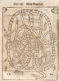 Bautil 138 - U 102.png 972 × 1,332; 2.81 MB
-
 Järva 03 44 01 466000.jpeg 3,024 × 4,032; 6.05 MB
-
 Järva 03 44 12 064000.jpeg 3,795 × 2,621; 2.64 MB
-
 Järva 03 44 19 712000.jpeg 4,032 × 3,024; 6.52 MB
-
 U 102 RAÄs infotavla 2015.jpg 3,040 × 2,272; 1.32 MB
-
 Sweeping the runes.jpg 985 × 707; 318 KB
-
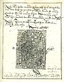 U 102, Collectaneum Monumentale Runicum.jpg 1,518 × 1,938; 807 KB
-
 U102 2005.jpg 1,000 × 743; 288 KB
-
 U102.jpg 743 × 1,000; 231 KB
-
 Upplands runinskrifter U102 runes.png 870 × 39; 4 KB
-
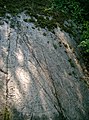
 U102 Viby - KMB - 16001000188464.jpg 790 × 568; 146 KB


