Category:Upplands runinskrifter 448
Jump to navigation
Jump to search
| Object location | | View all coordinates using: OpenStreetMap |
|---|
 | |||||
| Upload media | |||||
| Instance of |
| ||||
|---|---|---|---|---|---|
| Location | Odensala socken, Ärlinghundra hundred, Stockholm County, Sweden | ||||
| Heritage designation |
| ||||
 | |||||
|
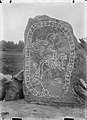
This is a category about an archaeological site or a monument in Sweden, number 10006401350001 in the RAÄ Fornsök database. |
Media in category "Upplands runinskrifter 448"
The following 7 files are in this category, out of 7 total.
-
 Harg, runsten U 448.jpg 744 × 1,024; 196 KB
-
 U448 Harg - KMB - 16001000167724.jpg 780 × 790; 221 KB
-
 U448 Harg - KMB - 16001000167844.jpg 785 × 790; 206 KB
-
 U448 Harg - KMB - 16001000167848.jpg 786 × 790; 293 KB
-
 U448 Harg - KMB - 16001000182024.jpg 574 × 790; 134 KB
-
 Upplands runinskrifter 448 runes.png 522 × 40; 4 KB
-
 Upplands runinskrifter 448.jpg 861 × 1,117; 303 KB


