Category:Upplands runinskrifter 792
Jump to navigation
Jump to search
| Object location | | View all coordinates using: OpenStreetMap |
|---|
 | |||||
| Upload media | |||||
| Instance of |
| ||||
|---|---|---|---|---|---|
| Location | Tillinge socken, Åsunda hundred | ||||
| Heritage designation |
| ||||
 | |||||
|
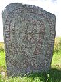
This is a category about an archaeological site or a monument in Sweden, number 10027700080001 in the RAÄ Fornsök database. |
Media in category "Upplands runinskrifter 792"
The following 8 files are in this category, out of 8 total.
-
 U 792, Ulunda.jpg 1,944 × 2,592; 881 KB
-
 U792 Ulunda - KMB - 16000300012986.jpg 512 × 768; 96 KB
-
 U792 Ulunda - KMB - 16000300012989.jpg 512 × 768; 103 KB
-
 U792 Ulunda - KMB - 16000300012991.jpg 512 × 768; 76 KB
-
 U792 Ulunda - KMB - 16000300012992.jpg 768 × 512; 72 KB
-
 U792 Ulunda - KMB - 16000300012994.jpg 768 × 512; 74 KB
-
 U792 Ulunda - KMB - 16001000012589.jpg 768 × 508; 521 KB
-
 U792 Ulunda - KMB - 16001000012591.jpg 378 × 570; 276 KB


