Category:Urban development in Ruhland
Jump to navigation
Jump to search
| Object location | | View all coordinates using: OpenStreetMap |
|---|
Städtebauliche Entwicklung in Ruhland
[edit]Deutsch: Diese Kategorie erfasst Teilgebiete von Ruhland mit Ortsteil Arnsdorf, die Phasen und Etappen bei der städtebaulichen Entwicklung durchgemacht haben oder dabei besondere Rollen spielen.
Dies beinhaltet Bebauungs- und Flächennutzungspläne sowie Planungen für Straßen und Wege einschließlich deren verkehrsrechtliche Widmung.
Dies beinhaltet Bebauungs- und Flächennutzungspläne sowie Planungen für Straßen und Wege einschließlich deren verkehrsrechtliche Widmung.
Subcategories
This category has only the following subcategory.
S
Media in category "Urban development in Ruhland"
The following 5 files are in this category, out of 5 total.
-
 Ruhland, Dresdener Str. 46, Plakat „Begleitendes Wohnen“ Karl-Marx-Straße, 01.jpg 2,339 × 3,322; 5.29 MB
-
 Ruhland, Wohngebiet Hainweg Beschluss im Amtsblatt 1994.10.pdf 645 × 1,479, 2 pages; 3.76 MB
-
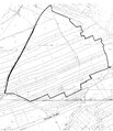 Ruhland, Wohngebiet Hainweg, Karte im Amtsblatt 1994.10 .pdf 1,241 × 1,439; 2.35 MB
-
-
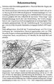
 Ruhland, Wohnpark Neue Sorge, Karte Amtsblatt 1994.10.pdf 564 × 341; 904 KB
