Category:Utah State Route 70 (1931-1977)
Jump to navigation
Jump to search
former state highway in Box Elder County, Utah, United States _and_the_west_end_of_Utah_State_Route_30.JPG)  | |||||
| Upload media | |||||
| Instance of | |||||
|---|---|---|---|---|---|
| Location | Box Elder County, Utah | ||||
| Transport network | |||||
| Owned by |
| ||||
| Maintained by |
| ||||
| Inception |
| ||||
| Dissolved, abolished or demolished date |
| ||||
| Length |
| ||||
| Terminus | |||||
| Replaced by | |||||
 | |||||
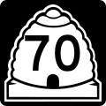
English: Media related to Utah State Route 70 (1931-1977)', "SR-70, a former 90.6612-mile (145.9051 km) state highway in Box Elder County, Utah, United States, that connected Nevada State Route 30 (now renumbered as Nevada State Route 233) in Nevada with Interstate 84 (west of Snowville). In 1977, SR-70 was renumbered as the western segment of Utah State Route 30. (However, beginning in 1967, the official maps issued by the State Road Commission of Utah incorrectly labeled the highway west of Curlew Junction as SR-30.)
Subcategories
This category has only the following subcategory.
Media in category "Utah State Route 70 (1931-1977)"
The following 2 files are in this category, out of 2 total.
-
 Utah 70.svg 600 × 600; 11 KB
-
 Utah SR 70.svg 385 × 385; 8 KB
