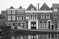
Category:Utrechtse Veer 15, Leiden
Jump to navigation
Jump to search
| Object location | | View all coordinates using: OpenStreetMap |
|---|
 | |||||
| Upload media | |||||
| Instance of |
| ||||
|---|---|---|---|---|---|
| Location | Leiden, South Holland, Netherlands | ||||
| Street address |
| ||||
| Located on street | |||||
| Heritage designation |
| ||||
 | |||||
|
This is a category about rijksmonument number 25619
|
| Address |
|
Media in category "Utrechtse Veer 15, Leiden"
The following 2 files are in this category, out of 2 total.
-
 Gevels - Leiden - 20137459 - RCE.jpg 1,200 × 803; 153 KB
-
 Leiden - Utrechtse Veer 15.JPG 2,736 × 3,648; 4.04 MB
