Category:Val Thorens
Jump to navigation
Jump to search
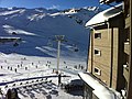
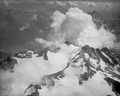
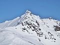
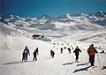
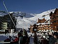
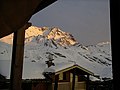
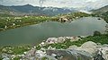
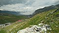
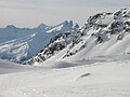
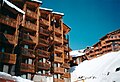
English: Pictures of Val Thorens (2300 m) a ski town resort belongs to the municipality Saint-Martin-de-Belleville in the French Alps in the Tarentaise Valley in the departement Savoie in France.
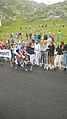
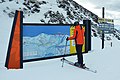
Val Thorens is a part of the big ski region Les 3 Vallées (Les Trois Vallées) from what Courchevel (opened in 1946), Méribel (1939), Les Menuires (1964) and Val Thorens (1972) are the greatest, connected in 1973. Les 3 Vallées have about 600 km (370 mi) of ski slopes and 183 ski lifts. Les Trois Vallées is the largest connected ski area in the world
Nederlands: Afbeeldingen van Val Thorens (2300 m) een wintersportoord behorende tot de gemeente Saint-Martin-de-Belleville in de Franse Alpen in de Tarentaisevallei in het departement Savoie in Frankrijk.
Val Thorens is een deel van het grote wintersportgebied Les 3 Vallées (Les Trois Vallées) waarvan Courchevel (geopend in 1946), Méribel (1939), Les Menuires (1964) en Val Thorens (1972) de grootste zijn, die in 1973 met elkaar verbonden werden. Les 3 Vallées kan beschouwd worden als 's werelds grootste aaneengesloten wintersportgebied.
ski resort in France  | |||||
| Upload media | |||||
| Instance of | |||||
|---|---|---|---|---|---|
| Part of | |||||
| Location | |||||
| Connects with |
| ||||
| Architect |
| ||||
| Mountain range | |||||
| Elevation above sea level |
| ||||
| official website | |||||
 | |||||
Subcategories
This category has the following 10 subcategories, out of 10 total.
2
- 2005–06 Andros Trophy (1 F)
- 2014–15 Andros Trophy (2 F)
C
L
- Lacs de Tête Ronde (5 F)
S
- Summer in Val Thorens (8 F)
T
- Télécabine de Caron (2 F)
- Téléphérique de la Cime Caron (23 F)
V
- Views of Val Thorens (85 F)
Media in category "Val Thorens"
The following 124 files are in this category, out of 124 total.
-
 1 puesto.jpg 600 × 400; 33 KB
-
 2014 Val-Thorens Luyten-De-Hauwere 03.jpg 1,936 × 1,936; 1.34 MB
-
 2014 Val-Thorens Luyten-De-Hauwere 06.jpg 1,936 × 2,592; 1.38 MB
-
 2014 Val-Thorens Luyten-De-Hauwere 07.jpg 2,592 × 1,936; 2.15 MB
-
 2014 Val-Thorens Luyten-De-Hauwere 08.jpg 2,592 × 1,936; 2.12 MB
-
 2014 Val-Thorens Luyten-De-Hauwere 11.jpg 2,592 × 1,936; 1.99 MB
-
 2014 Val-Thorens Luyten-De-Hauwere 12.jpg 2,592 × 1,936; 2.15 MB
-
 73440 Saint-Martin-de-Belleville, France - panoramio (1).jpg 2,048 × 1,536; 363 KB
-
 Aguille de Peclet.JPG 4,320 × 3,240; 5.11 MB
-
 Aiguille et glacier de Péclet enneigés (février 2024).JPG 4,000 × 3,000; 5.71 MB
-
 Aiguilles de Péclet et de Polset depuis Cime de Caron (février 2024).JPG 4,000 × 3,000; 5.33 MB
-
 Bienvenue à Méribel depuis Val Thorens en hiver (2019).JPG 3,264 × 2,448; 4.81 MB
-
 Cafe Snesko Bar.jpg 700 × 525; 160 KB
-
 Chocard à bec jaune se nourrissant à Val Thorens (avril 2022).JPG 2,048 × 1,536; 1.47 MB
-
 Chocard à bec jaune sur les hauteurs de Val Thorens (avril 2022).JPG 2,048 × 1,536; 1.17 MB
-
 Chocard à bec jaune à Val Thorens (avril 2022).JPG 2,048 × 1,536; 1.26 MB
-
 Chocards en vol au-dessus de Val Thorens (avril 2022).JPG 1,701 × 1,278; 780 KB
-
 Col du Bouchet entre Val Thorens et Orelle (hiver 2019).JPG 4,000 × 3,000; 5.44 MB
-
 Crashed sports plane.jpg 3,072 × 2,304; 1.02 MB
-
 Croix du Bienheureux Paul, Val Thorens.jpg 3,648 × 2,736; 3.5 MB
-
 Esquiando en Val Thorens - panoramio.jpg 2,048 × 1,536; 147 KB
-
 ETH-BIB-Ort unbekannt-LBS H1-020753.tif 6,178 × 4,919; 87.02 MB
-
 Extreme Environments - Audi FIS Ski Cross World Cup - Val Thorens, France 2.jpg 3,609 × 2,706; 1.84 MB
-
 Extreme Environments - Audi FIS Ski Cross World Cup - Val Thorens, France.jpg 3,925 × 1,695; 1.09 MB
-
 French Alps - View from Val Thorens.jpg 3,104 × 1,746; 962 KB
-
 Funitel Fond.JPG 890 × 539; 144 KB
-
 Glacier de Chaviere (101892469).jpg 10,837 × 2,748; 2.7 MB
-
 La Folie Douce - panoramio.jpg 4,288 × 2,848; 4.05 MB
-
 Lac des Grenouilles, Val Thorens.jpg 3,648 × 2,736; 3.62 MB
-

-
 Les 3 Vallées, Val Thorens - panoramio (1).jpg 4,608 × 3,456; 5.54 MB
-
 Les 3 Vallées, Val Thorens - panoramio (2).jpg 4,608 × 2,304; 5.37 MB
-
 Les 3 Vallées, Val Thorens - panoramio.jpg 4,608 × 3,456; 4.71 MB
-
 Massif des Écrins from Pointe de la Masse.jpg 1,024 × 768; 538 KB
-
 Mont du Borgne (hiver 2016).JPG 2,048 × 1,536; 1,008 KB
-
 Mont du Borgne et Col de la Tempête enneigés (avril 2022).JPG 3,264 × 2,448; 3.41 MB
-
 Ombrage couchant.jpg 2,272 × 1,704; 450 KB
-
 Ouest Col de la Tempête enneigé à Val Thorens (février 2024).JPG 4,000 × 3,000; 4.67 MB
-
 Ouest de la Cime de Caron enneigé en hiver (février 2024).JPG 4,000 × 3,000; 6.15 MB
-
 Ouest Pointe de Thorens enneigée vue de contrebas (février 2024).JPG 3,196 × 2,368; 2.77 MB
-
 Panorama from Col de Thorens.tif 12,854 × 4,192; 127.92 MB
-
 Parkofvalthorens.jpg 500 × 375; 34 KB
-
 Piste de ski des Pionniers enneigée à Val Thorens (avril 2022).JPG 2,048 × 1,536; 1.4 MB
-
 Piste Rouge sous la Cime de Caron à Val Thorens (février 2024).JPG 4,000 × 3,000; 5 MB
-
 Pointe de Thorens (hiver 2016).JPG 2,794 × 2,095; 1.99 MB
-
 Pralolognan prapoutel ski 009.jpg 2,048 × 1,536; 660 KB
-
 Péclet et Roc des Saints-Pères vus de Val Thorens (avril 2022) 1.JPG 3,264 × 2,448; 3.94 MB
-
 Péclet et Roc des Saints-Pères vus de Val Thorens (avril 2022) 2.JPG 3,264 × 2,448; 3.71 MB
-
 Péclet.JPG 1,082 × 405; 141 KB
-
 Restaurant d'altitude à Val Thorens en fin d'hiver (avril 2022).JPG 3,080 × 2,220; 2.58 MB
-
 Roc et Aiguille des Saints-Pères enneigés face ouest (avril 2022).JPG 3,264 × 2,448; 4.6 MB
-
 Ski à Val Thorens (2016).JPG 2,048 × 1,536; 1.05 MB
-
 Skiing towards Val Thorens from the south, 1998.jpg 1,700 × 1,208; 1.45 MB
-
 Sous le glacier et l'aiguille de Péclet enneigés (avril 2022).JPG 3,264 × 2,448; 4.73 MB
-
 Tapis roulant moving carpet funbelt ficap montagne val thorens.JPG 4,416 × 3,312; 5.93 MB
-
 Thorens-mw1.jpg 800 × 600; 103 KB
-
 Thorens-mw10.jpg 800 × 600; 109 KB
-
 Thorens-mw2.jpg 800 × 600; 91 KB
-
 Thorens-mw3.jpg 800 × 600; 88 KB
-
 Thorens-mw4.jpg 600 × 800; 24 KB
-
 Thorens-mw5.jpg 600 × 800; 23 KB
-
 Thorens-mw6.jpg 800 × 600; 122 KB
-
 Thorens-mw8.jpg 800 × 600; 146 KB
-
 Thorens-mw9.jpg 800 × 600; 110 KB
-
 Thorens.jpg 800 × 600; 357 KB
-
 Tour de France 2019 Val Thorens 0.jpg 3,840 × 2,160; 2.99 MB
-
 Tour de France 2019 Val Thorens 10.jpg 3,840 × 2,160; 4.11 MB
-
 Tour de France 2019 Val Thorens 11.jpg 3,840 × 2,160; 4.28 MB
-
 Tour de France 2019 Val Thorens 12.jpg 3,840 × 2,160; 2.85 MB
-
 Tour de France 2019 Val Thorens 13.jpg 3,840 × 2,160; 3.27 MB
-
 Tour de France 2019 Val Thorens 15.jpg 3,840 × 2,160; 2.47 MB
-
 Tour de France 2019 Val Thorens 17.jpg 2,160 × 3,840; 4.92 MB
-
 Tour de France 2019 Val Thorens 18.jpg 2,160 × 3,840; 4.92 MB
-
 Tour de France 2019 Val Thorens 19.jpg 2,160 × 3,840; 4.85 MB
-
 Tour de France 2019 Val Thorens 2.jpg 3,840 × 2,160; 4.59 MB
-
 Tour de France 2019 Val Thorens 20.jpg 2,160 × 3,840; 3.64 MB
-
 Tour de France 2019 Val Thorens 21.jpg 2,160 × 3,840; 4.21 MB
-
 Tour de France 2019 Val Thorens 23.jpg 2,160 × 3,840; 4.67 MB
-
 Tour de France 2019 Val Thorens 24.jpg 2,160 × 3,840; 4.93 MB
-
 Tour de France 2019 Val Thorens 25.jpg 2,160 × 3,840; 3.57 MB
-
 Tour de France 2019 Val Thorens 26.jpg 2,160 × 3,840; 4.46 MB
-
 Tour de France 2019 Val Thorens 27.jpg 2,160 × 3,840; 4.59 MB
-
 Tour de France 2019 Val Thorens 28.jpg 2,160 × 3,840; 4.45 MB
-
 Tour de France 2019 Val Thorens 29.jpg 2,160 × 3,840; 4.6 MB
-
 Tour de France 2019 Val Thorens 3.jpg 2,160 × 3,840; 5.28 MB
-
 Tour de France 2019 Val Thorens 30.jpg 2,160 × 3,840; 4.84 MB
-
 Tour de France 2019 Val Thorens 31.jpg 2,160 × 3,840; 4.71 MB
-
 Tour de France 2019 Val Thorens 32.jpg 2,160 × 3,840; 4.56 MB
-
 Tour de France 2019 Val Thorens 33.jpg 2,160 × 3,840; 5.13 MB
-
 Tour de France 2019 Val Thorens 34.jpg 2,160 × 3,840; 5.12 MB
-
 Tour de France 2019 Val Thorens 35.jpg 2,160 × 3,840; 4.88 MB
-
 Tour de France 2019 Val Thorens 36.jpg 2,160 × 3,840; 5.15 MB
-
 Tour de France 2019 Val Thorens 37.jpg 2,160 × 3,840; 4.9 MB
-
 Tour de France 2019 Val Thorens 4.jpg 3,840 × 2,160; 3.53 MB
-
 Tour de France 2019 Val Thorens 5.jpg 3,840 × 2,160; 3.66 MB
-
 Tour de France 2019 Val Thorens 6.jpg 3,840 × 2,160; 4.54 MB
-
 Tour de France 2019 Val Thorens 7.jpg 3,840 × 2,160; 4.58 MB
-
 Tour de France 2019 Val Thorens 8.jpg 3,840 × 2,160; 4.12 MB
-
 Tour de France 2019 Val Thorens 9.jpg 2,160 × 3,840; 4.38 MB
-
 Tour de France Val Thorens 1.jpg 2,160 × 3,840; 3.03 MB
-
 Tour de France Val Thorens 11.jpg 2,160 × 3,840; 3.03 MB
-
 Tour de France Val Thorens 12.jpg 2,160 × 4,096; 1.17 MB
-
 Tour de France Val Thorens 13.jpg 1,024 × 768; 137 KB
-
 Tour de France Val Thorens 2.jpg 2,160 × 3,840; 3.93 MB
-
 Tour de France Val Thorens 3.jpg 2,160 × 3,840; 3.95 MB
-
 Tour de France Val Thorens 4.jpg 2,160 × 3,840; 4.16 MB
-
 Tour de France Val Thorens 5.jpg 2,160 × 3,840; 3.68 MB
-
 Tour de France Val Thorens 6.jpg 2,160 × 3,840; 3.13 MB
-
 Tour de France Val Thorens 7.jpg 2,160 × 3,840; 3.04 MB
-
 Tour de France Val Thorens 8.jpg 2,160 × 3,840; 2.97 MB
-
 Tour de France Val Thorens 9.jpg 2,160 × 3,840; 3.03 MB
-
 Télésiège du Col fermé et bloqué à Val Thorens (avril 2022).JPG 2,048 × 1,536; 1.49 MB
-
 Val Thorens (Orelle).jpg 3,264 × 2,448; 1.89 MB
-
 Val Thorens depuis Cime de Caron.jpg 7,873 × 2,247; 9.69 MB
-
 Val Thorens ski resort map.jpg 5,677 × 3,774; 8.83 MB
-
 Val thorens snow.JPG 1,024 × 768; 179 KB
-
 Val Thorens welcome sign.jpg 5,919 × 3,935; 8.68 MB
-
 Val Thorens, France (Unsplash RCF- l7vITo).jpg 6,000 × 4,000; 8.41 MB
-
 Val thorens.jpg 3,264 × 2,448; 3.55 MB
-
 Val Thorens.JPG 2,041 × 1,480; 708 KB
-
 Val-Thorens - Col de la Chambre (25916842025).jpg 3,234 × 1,595; 652 KB
-
 Vallon du Lou at dusk.jpg 6,016 × 4,000; 8.22 MB
-
 Vallon du Lou vu du col de la Chambre en hiver (2019).JPG 3,264 × 2,448; 4.16 MB
-
 Village Montana, Val Thorens, 1998.jpg 1,744 × 1,190; 1.58 MB


.jpg)

.JPG)
.JPG)
.JPG)

.JPG)
.JPG)
.JPG)
.JPG)
.JPG)


.jpg)
.jpg)


.JPG)
.JPG)

.JPG)
.JPG)
.JPG)

.JPG)
.JPG)
.JPG)

_1.JPG)
_2.JPG)
.JPG)
.JPG)
.JPG)

.JPG)


.JPG)
.jpg)


.jpg)


.jpg)

.JPG)

.jpg)