Category:Vehicles in the East Riding of Yorkshire
Jump to navigation
Jump to search
Subcategories
This category has the following 11 subcategories, out of 11 total.
A
C
S
T
Media in category "Vehicles in the East Riding of Yorkshire"
The following 136 files are in this category, out of 136 total.
-
 1905 on Thwaite Street, Cottingham, East Yorkshire, England.jpg 1,317 × 821; 902 KB
-
 462 Squadron RAAF Halifax at Driffield AWM UK2232.jpg 450 × 338; 20 KB
-
 466 Squadron RAAF Halifax at RAF Leconfield AWM UK0966.jpg 450 × 334; 19 KB
-
 A63 eastbound at Melton (geograph 5254433).jpg 640 × 511; 63 KB
-
 Acey Farm, Preston - geograph.org.uk - 303482.jpg 640 × 480; 121 KB
-

-

-
 Barmston Main Drain (geograph 6404892).jpg 1,024 × 768; 148 KB
-
 Beeches Farm, Faxfleet - geograph.org.uk - 860450.jpg 640 × 456; 233 KB
-
 Beverley - geograph.org.uk - 315683.jpg 640 × 367; 86 KB
-

-
 Beverley Museum of Army Transport Gazelle geograph-3283289-by-Ben-Brooksbank.jpg 2,337 × 1,431; 3.32 MB
-
-
 Bowlams Dike near Little Catwick.jpg 482 × 640; 206 KB
-
 Bowser on the Chalkland Way near Grimthorpe Manor (geograph 4391933).jpg 1,600 × 1,062; 576 KB
-
 Bridleway to Wawne (geograph 5677247).jpg 1,024 × 768; 184 KB
-
 Bridlington Station 1904325 98f229a9.jpg 640 × 353; 43 KB
-
 Building the Beverley Southern Relief Road (geograph 3882729).jpg 640 × 426; 217 KB
-
 Caravan Club site on Willow Lane, Beverley (geograph 4400285).jpg 1,600 × 1,062; 837 KB
-
 Chalk 'workings', north-east of Wetwang (geograph 6827960).jpg 1,600 × 1,200; 521 KB
-
 Chance light at RAF Pocklington WWII IWM CH 6695.jpg 800 × 534; 47 KB
-
 Cheverton Avenue - Queen Street (geograph 4595387).jpg 640 × 480; 65 KB
-

-
 Closed building site, Hessle (geograph 6425897).jpg 1,024 × 768; 909 KB
-
 Cottingham Day 2011 IMG 1960 - panoramio.jpg 799 × 1,200; 589 KB
-
 Cottingham IMG 6083 - panoramio.jpg 973 × 1,200; 281 KB
-
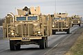
 Coyote Tactical Support Vehicle (TSV) MOD 45152541.jpg 3,000 × 2,000; 980 KB
-
 Coyote Tactical Support Vehicle (TSV) MOD 45152542.jpg 3,000 × 2,000; 1.16 MB
-
 Coyote Tactical Support Vehicle (TSV) MOD 45152543.jpg 3,000 × 2,000; 743 KB
-
 Coyote Tactical Support Vehicle (TSV) MOD 45152544.jpg 3,000 × 2,000; 1.04 MB
-
 Coyote Tactical Support Vehicle (TSV) MOD 45152545.jpg 3,000 × 2,000; 778 KB
-
 Coyote Tactical Support Vehicle (TSV) MOD 45152546.jpg 3,000 × 2,000; 795 KB
-
 Cranswick Industrial Estate, Hutton Cranswick (geograph 6495979).jpg 5,456 × 3,632; 2.16 MB
-
 Crosslands Lane - geograph.org.uk - 895846.jpg 640 × 480; 43 KB
-
 Defence School of Transport, Leconfield - geograph.org.uk - 533636.jpg 639 × 461; 100 KB
-
-
 Defence School of Transport, Leconfield - geograph.org.uk - 533651.jpg 639 × 479; 104 KB
-

-

-

-
 Digging the attenuation, Willerby (geograph 4507643).jpg 640 × 499; 195 KB
-
 Ditching work in progress near Adlingfleet (geograph 6556365).jpg 3,894 × 2,369; 2.03 MB
-
 Drain clearing, Bransholme, Hull (geograph 6996826).jpg 1,024 × 686; 1.45 MB
-
 Driffield Showground - geograph.org.uk - 918610.jpg 640 × 462; 104 KB
-
 Driffield Showground - geograph.org.uk - 918611.jpg 640 × 477; 100 KB
-
 Driffield Showground - geograph.org.uk - 918612.jpg 490 × 640; 96 KB
-
 Driffield Showground - geograph.org.uk - 918613.jpg 640 × 478; 81 KB
-
 Driffield Showground - geograph.org.uk - 918614.jpg 640 × 475; 104 KB
-
 Driffield Showground - geograph.org.uk - 918615.jpg 640 × 447; 84 KB
-
 Driffield Showground - geograph.org.uk - 918616.jpg 640 × 454; 67 KB
-
 Driffield Showground - geograph.org.uk - 918617.jpg 525 × 640; 106 KB
-
 Driffield Showground - geograph.org.uk - 918618.jpg 474 × 640; 99 KB
-
 Driffield Showground - geograph.org.uk - 918619.jpg 501 × 640; 123 KB
-
 Driffield Showground - geograph.org.uk - 918620.jpg 640 × 468; 86 KB
-
 Driffield Sugar Mills - Demolition - geograph.org.uk - 356477.jpg 640 × 480; 91 KB
-
 DST Leconfield - Mastiff.jpg 1,602 × 1,299; 224 KB
-
 East Yorkshire wagon at Lockington circa.1910 (archive ref DDX1862-2) (29964025873).jpg 3,920 × 2,392; 2.61 MB
-
 Eastfield Farm, Rise - geograph.org.uk - 907143.jpg 640 × 472; 122 KB
-
 Enholmes Farm, Patrington - geograph.org.uk - 296884.jpg 640 × 487; 81 KB
-
 Entering Wawne (geograph 4352652).jpg 640 × 440; 63 KB
-
 Entering Woodmansey on the A1174 (geograph 4979517).jpg 3,055 × 2,278; 2.09 MB
-
 Farm Buildings, Demming Farm - geograph.org.uk - 1223802.jpg 640 × 481; 73 KB
-
 Flood alleviation work, near Hull (geograph 4507650).jpg 640 × 461; 176 KB
-
 Fort Paull (geograph 5055151).jpg 1,024 × 683; 164 KB
-
 Fort Paull 2-5-11 IMG 1831.jpg - panoramio.jpg 1,200 × 799; 434 KB
-
 Fosham Garth Farm - geograph.org.uk - 561082.jpg 640 × 482; 107 KB
-
 Fosse Hill Jetksi Centre, near Catwick - geograph.org.uk - 1497557.jpg 640 × 426; 222 KB
-
 Goole Docks' Container Cranes - geograph.org.uk - 843374.jpg 499 × 640; 67 KB
-
 Groyne replacement, Withernsea (geograph 5513285).jpg 640 × 480; 185 KB
-
 Hedon Road Improvements 2002 - geograph.org.uk - 275153.jpg 640 × 480; 110 KB
-
 Hill Top Farm and Cumbrian Way junction (geograph 4474201).jpg 3,550 × 2,623; 2.61 MB
-
 House building, Kirk Ella (geograph 6889879).jpg 1,024 × 705; 1.13 MB
-

-
 Junction of Paths on the Chalkland Way (geograph 4391936).jpg 1,600 × 1,062; 835 KB
-
 Lagoon construction, Willerby (geograph 4507645).jpg 640 × 478; 181 KB
-
 Lagoon digging, Willerby (geograph 4507648).jpg 640 × 475; 164 KB
-

-
 Low Farm, Easington - geograph.org.uk - 983246.jpg 640 × 469; 105 KB
-
 Machinery at Newport Road Quarry - geograph.org.uk - 733158.jpg 640 × 480; 179 KB
-

-

-
 Mastiff 2 MOD 45150029.jpg 3,000 × 2,000; 4.15 MB
-
 Mastiff 2 MOD 45150030.jpg 3,000 × 2,000; 4.04 MB
-
 Mastiff 2 MOD 45150031.jpg 3,000 × 2,000; 4.49 MB
-
 Mastiff 2 MOD 45150032.jpg 3,000 × 2,000; 4.74 MB
-
 Meaux Road, Wawne - geograph.org.uk - 1161463.jpg 640 × 466; 101 KB
-
 Mountains out of molehills - geograph.org.uk - 209345.jpg 640 × 393; 81 KB
-
 New Bypass for Beverley (geograph 4075307).jpg 1,600 × 1,064; 557 KB
-
 New Haltemprice Farm? (geograph 6894083).jpg 1,024 × 786; 1.2 MB
-
 Newport Road Quarry - geograph.org.uk - 596099.jpg 640 × 427; 76 KB
-
 North Carr, Weel - geograph.org.uk - 490442.jpg 640 × 479; 97 KB
-
 North end of Hessle Haven - geograph.org.uk - 260181.jpg 640 × 416; 232 KB
-
 Northfield Road looking East (geograph 6829366).jpg 4,608 × 3,456; 3.7 MB
-
 Not the usual farm traffic. Access road to Danebury Manor (geograph 6649860).jpg 4,608 × 3,456; 2.93 MB
-
 Old bridge over Lambwath Stream (geograph 3975736).jpg 3,264 × 2,448; 2.42 MB
-
 On Withernsea beach (geograph 4988011).jpg 4,476 × 3,585; 2.68 MB
-

-
 Path leading to Hempholme Lock (geograph 5501430).jpg 1,600 × 1,065; 807 KB
-
 Path leading to Hutton Cranswick (geograph 6495665).jpg 5,456 × 3,632; 2.4 MB
-
 Patrington Methodist Church - geograph.org.uk - 243957.jpg 482 × 640; 91 KB
-
 Patrington Methodist Church - geograph.org.uk - 243960.jpg 640 × 508; 83 KB
-
 Paull Lighthouse - geograph.org.uk - 977972.jpg 606 × 640; 101 KB
-

-
 Portmadoc Close off Snowdon Way, Hull (geograph 6779379).jpg 5,456 × 3,632; 2.12 MB
-

-
 Preparing To Enter The Ring - geograph.org.uk - 205370.jpg 640 × 480; 101 KB
-
 Queensgate, Beverley, 1900 (archive ref DDX1525-1-8) (25289431682).jpg 867 × 574; 108 KB
-
 Queueing for a Pea - geograph.org.uk - 1172787.jpg 640 × 480; 186 KB
-
 RAF Bomber Command HU108387.jpg 800 × 629; 62 KB
-
 Retired machinery, Houghton Moor - geograph.org.uk - 1183728.jpg 640 × 438; 189 KB
-
 Rhyl Close off Snowdon Way, Hull (geograph 6779468).jpg 5,456 × 3,632; 1.84 MB
-
 Roadbuilding south of Beverley (geograph 3882717).jpg 640 × 426; 195 KB
-
 Royal Air Force Bomber Command, 1942-1945. CH10331.jpg 800 × 570; 47 KB
-
 Royal Air Force Bomber Command, 1942-1945. CH11401.jpg 800 × 677; 73 KB
-
 Royal Air Force Bomber Command, 1942-1945. CH6695.jpg 800 × 535; 59 KB
-
 Rusty railings, Withernsea (geograph 5513291).jpg 640 × 479; 193 KB
-
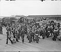
 Saturday Market, Beverley 1881 (archive ref PH-4-5 a) (29122664806).jpg 833 × 519; 103 KB
-
 Sea defence work on Withernsea beach (geograph 4988017).jpg 3,749 × 3,637; 2.69 MB
-
 Sea Field, Mappleton - geograph.org.uk - 456516.jpg 640 × 451; 105 KB
-
 Springfield Way development, Anlaby - geograph.org.uk - 1336754.jpg 640 × 426; 217 KB
-
 Supermarket delivery, Hull (geograph 6694929).jpg 1,024 × 790; 1.05 MB
-

-
 The Hay Wain - geograph.org.uk - 205372.jpg 640 × 480; 107 KB
-
 The River Hull from Hempholme Weir - geograph.org.uk - 1410051.jpg 640 × 480; 65 KB
-
 The road to Weeton - geograph.org.uk - 322558.jpg 640 × 371; 77 KB
-
 The Wolds Way and the A63 (geograph 3898276).jpg 1,024 × 768; 160 KB
-
 Three Jolly Tars Farm (geograph 5503016).jpg 1,600 × 1,065; 679 KB
-
 Time for Tea - geograph.org.uk - 82349.jpg 640 × 480; 37 KB
-
-
 TomTom Camera Car on Wawne Road, Bransholme (geograph 4611575).jpg 1,200 × 907; 321 KB
-
 Tree planting off Long Lane (geograph 4400013).jpg 1,600 × 1,062; 725 KB
-
 Vantastic Sunrise - geograph.org.uk - 981778.jpg 640 × 548; 63 KB
-
 Vote Yorkshire First placard (geograph 4476367).jpg 2,448 × 1,624; 1.22 MB
-
 Webster's Farm and Country Store (geograph 6516382).jpg 3,648 × 1,744; 2.16 MB
-
 Welshpool Close off Snowdon Way, Hull (geograph 6779473).jpg 5,456 × 3,632; 1.72 MB
-
 Wilfholme Pumping Station - geograph.org.uk - 1541418.jpg 640 × 427; 141 KB


.jpg)


.jpg)


_(25290468192).jpg)
_(28634461652).jpg)

.jpg)
.jpg)

.jpg)
.jpg)
.jpg)

.jpg)
_(37)_(26796730166).jpg)
.jpg)


_MOD_45152541.jpg)
_MOD_45152542.jpg)
_MOD_45152543.jpg)
_MOD_45152544.jpg)
_MOD_45152545.jpg)
_MOD_45152546.jpg)
.jpg)

.jpg)
.jpg)


_(29964025873).jpg)


.jpg)
.jpg)

.jpg)
.jpg)


.jpg)

.jpg)
.jpg)

.jpg)
.jpg)
.jpg)
_(28868523860).jpg)


_(25135802882).jpg)


.jpg)
.jpg)


.jpg)
.jpg)
.jpg)
.jpg)
_(27669234893).jpg)
.jpg)
.jpg)


_(30519000012).jpg)
.jpg)
_(38)_(26737207462).jpg)

_(25289431682).jpg)


.jpg)
.jpg)


.jpg)
_(29122664806).jpg)
.jpg)


.jpg)
_(5)_(26225758104).jpg)


.jpg)
.jpg)

_(34049872915).jpg)
.jpg)
.jpg)

.jpg)
.jpg)
.jpg)

.jpg)