Category:Vemork
Jump to navigation
Jump to search
| Camera location | | View all coordinates using: OpenStreetMap |
|---|
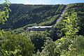
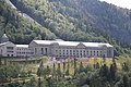
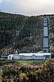
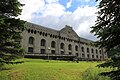
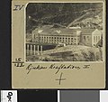
English: Pictures of Vemork, a hydroelectric powerplant in Norway. Located in the municipality Tinn outside Rjukan in the county Vestfold og Telemark in the south of Norway
hydroelectric power station and museum in Tinn, Norway  | |||||
| Upload media | |||||
| Instance of | |||||
|---|---|---|---|---|---|
| Location | Tinn Municipality, Telemark, Norway | ||||
| Located in or next to body of water |
| ||||
| Owned by | |||||
| Operator | |||||
| Heritage designation |
| ||||
| Service entry |
| ||||
| Throughput |
| ||||
| Nominal power capacity |
| ||||
| Elevation above sea level |
| ||||
| Reservoir created |
| ||||
| official website | |||||
 | |||||
Media in category "Vemork"
The following 78 files are in this category, out of 78 total.
-
 55x21 Vemork - no-nb digifoto 20160412 00122 bldsa EYDE 5 07B 012.jpg 7,587 × 5,726; 3.01 MB
-
 74 Afløbskanal. Kraftstasjonen - no-nb digifoto 20160408 00095 bldsa EYDE 5 5 og 6 021.jpg 6,676 × 5,243; 2.25 MB
-

-
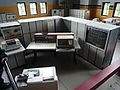 Control room Vemork.jpg 3,648 × 2,736; 4.08 MB
-
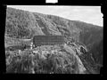
 Fra Rjukananlægget, Vestfjorddalen - no-nb digifoto 20160329 00153 bldsa NGU0129.jpg 5,600 × 8,017; 5.48 MB
-
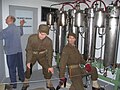 NorwegianHeavyWaterSabotage.jpg 2,048 × 1,536; 670 KB
-
 Old turbines in Vemork Hydroelectric Plant.jpg 1,536 × 2,048; 681 KB
-
 P1000742Vemork.JPG 3,264 × 2,448; 3.92 MB
-
 PSM V80 D050 Rjukan fos upper power house.png 1,500 × 1,168; 532 KB
-
 Rjukan - no-nb digifoto 20160511 00012 NB MIT FNR 04361 (cropped).jpg 6,185 × 4,500; 3.72 MB
-
 Rjukan - no-nb digifoto 20160511 00012 NB MIT FNR 04361.jpg 7,210 × 5,410; 4.14 MB
-
 Rjukan I & II - no-nb digifoto 20160413 00081 bldsa EYDE 5 07A 028.jpg 5,483 × 5,265; 2.63 MB
-
 Rjukan I, Maskinhallen - no-nb digifoto 20160412 00349 bldsa EYDE 5 07A 013.jpg 5,510 × 5,210; 2.33 MB
-
 Rjukan I.N.A 1 Rørgaden - no-nb digifoto 20160412 00150 bldsa EYDE 5 07B 055.jpg 6,537 × 5,205; 3.69 MB
-
 Rjukan I.N.A 12. Rørgaden - no-nb digifoto 20160412 00148 bldsa EYDE 5 07B 053.jpg 6,454 × 5,136; 2.52 MB
-

-
-

-
 Rjukan I.N.A 5. Rørgaden - no-nb digifoto 20160408 00097 bldsa EYDE 5 5 og 6 023.jpg 6,685 × 5,236; 2.52 MB
-

-
 Rjukan I.Ø.A 2. Damstedet - no-nb digifoto 20160412 00140 bldsa EYDE 5 07B 045.jpg 6,251 × 4,899; 1.46 MB
-

-
 Rjukan I.Ø.A 4. Fordelingsbassinet - no-nb digifoto 20160412 00141 bldsa EYDE 5 07B 046.jpg 6,249 × 4,905; 2.19 MB
-
 Rjukan I.Ø.A No 1 Indtaget - no-nb digifoto 20160408 00094 bldsa EYDE 5 5 og 6 020.jpg 6,625 × 5,200; 2.29 MB
-
 Rjukan Kraftanlæg I - no-nb digifoto 20160412 00123 bldsa EYDE 5 07B 013 (cropped).jpg 3,879 × 3,572; 1.05 MB
-
 Rjukan Kraftanlæg I - no-nb digifoto 20160412 00123 bldsa EYDE 5 07B 013.jpg 6,121 × 6,920; 4 MB
-
 Rjukan-vemork-1.JPG 434 × 512; 59 KB
-
 Turbines at Vemork.jpg 5,184 × 3,456; 5.64 MB
-
 Vemork - turbinhallen I.jpg 3,264 × 2,448; 1.42 MB
-
 Vemork - turbinhallen II.jpg 3,264 × 2,448; 1.5 MB
-
 Vemork 080208.JPG 3,008 × 2,000; 1.44 MB
-
 Vemork 1.jpg 1,873 × 2,738; 1.62 MB
-
 Vemork 2.jpg 1,857 × 2,706; 1.57 MB
-
 Vemork 2008-02-08.JPG 1,842 × 2,769; 765 KB
-
 Vemork 3.jpg 2,742 × 1,880; 1.96 MB
-
 Vemork DSC01163 s.jpg 1,148 × 764; 191 KB
-
 Vemork DSC01165 s.jpg 1,148 × 764; 217 KB
-
 Vemork DSCF5426.jpg 3,264 × 2,448; 1.85 MB
-
 Vemork fabriek 1.png 1,600 × 1,200; 4.05 MB
-
 Vemork fabriek 2.png 1,600 × 1,200; 2.73 MB
-
 Vemork fabriek 3.png 1,200 × 1,600; 3.46 MB
-
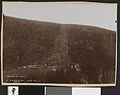
 Vemork Hydroelectric Plant 1935.jpg 617 × 406; 55 KB
-
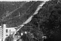
 Vemork i høstsol (392242350).jpg 3,872 × 2,592; 3.03 MB
-
 Vemork IMG 0130 RK 179963.JPG 5,184 × 3,456; 10.04 MB
-
 Vemork IMG 0133 RK 179963.JPG 5,184 × 3,456; 8.56 MB
-
 Vemork IMG 0134 RK 179963.JPG 5,184 × 3,456; 8.64 MB
-
 Vemork IMG 0135 RK 179963.JPG 5,184 × 3,456; 8.18 MB
-
 Vemork July 2018.jpg 5,184 × 3,456; 7.52 MB
-
 Vemork kraftstasjon (21815773971).jpg 1,987 × 3,000; 2.38 MB
-
 Vemork maana IMG 0127.JPG 3,456 × 5,184; 9.93 MB
-
 Vemork maana IMG 0129.JPG 3,456 × 5,184; 10.37 MB
-
 Vemork main building.jpg 5,184 × 3,456; 7.95 MB
-
 Vemork nye kraftstasjon.JPG 2,816 × 2,112; 1.35 MB
-
 Vemork P1030336.jpg 2,304 × 1,728; 1.66 MB
-
 Vemork P1030341.jpg 2,304 × 1,728; 1.55 MB
-
 Vemork Power Station.jpg 2,200 × 1,968; 876 KB
-
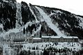
 Vemork Tinn.jpg 3,648 × 2,736; 2.23 MB
-
 Vemork, Rjukan - no-nb digifoto 20151127 00149 NB MIT FNR 14085.jpg 7,000 × 5,120; 3.19 MB
-
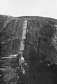
 Vemork, Rjukan, tørt elveleie, 24.07.1969, VN2652 (21782535396).jpg 1,980 × 1,310; 741 KB
-
 Vemork-rjukan-cow-bridge-decoration.jpg 1,600 × 1,200; 556 KB
-
 VemorkHydroelectricPlant-small.jpg 213 × 213; 14 KB
-
 VemorkHydroelectricPlant.jpg 512 × 384; 53 KB
-
 Vestlandstur 2007 085.jpg 2,272 × 1,704; 3.14 MB
-

-

-

-
 13593 Fordelingsbasinet - no-nb digifoto 20160412 00328 bldsa EYDE 5 07A 007.jpg 5,509 × 5,210; 2.05 MB
-
 Fordelingsbasinet. 88. (9456210633).jpg 1,000 × 993; 401 KB
-
-
 13602 Kraftledninger Rjukan I - no-nb digifoto 20160412 00331 bldsa EYDE 5 07A 010.jpg 5,507 × 5,204; 2.14 MB
-

-
 12410 Rjukan Kraftstation - no-nb digifoto 20160412 00327 bldsa EYDE 5 07A 006.jpg 5,543 × 5,180; 2.29 MB
-
-
 13577 Rjukan I Kraftstation - no-nb digifoto 20160412 00351 bldsa EYDE 5 07A 015.jpg 5,511 × 5,210; 2.2 MB
-
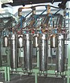
 Rørbrudsventiler for kraftverk.jpg 1,494 × 1,122; 1.21 MB
-
 13373 Vemork kraftverk - no-nb digifoto 20160412 00209 bldsa EYDE 5 07B 062.jpg 6,719 × 5,070; 3.2 MB
-

-
 13597 Øvre del af Rørgade, Rjukan I - no-nb digifoto 20160412 00329 bldsa EYDE 5 07A 008.jpg 5,507 × 5,204; 2.12 MB


.jpg)


.jpg)


.jpg)


.jpg)


.jpg)


.jpg)

.jpg)

.jpg)
.jpg)

.jpg)

.jpg)


.jpg)
