Category:Verbrand Fort
Jump to navigation
Jump to search
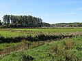
redoute and natural landscape in Damme, Belgium  | |||||
| Upload media | |||||
| Instance of | |||||
|---|---|---|---|---|---|
| Part of |
| ||||
| Location | Damme, Arrondissement of Bruges, West Flanders, Flemish Region, Belgium | ||||
 | |||||
Media in category "Verbrand Fort"
The following 2 files are in this category, out of 2 total.
-
 Het Verbrand Fort.jpg 946 × 2,048; 283 KB
-
 Verbrand Fort.jpg 5,184 × 3,888; 10.07 MB
