Category:Views of Thornton, West Yorkshire
Jump to navigation
Jump to search
Wikimedia category | |||||
| Upload media | |||||
| Instance of | |||||
|---|---|---|---|---|---|
| Category combines topics | |||||
| Thornton | |||||
village in West Yorkshire, England, UK .jpg) | |||||
| Instance of | |||||
| Location | Bradford, West Yorkshire, Yorkshire and the Humber, England | ||||
 | |||||
Media in category "Views of Thornton, West Yorkshire"
The following 55 files are in this category, out of 55 total.
-
 A View Northwards from Mountain - geograph.org.uk - 5320501.jpg 5,184 × 3,456; 7.66 MB
-
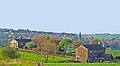
 Carr House Farm - geograph.org.uk - 3738136.jpg 640 × 459; 53 KB
-
 Descending Bailey Fold - geograph.org.uk - 5233414.jpg 1,600 × 1,067; 339 KB
-
 Fourth Tee on Headley Golf Course - geograph.org.uk - 5320955.jpg 5,184 × 3,456; 5.84 MB
-
 Hanging Falls, Clayton - geograph.org.uk - 392600.jpg 640 × 480; 101 KB
-
 Hay Bales at Moor Royd Gate Farm - geograph.org.uk - 5320547.jpg 5,184 × 3,456; 6.39 MB
-
 Hougomont (4733250091).jpg 2,407 × 1,605; 4.44 MB
-
 Mixenden Reservoir and NE, aerial 2018 - geograph.org.uk - 5885194.jpg 800 × 533; 102 KB
-
 Pit Lane, Queensbury (2616498538).jpg 2,169 × 1,635; 3.82 MB
-

-
 Prospect Mills, Thornton (21927767350).jpg 4,000 × 3,000; 8.49 MB
-
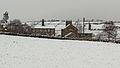
 Snow in Thornton (15691700143).jpg 3,521 × 1,981; 4.2 MB
-
 Snow in Thornton (16131559458).jpg 3,800 × 2,138; 5.19 MB
-
 Snowy view from Cliffe Lane, Thornton (16123640738).jpg 3,902 × 2,180; 5 MB
-
 Thornton (1382218130).jpg 2,560 × 1,712; 1.49 MB
-
 Thornton (14604782154).jpg 2,358 × 2,780; 5.44 MB
-
 Thornton (14682769450).jpg 3,740 × 2,244; 5.66 MB
-
 Thornton (17107298577).jpg 2,481 × 2,791; 6.59 MB
-
 Thornton (17292283135).jpg 3,565 × 2,451; 7.07 MB
-
 Thornton (1859770062).jpg 3,803 × 2,503; 2.6 MB
-
 Thornton (2319523886).jpg 2,560 × 1,705; 2.87 MB
-
 Thornton (2474771852).jpg 2,727 × 1,508; 2.87 MB
-
 Thornton (3270415248).jpg 2,317 × 1,727; 2.79 MB
-
 Thornton (5888653976).jpg 4,176 × 2,679; 6.41 MB
-
 Thornton (6837434455).jpg 2,726 × 3,812; 5.79 MB
-
 Thornton (8172544633).jpg 4,042 × 2,695; 7.48 MB
-
 Thornton (8476073265).jpg 1,661 × 1,583; 1.9 MB
-
 Thornton (8687266512).jpg 3,911 × 2,786; 10.91 MB
-
 Thornton (8721448246).jpg 2,640 × 3,978; 8.15 MB
-
 Thornton (8723227217).jpg 4,077 × 2,755; 8.16 MB
-
 Thornton (9416784864).jpg 3,880 × 1,870; 3.75 MB
-
 Thornton - geograph.org.uk - 182338.jpg 640 × 480; 71 KB
-
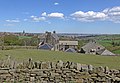
 Thornton Viaduct (2446060768).jpg 2,560 × 1,310; 2.79 MB
-
 Thornton village - mills and church - geograph.org.uk - 4618034.jpg 1,024 × 768; 224 KB
-
 Thornton village viewed from the viaduct - geograph.org.uk - 4618018.jpg 1,024 × 768; 239 KB
-
 Thornton, from Brewery Lane (17293405101).jpg 3,817 × 2,784; 8.7 MB
-

-
 Thornton, from Mountain (14163535946).jpg 3,272 × 4,515; 11.56 MB
-
 Thornton, from Mountain (8179687384).jpg 4,320 × 2,432; 5.94 MB
-
 Thornton, from Queensbury (14550656666).jpg 3,432 × 4,345; 13.32 MB
-
 Thornton, from Queensbury (1828418769).jpg 3,872 × 2,592; 2.23 MB
-
 Thornton, from Queensbury (8684401892).jpg 2,844 × 3,720; 9.14 MB
-
 Thornton, from the Viaduct (8704534493).jpg 2,342 × 2,342; 2.8 MB
-
 Thornton, from the Viaduct (Taken by Flickr user 2nd February 2013).jpg 2,597 × 1,789; 2.75 MB
-
 Valley (3100919862).jpg 2,560 × 1,706; 2.94 MB
-
 View from Queensbury.jpg 4,742 × 3,499; 14.46 MB
-
 View from Thornton Road 2 (4378568643).jpg 2,392 × 1,595; 2.76 MB
-
 View from Thornton Viaduct 1 (3100921626).jpg 2,494 × 1,662; 2.76 MB
-
 View from Thornton Viaduct 2 (3100085709).jpg 2,560 × 1,920; 4.04 MB
-
 View from Thornton Viaduct 3 (3100085179).jpg 2,545 × 1,696; 2.99 MB
-
 View from Thornton Viaduct 4 (3100084813).jpg 1,920 × 2,560; 3.5 MB
-
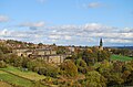
 View towards Thornton - geograph.org.uk - 5320615.jpg 5,184 × 3,456; 7.21 MB
-
 View towards Thornton 1 (5215080593).jpg 1,662 × 2,419; 3.16 MB
-
 View towards Thornton 2 (5215668404).jpg 3,894 × 2,603; 8.07 MB
-
 View towards Thornton, from Sheep Hill Lane (2497924572).jpg 2,383 × 1,388; 3.67 MB


.jpg)

.jpg)

.jpg)
.jpg)
.jpg)
.jpg)
.jpg)
.jpg)
.jpg)
.jpg)
.jpg)
.jpg)
.jpg)
.jpg)
.jpg)
.jpg)
.jpg)
.jpg)
.jpg)
.jpg)
.jpg)
.jpg)
.jpg)

.jpg)


.jpg)

.jpg)
.jpg)
.jpg)
.jpg)
.jpg)
.jpg)
.jpg)

.jpg)
.jpg)
.jpg)
.jpg)
.jpg)

.jpg)
.jpg)
.jpg)