Category:Villa Elisabeth (Luxembourg)
Jump to navigation
Jump to search
| Object location | | View all coordinates using: OpenStreetMap |
|---|
.jpg) | |||||
| Upload media | |||||
| Instance of | |||||
|---|---|---|---|---|---|
| Location | Luxembourg, Canton of Luxembourg, Luxembourg | ||||
| Dissolved, abolished or demolished date |
| ||||
 | |||||
Media in category "Villa Elisabeth (Luxembourg)"
The following 14 files are in this category, out of 14 total.
-
 Luxembourg Rue Mathias Hardt (105).jpg 5,847 × 3,899; 6.4 MB
-
 Luxembourg, Café Villa Elisabeth (vers 1900).jpeg 880 × 575; 112 KB
-
 Luxembourg, Villa Elisabeth (1).jpg 2,457 × 2,077; 1.51 MB
-
 Luxembourg, Villa Elisabeth (2).JPG 3,325 × 2,481; 1.53 MB
-
 Luxembourg, Villa Elisabeth (3).JPG 3,456 × 2,592; 2.83 MB
-
 Luxembourg, Villa Elisabeth (4).JPG 3,271 × 2,439; 1.6 MB
-
 Luxembourg, Villa Elisabeth (5).JPG 3,456 × 2,592; 2.94 MB
-
 Luxembourg, Villa Elisabeth (6).JPG 3,456 × 2,592; 3.66 MB
-
 Luxembourg, Villa Elisabeth (Shell).JPG 3,456 × 2,592; 2.36 MB
-
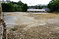
 Luxembourg, Villa Elisabeth démolition (1).jpg 6,000 × 4,000; 6.29 MB
-
 Luxembourg, Villa Elisabeth démolition (2).jpg 5,819 × 3,879; 4.56 MB
-
 Luxembourg, Villa Elisabeth démolition (3).jpg 5,847 × 3,899; 4.27 MB
-
 Luxembourg, Villa Elisabeth démolition (4).jpg 6,000 × 4,000; 4.57 MB
-
 Luxembourg, Villa Elisabeth démolition (5).jpg 5,847 × 3,899; 3.71 MB
.jpg)
.jpeg)
.jpg)
.JPG)
.JPG)
.JPG)
.JPG)
.JPG)
.JPG)
.jpg)
.jpg)
.jpg)
.jpg)