Category:Village Church Neuholland
Jump to navigation
Jump to search
| Object location | | View all coordinates using: OpenStreetMap |
|---|
church building in Oberhavel district, Brandenburg state, Germany   | |||||
| Upload media | |||||
| Instance of | |||||
|---|---|---|---|---|---|
| Location | Neuholland, Liebenwalde, Oberhavel District, Brandenburg, Germany | ||||
| Heritage designation | |||||
 | |||||
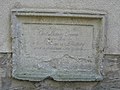
This is the category of the Brandenburger Baudenkmal (cultural heritage monument) with the ID 09165074 (Wikidata)
|
Deutsch: Die Dorfkirche in Neuholland bei Liebenwalde (zu Liebenwalde), Mark Brandenburg, gehört und dient einer lutherischen Gemeinde der unierten Evangelischen Kirche Berlin-Brandenburg-Schlesische Oberlausitz.
English: The Village Church in Neuholland bei Liebenwalde (a locality of Liebenwalde), March of Brandenburg, Germany, is owned and used by a Lutheran congregation within the Evangelical Church of Berlin-Brandenburg-Silesian Upper Lusatia, a united Protestant church body of Calvinist, Lutheran and united congregations.
Français : Église de Neuholland, ville de Liebenwalde, arrondissement de Haute-Havel, état fédéral de Brandebourg, Allemagne
Subcategories
This category has only the following subcategory.
Media in category "Village Church Neuholland"
The following 4 files are in this category, out of 4 total.
-
 1955, Günter Johl, Christuszyklus, Neuholland, Dorfkirche.jpg 1,726 × 3,000; 3.71 MB
-
 Church Neuholland (1).jpg 3,072 × 2,304; 4.16 MB
-
 Church Neuholland.jpg 3,072 × 2,304; 2.99 MB
-
 Village Church Neuholland 2015 NE.jpg 2,656 × 1,462; 1.74 MB

.jpg)
