Category:Vistula Peninsula
Jump to navigation
Jump to search
English: Vistula Peninsula
peninsular stretch of land in the Baltic Sea on the border between Russia and Poland  | |||||
| Upload media | |||||
| Instance of | |||||
|---|---|---|---|---|---|
| Part of | |||||
| Location | |||||
| Located in or next to body of water | |||||
| Elevation above sea level |
| ||||
 | |||||
Subcategories
This category has the following 4 subcategories, out of 4 total.
Media in category "Vistula Peninsula"
The following 19 files are in this category, out of 19 total.
-
 Vistula Lagoon.jpg 800 × 600; 92 KB
-
 313.53 Mierzeja Wiślana.png 750 × 750; 196 KB
-
 Bundesarchiv Bild 196-01484, Groß Bruch.jpg 782 × 800; 75 KB
-
 Droga wojewódzka 501 (Poland) map.jpg 659 × 411; 76 KB
-
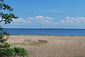
 Gdańsk Bay.jpg 3,872 × 2,592; 2.8 MB
-
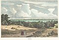 Kahlberg, 1880, Adolf Closs, after Hermann Penner.jpg 2,000 × 1,357; 1.15 MB
-
 Mierzeja Wislana aerial.jpg 6,000 × 4,000; 5.7 MB
-
 Mierzeja wislana Piaski granica.JPG 3,872 × 2,592; 4.45 MB
-
 Mierzeja wislana widok na Frombork.jpg 3,872 × 2,592; 4.43 MB
-
 Mierzeja Wiślana.PNG 510 × 311; 13 KB
-
 Polens Ostsee Kanal.jpg 6,000 × 4,000; 7.65 MB
-
 Vistula spit - east.jpg 2,784 × 2,088; 1.31 MB
-
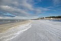
 Vistula spit - north beach.jpg 2,753 × 2,065; 935 KB
-
 Vistula spit map (polish).jpg 800 × 600; 182 KB
-
 Vistula spit map.jpg 800 × 600; 118 KB
-
 Vistula Spit winter2009.jpg 3,000 × 2,000; 1.5 MB
-
 Vistula spit.jpg 2,773 × 2,080; 981 KB
-
 Danziger Bucht 1902 (Krynica Morska).jpg 4,590 × 3,066; 3.27 MB
-
 Zalew Wiślany o wschodzie słońca widok na wysoczyznę Elbląską.jpg 3,872 × 2,592; 616 KB


_map.jpg)


.jpg)


.jpg)
