Category:Vogelschutzgebiet Mangfallgebirge
Jump to navigation
Jump to search
| Diese Kategorie repräsentiert ein Schutzgebiet nach Naturschutzrecht in Deutschland. |
|---|
| Diese Kategorie wurde nach einem klaren Schema angelegt, sie sollte nicht verschoben, gelöscht oder umkategorisiert werden. Sie ist unter anderem in dieser Uploadkarte hinterlegt. Beschreibung und Hintergründe auf der Seite des Wikiprojekts |
| Foto zu Wiki Loves Earth hochladen! - Seite von Wiki Loves Earth Deutschland |
special protection areas in Bayern, Germany | |||||
| Upload media | |||||
| Instance of |
| ||||
|---|---|---|---|---|---|
| Named after | |||||
| Location | Miesbach, Upper Bavaria, Bavaria, Germany | ||||
| Applies to jurisdiction | |||||
| Inception |
| ||||
| Area |
| ||||
 | |||||
![]() Artikel im Wikipedia Projekt: Mangfallgebirge
Artikel im Wikipedia Projekt: Mangfallgebirge
Deutsch: EU-Vogelschutzgebiet „Mangfallgebirge'“ (8336-471) im Landkreis Miesbach, Oberbayern.
Subcategories
This category has the following 28 subcategories, out of 28 total.
B
- Blauberge (21 F)
G
- Gamswand (3 F)
H
- Hochmiesing (30 F)
K
- Kreuzbergalm (3 F)
- Königsalm (Kreuth) (10 F)
L
- Langeckberg (3 F)
M
- Mäander der Roten Valepp (9 F)
P
- Plankenstein (Berg) (22 F)
- Platteneck (Kreuth) (4 F)
R
- Rieselsbergalm (Kreuth) (1 F)
- Risserkogel (27 F)
- Ritzelbergalm (1 F)
- Ruchenköpfe (1 P, 19 F)
S
- Sandbichler Alm (2 F)
- Schildenstein (17 F)
- Schinder (20 F)
- Schreistein (3 F)
- Seeberg (Mangfallgebirge) (9 F)
- Siebligrat (1 F)
- Sillbergalm (10 F)
- Soinalm (18 F)
- Soinsee (30 F)
W
- Wolfsschlucht (Mangfallgebirge) (12 F)
Media in category "Vogelschutzgebiet Mangfallgebirge"
The following 22 files are in this category, out of 22 total.
-
 Ankerbach (Weiße Valepp).jpg 2,592 × 1,456; 1.86 MB
-
 Bayralm.jpg 3,000 × 2,250; 3.61 MB
-
 Bernauer Bach.jpg 2,592 × 1,456; 1.56 MB
-
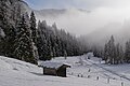
 Bernaueralm, Bavaria.jpg 2,592 × 1,456; 1.22 MB
-
 Blick auf Geißalm vom Weg zwischen Wildbad Kreuth und Königsalm.jpg 6,242 × 4,166; 11.78 MB
-
 Engelsbach (namenloser Zufluss).jpg 2,248 × 3,000; 4.71 MB
-
 Engelsbach.jpg 3,000 × 2,250; 5.17 MB
-
 Gruensee-2013-07-07 09-53-12 132.jpg 2,592 × 1,456; 1.56 MB
-
 Höllache.jpg 2,592 × 1,456; 1.96 MB
-
 Klareralm.jpg 3,000 × 2,250; 4.68 MB
-
 Kreuzberg Kreuzbergalm Sitzbank Grenzstein IMGP3425.jpg 1,024 × 721; 433 KB
-
 Lahner Alm, Teich, namenlos.jpg 1,456 × 2,592; 1.54 MB
-
 Lahner Alm.jpg 2,592 × 1,456; 1.41 MB
-
 Lahnerkopf (Mangfallgebirge).jpg 2,592 × 1,456; 1.08 MB
-
 Mangfallgebirge - Taubenstein - geograph.org.uk - 9240.jpg 425 × 640; 40 KB
-
 Neualpenbach.jpg 1,456 × 2,592; 1.66 MB
-
 Rauhensackbach.jpg 2,592 × 1,456; 1.57 MB
-
 Reitstein.jpg 1,600 × 1,204; 568 KB
-
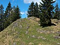
 Rotzigmoosberg.jpg 2,592 × 1,456; 1.71 MB
-
 Sagenbach.jpg 3,000 × 2,250; 4.49 MB
-
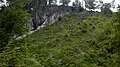
 Schreistein.jpg 3,000 × 2,250; 3.38 MB
-
 Wechselalm in winterlichen Stimmung in Sutten im FFH-Gebiet Mangfallgebirge.jpg 6,242 × 4,166; 12.43 MB
.jpg)


.jpg)


.jpg)


