Category:Volkspark, Rijssen
Jump to navigation
Jump to search
| Object location | | View all coordinates using: OpenStreetMap |
|---|
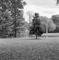
park in Rijssen-Holten, Netherlands  | |||||
| Upload media | |||||
| Instance of | |||||
|---|---|---|---|---|---|
| Part of | |||||
| Location | Rijssen, Overijssel, Netherlands | ||||
| Architect | |||||
| Heritage designation |
| ||||
| Inception |
| ||||
 | |||||
|
This is a category about rijksmonumentcomplex number 508544
|
|
This is a category about rijksmonument number 508548
|
| Address |
|
Subcategories
This category has the following 2 subcategories, out of 2 total.
G
- Gedenknaald Ter Horst (8 F)
V
- Voliere, Volkspark, Rijssen (4 F)
Media in category "Volkspark, Rijssen"
The following 5 files are in this category, out of 5 total.
-
 Exterieur OVERZICHT - Rijssen - 20297249 - RCE.jpg 1,192 × 1,200; 360 KB
-
 Overzicht muziektent - Rijssen - 20397529 - RCE.jpg 1,200 × 1,200; 332 KB
-
 Overzicht park - Rijssen - 20397535 - RCE.jpg 1,200 × 1,200; 365 KB
-
 Overzicht van het park met vijver en gedenknaald - Rijssen - 20385547 - RCE.jpg 1,188 × 1,200; 396 KB
-
 Park in Rijssen.jpg 2,592 × 1,944; 1.19 MB


