Category:Vondel's Landleeuw (Abbenes)
Jump to navigation
Jump to search
| Object location | | View all coordinates using: OpenStreetMap |
|---|
 | |||||
| Upload media | |||||
| Instance of | |||||
|---|---|---|---|---|---|
| Location | Abbenes, Haarlemmermeer, North Holland, Netherlands | ||||
| Architectural style | |||||
| Has part(s) | |||||
| Heritage designation |
| ||||
| Inception |
| ||||
 | |||||
|
This is a category about rijksmonument number 510057
|
| Address |
|
Media in category "Vondel's Landleeuw (Abbenes)"
The following 4 files are in this category, out of 4 total.
-
 Vondel's Landleeuw - landbouwschuur, Abbenes.jpg 2,913 × 1,930; 2.52 MB
-
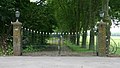 Vondel's Landleeuw - toegangshek, Abbenes.jpg 2,981 × 1,682; 2.07 MB
-
 Vondel's Landleeuw - wagenschuur, Abbenes.jpg 3,072 × 2,048; 3.34 MB
-
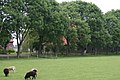
 Vondel's Landleeuw - woonhuis, Abbenes.jpg 3,072 × 2,048; 3.23 MB


