Category:Voormalige Sint-Martinuskerk (Ronse)
Jump to navigation
Jump to search
|
This is a category about onroerend erfgoed number 29047
|
| Object location | | View all coordinates using: OpenStreetMap |
|---|
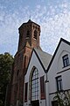
church in Ronse, Belgium  | |||||
| Upload media | |||||
| Instance of | |||||
|---|---|---|---|---|---|
| Dedicated to | |||||
| Location | Ronse, Arrondissement of Oudenaarde, East Flanders, Flemish Region, Belgium | ||||
| Diocese | |||||
 | |||||
Media in category "Voormalige Sint-Martinuskerk (Ronse)"
The following 19 files are in this category, out of 19 total.
-
 Gedesaffecteerde parochiekerk Sint-Martinus - 389490 - onroerenderfgoed.jpg 5,105 × 3,885; 2.21 MB
-
 Gedesaffecteerde parochiekerk Sint-Martinus - 389491 - onroerenderfgoed.jpg 4,001 × 5,413; 3.69 MB
-
 Gedesaffecteerde parochiekerk Sint-Martinus - 389492 - onroerenderfgoed.jpg 5,152 × 3,710; 2.48 MB
-
 Gedesaffecteerde parochiekerk Sint-Martinus - 389493 - onroerenderfgoed.jpg 3,901 × 5,388; 2.55 MB
-
 Gedesaffecteerde parochiekerk Sint-Martinus - 389494 - onroerenderfgoed.jpg 4,009 × 5,345; 3.57 MB
-
 Gedesaffecteerde parochiekerk Sint-Martinus - 389495 - onroerenderfgoed.jpg 5,399 × 4,056; 3.3 MB
-
 Gedesaffecteerde parochiekerk Sint-Martinus - 389496 - onroerenderfgoed.jpg 5,303 × 4,070; 3.65 MB
-
 Oude Sint-Martinuskerk 01.jpg 3,648 × 5,472; 5.41 MB
-
 Oude Sint-Martinuskerk 02.jpg 3,648 × 5,472; 5.8 MB
-
 Oude Sint-Martinuskerk 03.jpg 3,648 × 5,472; 7.73 MB
-
 Oude Sint-Martinuskerk 04.jpg 5,472 × 3,648; 7.26 MB
-
 Oude Sint-Martinuskerk 05.jpg 5,472 × 3,648; 7.57 MB
-
 Oude Sint-Martinuskerk Ronse.jpg 1,125 × 769; 276 KB
-
 Renaix - De oude Sint-Martinuskerk - panoramio.jpg 1,944 × 2,592; 1.46 MB
-
 Ronse - Sint-Martinustoren 1.jpg 1,728 × 2,304; 1.66 MB
-
 Ronse B PM 000016.jpg 426 × 600; 230 KB
-
 Ronse B PM 024028.jpg 600 × 400; 209 KB
-
 Voormalige Sint-Martinuskerk (Ronse) 01.jpg 4,618 × 3,464; 2.3 MB
-
 Voormalige Sint-Martinuskerk (Ronse) 02.jpg 3,464 × 4,618; 1.65 MB


_01.jpg)
_02.jpg)
Categories:
- Churches in Ronse
- Former churches in Belgium
- Onroerend erfgoed in Ronse
- 15th-century churches in East Flanders
- Brick Gothic churches in East Flanders
- Hall churches in East Flanders
- 19th-century churches in East Flanders
- Neoclassical churches in East Flanders
- Churches in Belgium by name
- Saint Martin churches in Belgium
- Buildings in Ronse by name