Category:Voorstraat 11, Bad Nieuweschans
Jump to navigation
Jump to search
| Object location | | View all coordinates using: OpenStreetMap |
|---|
building in Oldambt, Netherlands  | |||||
| Upload media | |||||
| Instance of | |||||
|---|---|---|---|---|---|
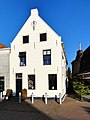
| Location | Bad Nieuweschans, Oldambt, Groningen, Netherlands | ||||
| Street address |
| ||||
| Heritage designation |
| ||||
 | |||||
|
This is a category about rijksmonument number 30459
|
| Address |
|
Media in category "Voorstraat 11, Bad Nieuweschans"
The following 4 files are in this category, out of 4 total.
-
 Voorgevels - Nieuweschans - 20164928 - RCE.jpg 1,200 × 808; 209 KB
-
 Voorgevels - Nieuweschans - 20164930 - RCE.jpg 1,200 × 807; 240 KB
-
 Voorstraat11 Nieuweschans.jpg 1,368 × 1,824; 377 KB
-
 Voorstraat11en13 Nieuweschans.jpg 1,824 × 1,368; 392 KB


