Category:Voorstraat 72, Asperen
Jump to navigation
Jump to search
| Object location | | View all coordinates using: OpenStreetMap |
|---|
 | |||||
| Upload media | |||||
| Instance of | |||||
|---|---|---|---|---|---|
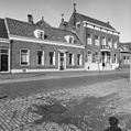
| Location | Asperen, West Betuwe, Gelderland, Netherlands | ||||
| Street address |
| ||||
| Located on street |
| ||||
| Heritage designation |
| ||||
 | |||||
|
This is a category about rijksmonument number 523127
|
| Address |
|
Media in category "Voorstraat 72, Asperen"
The following 3 files are in this category, out of 3 total.
-
 Asperen RM Voorstraat 72.jpg 3,863 × 3,319; 4.57 MB
-
 Exterieur VOORGEVELS - Asperen - 20301294 - RCE.jpg 1,195 × 1,200; 355 KB
-
 Voorstraat 72 Asperen.jpg 3,888 × 2,592; 6.18 MB

