Category:Waddington, Lancashire
Jump to navigation
Jump to search
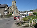
English: Waddington is a small village, 2 miles (3 km) north-west of Clitheroe, within the Ribble Valley district of Lancashire, England. It is also a civil parish. Prior to the 1974 county boundary changes, Waddington just fell within the boundary of Bowland Rural District of the West Riding of Yorkshire. (→Waddington, Lancashire)
Nederlands: Waddington is een plaats en civil parish in het bestuurlijke gebied Ribble Valley, in het Engelse graafschap Lancashire. (→Waddington (Lancashire))
Polski: Waddington – wieś w Anglii, w hrabstwie Lancashire, w dystrykcie Ribble Valley. Leży 49 km na północ od miasta Manchester i 306 km na północny zachód od Londynu. (→Waddington (Lancashire))

village and civil parish in Ribble Valley, Lancashire, UK _-_geograph.org.uk_-_54072.jpg) | |||||
| Upload media | |||||
| Instance of | |||||
|---|---|---|---|---|---|
| Location | Ribble Valley, Lancashire, North West England, England | ||||
| Population |
| ||||
 | |||||
Subcategories
This category has the following 7 subcategories, out of 7 total.
Media in category "Waddington, Lancashire"
The following 200 files are in this category, out of 306 total.
(previous page) (next page)-
 2.1.16 2 Waddington 2 (24111627956).jpg 6,016 × 4,000; 4.93 MB
-
 A copse hiding Buckstall - geograph.org.uk - 4554979.jpg 4,392 × 2,736; 7.12 MB
-
 A footbridge - geograph.org.uk - 3983867.jpg 4,592 × 3,056; 6.95 MB
-
 A gully with a secret - geograph.org.uk - 3979875.jpg 4,018 × 2,797; 7.85 MB
-
 A handsome tree on the moor - geograph.org.uk - 3988261.jpg 4,274 × 2,624; 7.25 MB
-
 A pair of stiles - geograph.org.uk - 4552408.jpg 640 × 450; 105 KB
-
 A Quiet Corner of Waddington - geograph.org.uk - 1670676.jpg 640 × 480; 111 KB
-
 A sorry sight - geograph.org.uk - 4555494.jpg 4,473 × 2,498; 7.73 MB
-

-

-
 B6478 - geograph.org.uk - 4647183.jpg 4,867 × 3,456; 1.75 MB
-

-
 B6478 Clitheroe Road - geograph.org.uk - 4628956.jpg 640 × 480; 400 KB
-

-
 B6478 north-west of Waddington - geograph.org.uk - 3866814.jpg 640 × 445; 85 KB
-
 B6478 on Waddington Fell - geograph.org.uk - 5477615.jpg 640 × 480; 41 KB
-
 B6478 passing through Waddington - geograph.org.uk - 5767493.jpg 640 × 480; 97 KB
-
 B6478 Slaidburn Road - geograph.org.uk - 5476691.jpg 640 × 481; 57 KB
-
 B6478 Slaidburn Road - geograph.org.uk - 5477600.jpg 640 × 481; 58 KB
-
 B6478, Waddington - geograph.org.uk - 1937313.jpg 640 × 480; 73 KB
-
 B6478, Waddington - geograph.org.uk - 5139933.jpg 640 × 480; 73 KB
-

-
 Bare trees near Horse Shoe Wood - geograph.org.uk - 3799458.jpg 3,252 × 2,168; 2.79 MB
-
 Bashall Brook - geograph.org.uk - 742385.jpg 640 × 480; 134 KB
-
 Belle Vue Lane, Waddington - geograph.org.uk - 3097395.jpg 640 × 424; 63 KB
-
 Belle Vue Lane, Waddington - geograph.org.uk - 4340665.jpg 640 × 480; 52 KB
-
 Bookers - geograph.org.uk - 3492259.jpg 3,234 × 2,501; 1.71 MB
-
 Branch Road, Waddington - geograph.org.uk - 3097442.jpg 640 × 424; 77 KB
-
 Bridge over the Stream - Waddington - geograph.org.uk - 2173144.jpg 4,224 × 3,168; 2.66 MB
-
 Brungerley Bridge - geograph.org.uk - 3066336.jpg 2,669 × 2,000; 2.32 MB
-
 Brungerley Bridge - geograph.org.uk - 3145937.jpg 2,048 × 1,536; 610 KB
-
 Brungerley Bridge Clitheroe - geograph.org.uk - 3235942.jpg 3,215 × 2,358; 3.77 MB
-
 Brungerley Bridge ^ the R Ribble, Clitheroe - geograph.org.uk - 6010881.jpg 5,184 × 2,920; 7.23 MB
-

-
 Bungalows, Waddington - geograph.org.uk - 5139934.jpg 640 × 480; 71 KB
-
 Bus on the B6478 - geograph.org.uk - 1674913.jpg 640 × 480; 74 KB
-
 Camp site in the grounds of Waddow Hall - geograph.org.uk - 2224799.jpg 640 × 480; 184 KB
-
 Camp site in the grounds of Waddow Hall - geograph.org.uk - 2224804.jpg 640 × 480; 115 KB
-

-
 Cattle Grid, Newton Fells - geograph.org.uk - 2367888.jpg 640 × 476; 77 KB
-
 Chapel at Waddington Almshouses - geograph.org.uk - 2949807.jpg 2,592 × 1,944; 1.38 MB
-
 Clitheroe Road (B6478), Waddington - geograph.org.uk - 5139924.jpg 640 × 480; 78 KB
-
 Clitheroe Road, Waddington - geograph.org.uk - 2283095.jpg 640 × 480; 143 KB
-
 Clitheroe Road, Waddington - geograph.org.uk - 3097430.jpg 640 × 424; 61 KB
-
 Clitheroe Road, Waddington - geograph.org.uk - 4500733.jpg 2,000 × 1,500; 439 KB
-
 Clitheroe Road, Waddington - geograph.org.uk - 4628994.jpg 640 × 480; 475 KB
-
 Colthurst Hall - geograph.org.uk - 1670698.jpg 640 × 480; 77 KB
-
 Coronation Gardens, Waddington - geograph.org.uk - 5767511.jpg 640 × 480; 125 KB
-
 Coronation Gardens, Waddington - geograph.org.uk - 6367081.jpg 2,592 × 1,944; 1.63 MB
-
 Cottages on Waddow View - geograph.org.uk - 5139915.jpg 640 × 480; 64 KB
-
 Country Kitchen, Waddington - geograph.org.uk - 2283090.jpg 480 × 640; 66 KB
-
 Cross Lane near Colthurst Hall - geograph.org.uk - 3866825.jpg 640 × 453; 114 KB
-
 Direction Sign – Signpost in Waddington - geograph.org.uk - 6691410.jpg 733 × 889; 202 KB
-
 DugdalesWaddington.jpg 900 × 674; 531 KB
-
 Easington Fell (east) - geograph.org.uk - 6100318.jpg 5,152 × 3,864; 7.53 MB
-
 Easington Fell (south east) - geograph.org.uk - 6100323.jpg 5,152 × 3,864; 7.11 MB
-
 Easington Fell - geograph.org.uk - 2367894.jpg 640 × 328; 37 KB
-
 Edisford Road - geograph.org.uk - 3309748.jpg 4,320 × 3,240; 4.01 MB
-
 Edisford Road - geograph.org.uk - 5139901.jpg 640 × 480; 111 KB
-

-

-
 Edisford Road west of Clitheroe - geograph.org.uk - 5476671.jpg 640 × 480; 124 KB
-
 Edisford Road, Waddington - geograph.org.uk - 3798133.jpg 3,872 × 2,592; 3.96 MB
-
 Edward VII postbox on Waddington Road, Lane Side - geograph.org.uk - 5141449.jpg 837 × 1,522; 256 KB
-
 Elizabeth II postbox outside Waddington Post Office - geograph.org.uk - 5141465.jpg 1,144 × 2,144; 553 KB
-
 Entering Waddington - geograph.org.uk - 5139913.jpg 640 × 480; 88 KB
-
 Entrance to Feazer farm - geograph.org.uk - 2555336.jpg 640 × 426; 293 KB
-
 Entrance to Waddington Fell Quarry - geograph.org.uk - 2285470.jpg 640 × 480; 96 KB
-
 Entrance to Waddington Fell Quarry - geograph.org.uk - 2555363.jpg 640 × 426; 282 KB
-
 Farmland near Waddington on a wet day - geograph.org.uk - 3797471.jpg 3,146 × 2,098; 1.65 MB
-
 Fell Road - geograph.org.uk - 4542375.jpg 4,592 × 3,056; 7.65 MB
-
 Fell Road approaching the Moorcock Inn - geograph.org.uk - 3492269.jpg 4,185 × 2,711; 2.03 MB
-
 Fell Road toward Waddington - geograph.org.uk - 2912272.jpg 5,184 × 3,456; 3.76 MB
-
 Fell Road, Waddington - geograph.org.uk - 2912269.jpg 5,184 × 3,456; 4.36 MB
-
 Fields House - geograph.org.uk - 3019336.jpg 4,288 × 3,216; 3.51 MB
-
 Fish ladder near Waddow Hall - geograph.org.uk - 2224717.jpg 640 × 426; 86 KB
-

-
 Footbridge over Waddington Brook - geograph.org.uk - 5139922.jpg 640 × 480; 119 KB
-
 Footpath - geograph.org.uk - 827389.jpg 640 × 480; 138 KB
-
 Footpath approaching Hollins Clough - geograph.org.uk - 1670683.jpg 640 × 480; 94 KB
-
 Footpath in the grounds of Waddow Hall - geograph.org.uk - 2224798.jpg 480 × 640; 102 KB
-
-
 Footpath leaving Edisford Road - geograph.org.uk - 3309734.jpg 4,320 × 3,240; 4.75 MB
-
 Footpath near Waddington - geograph.org.uk - 3436618.jpg 1,024 × 682; 530 KB
-
 Footpath near Waddow - geograph.org.uk - 3799448.jpg 3,604 × 2,403; 3.09 MB
-
 Footpath on Bradford Fell - geograph.org.uk - 2170077.jpg 3,872 × 2,592; 1.71 MB
-
 Footpath to Lower New House - geograph.org.uk - 3097398.jpg 640 × 424; 82 KB
-
 Footpath to Waddow Hall - geograph.org.uk - 3797245.jpg 3,727 × 2,485; 3.89 MB
-
 Gate Guard - Edisford Road - geograph.org.uk - 3019342.jpg 1,706 × 3,206; 1.38 MB
-
 Gate on Bradford Fell - geograph.org.uk - 2171361.jpg 3,872 × 2,592; 1.65 MB
-
 Gated Pasture on Twitter Lane - geograph.org.uk - 3491045.jpg 4,590 × 3,168; 2.84 MB
-
 Gateway, Waddington Hall.jpg 424 × 640; 90 KB
-
 Grazing Carter Fold Farm, Waddington - geograph.org.uk - 5139931.jpg 640 × 480; 92 KB
-
 Grazing land south of Waddington - geograph.org.uk - 3798118.jpg 3,556 × 2,370; 3.29 MB
-
 Grazing near the River Ribble - geograph.org.uk - 5139902.jpg 640 × 480; 89 KB
-
 Grazing off the B6478 - geograph.org.uk - 5139909.jpg 640 × 480; 71 KB
-
 Higher Buck, Waddington - geograph.org.uk - 2285466.jpg 640 × 480; 117 KB
-
 Higher Buck, Waddington - geograph.org.uk - 3095937.jpg 640 × 424; 67 KB
-
 House, Lane Side - geograph.org.uk - 5141455.jpg 640 × 480; 72 KB
-
 Ice at the weir near Waddow Hall - geograph.org.uk - 2222623.jpg 640 × 425; 91 KB
-
 Ice at the weir near Waddow Hall - geograph.org.uk - 2224780.jpg 640 × 480; 142 KB
-
 Ice at the weir near Waddow Hall - geograph.org.uk - 2224781.jpg 640 × 480; 159 KB
-

-

-
 Kennels, Shireburn - geograph.org.uk - 5139900.jpg 640 × 480; 95 KB
-
 Lane Side, Waddington.jpg 5,184 × 2,606; 1.75 MB
-
 Lower Buck Inn, Waddington - geograph.org.uk - 742224.jpg 640 × 480; 197 KB
-
 Mist under Pendle - geograph.org.uk - 1149698.jpg 640 × 472; 49 KB
-
 Modern cottage at Feazer Farm. - geograph.org.uk - 2949814.jpg 2,592 × 1,944; 1.31 MB
-
 Moorcock Inn - geograph.org.uk - 2912276.jpg 5,184 × 3,456; 2.81 MB
-
 New house on Waddow Grove - geograph.org.uk - 1937302.jpg 640 × 480; 122 KB
-
 Old Boundary Marker - geograph.org.uk - 6443106.jpg 960 × 527; 193 KB
-
 Old Boundary Marker - geograph.org.uk - 6492156.jpg 720 × 960; 176 KB
-

-

-
 Ordnance Survey Flush Bracket S0752 - geograph.org.uk - 4006310.jpg 4,000 × 3,000; 4.55 MB
-
 Pasture in front of Colthurst - geograph.org.uk - 1670691.jpg 640 × 480; 88 KB
-
 Peg o' Nell's Well, Waddow Hall - geograph.org.uk - 2224791.jpg 640 × 480; 216 KB
-
 Peg o' Nell's Well, Waddow Hall - geograph.org.uk - 2224794.jpg 480 × 640; 108 KB
-
 Plantation south of Daisy Hill Farmhouse - geograph.org.uk - 4209973.jpg 4,288 × 3,216; 3.37 MB
-
 Plaque - geograph.org.uk - 327094.jpg 640 × 480; 162 KB
-
 R Ribble NW of Crosshill Quarry near Clitheroe - geograph.org.uk - 6010884.jpg 5,184 × 2,920; 6.29 MB
-
 Radio Transmission Mast on Waddington Fell - geograph.org.uk - 3744566.jpg 4,320 × 3,240; 2.13 MB
-
 Regent Street, Waddington - geograph.org.uk - 3095943.jpg 424 × 640; 72 KB
-
 Regents Street, Waddington - geograph.org.uk - 1067574.jpg 640 × 480; 76 KB
-
 River Ribble - geograph.org.uk - 827372.jpg 640 × 480; 143 KB
-
 River Ribble - geograph.org.uk - 827375.jpg 640 × 480; 127 KB
-
 River Ribble - geograph.org.uk - 827424.jpg 640 × 480; 205 KB
-
 River Ribble - geograph.org.uk - 827427.jpg 640 × 480; 198 KB
-
 River Ribble - geograph.org.uk - 827435.jpg 640 × 480; 164 KB
-

-

-

-

-
 Road junction in Waddington - geograph.org.uk - 4002757.jpg 4,000 × 3,000; 2.41 MB
-
 Road to Brungerley - geograph.org.uk - 827352.jpg 640 × 480; 188 KB
-
 Road to Lillands - geograph.org.uk - 2282918.jpg 640 × 480; 114 KB
-
 Rough grazing on Waddington Fell - geograph.org.uk - 6775901.jpg 6,000 × 4,000; 4.34 MB
-
 Sheep above the Ribble - geograph.org.uk - 3797235.jpg 3,604 × 2,403; 3.87 MB
-
 Shireburn Park - geograph.org.uk - 3994614.jpg 4,592 × 2,520; 7.65 MB
-
 Sign for the Higher Buck, Waddington - geograph.org.uk - 5139928.jpg 464 × 640; 75 KB
-
 Silageing at Brungerley - geograph.org.uk - 827362.jpg 640 × 480; 151 KB
-
 Slaidburn Road - geograph.org.uk - 742190.jpg 640 × 480; 174 KB
-
 Slaidburn Road - geograph.org.uk - 742194.jpg 640 × 480; 238 KB
-
 Slaidburn Road near Chancery Farm - geograph.org.uk - 3492263.jpg 4,301 × 3,006; 2.39 MB
-
 Slaidburn Road on Tittrington Brow - geograph.org.uk - 4504800.jpg 2,000 × 1,440; 378 KB
-
 Slaidburn Road towards Clitheroe - geograph.org.uk - 4504806.jpg 2,000 × 1,388; 369 KB
-
 Slaidburn Road towards Clitheroe - geograph.org.uk - 4504831.jpg 2,000 × 1,500; 447 KB
-
 Small coppice by Tittrington Brow - geograph.org.uk - 3112872.jpg 1,600 × 1,024; 293 KB
-
 St Helen's Church Waddington, West Tower - geograph.org.uk - 6367084.jpg 1,944 × 2,592; 1.07 MB
-
 St Helen's Church, Waddington - geograph.org.uk - 6367097.jpg 2,334 × 1,708; 1.04 MB
-
 St. Helen's Church, Waddington - geograph.org.uk - 5139930.jpg 640 × 480; 80 KB
-
 St.Helen's Church, Waddington - geograph.org.uk - 5138826.jpg 1,800 × 1,440; 1.75 MB
-
 Start Of Footpath To Easington Fell - geograph.org.uk - 3566152.jpg 3,072 × 2,304; 4.06 MB
-
 Stephen Bridge - geograph.org.uk - 3436614.jpg 1,024 × 682; 611 KB
-
 Stephen Bridge - geograph.org.uk - 455070.jpg 640 × 480; 100 KB
-
 Stream, Shireburn - geograph.org.uk - 5139898.jpg 480 × 640; 128 KB
-
 The Annexe, Cuttock Clough House - geograph.org.uk - 2990681.jpg 640 × 423; 56 KB
-
 The Chapel at Waddington Hospital - geograph.org.uk - 4629065.jpg 640 × 481; 628 KB
-

-
 The Church of St Helen, Waddington - geograph.org.uk - 4629104.jpg 640 × 480; 546 KB
-
 The Country Cottage, Waddington - geograph.org.uk - 3097417.jpg 640 × 424; 73 KB
-
 The entrance to Waddington Fell Quarry - geograph.org.uk - 2170066.jpg 3,872 × 2,592; 2.13 MB
-
 The footpath to West Bradford - geograph.org.uk - 3228875.jpg 4,496 × 2,863; 7.3 MB
-
 The Higher Buck, Waddington - geograph.org.uk - 1067577.jpg 640 × 479; 70 KB
-
 The Higher Buck, Waddington - geograph.org.uk - 5139926.jpg 640 × 480; 53 KB
-
-

-
 The Lower Buck, Waddington - geograph.org.uk - 3097390.jpg 640 × 424; 69 KB
-
 The Moorcock Inn - (Currently Deserted) - geograph.org.uk - 3492281.jpg 4,341 × 2,856; 2.39 MB
-
 The Moorcock Inn - geograph.org.uk - 2555365.jpg 640 × 426; 235 KB
-
 The Moorcock Inn - geograph.org.uk - 3979706.jpg 4,475 × 2,978; 6.48 MB
-
 The Moorcock Inn from Slaidburn Road - geograph.org.uk - 5477610.jpg 640 × 480; 44 KB
-
 The Moorcock Inn on Slaidburn Road - geograph.org.uk - 4500734.jpg 2,000 × 1,500; 372 KB
-
 The Moorcock Inn on Slaidburn Road - geograph.org.uk - 4500736.jpg 2,000 × 1,500; 245 KB
-
 The moorland - geograph.org.uk - 3980271.jpg 4,471 × 2,410; 7.92 MB
-

-
 The remains of the Moorcock Inn - geograph.org.uk - 5138829.jpg 1,800 × 1,012; 1.68 MB
-
 The River Ribble - geograph.org.uk - 5139908.jpg 640 × 480; 48 KB
-
 The River Ribble and the Ribble Way - geograph.org.uk - 3228844.jpg 4,592 × 3,056; 5.69 MB
-
 The River Ribble from Brungerley Bridge - geograph.org.uk - 3019389.jpg 4,288 × 3,216; 4.22 MB
-
 The road to Waddington - geograph.org.uk - 1572932.jpg 640 × 480; 73 KB
-
 The road to Waddington, B6478 - geograph.org.uk - 5285641.jpg 4,032 × 3,024; 3.23 MB
-
 The road wiggles through Hollins Wood - geograph.org.uk - 4542252.jpg 4,592 × 3,056; 7.76 MB
-
 The signals mast on Waddington Hill - geograph.org.uk - 3979759.jpg 4,245 × 2,440; 6.28 MB
-
 The Slaidburn Road and Moorcock Inn - geograph.org.uk - 3112832.jpg 1,600 × 1,179; 483 KB
-
 The view North over the concealed quarry - geograph.org.uk - 3979799.jpg 4,592 × 2,760; 7.9 MB
-
 The view towards a misty Pendle Hill - geograph.org.uk - 3983811.jpg 4,592 × 3,056; 7.33 MB
-
 The Waddington Arms - geograph.org.uk - 3228983.jpg 4,592 × 3,056; 7.16 MB
-
 The Waddington Arms - Waddington - geograph.org.uk - 2173147.jpg 4,224 × 3,168; 3.22 MB
-

-
 Through the arched window - geograph.org.uk - 2437334.jpg 4,000 × 3,000; 3.79 MB
-
 Tittrington Brow - geograph.org.uk - 3492294.jpg 3,902 × 2,873; 2.18 MB
-
 Tittrington Brow - geograph.org.uk - 4460428.jpg 5,084 × 2,835; 1.78 MB
-
 Tittrington Brow on the Slaidburn Road - geograph.org.uk - 3112847.jpg 1,600 × 1,068; 387 KB
-
 Too much information again - geograph.org.uk - 2035586.jpg 2,569 × 1,926; 931 KB
-
 Track in the grounds of Waddow Hall - geograph.org.uk - 2224805.jpg 640 × 480; 147 KB
-
 Track in the grounds of Waddow Hall - geograph.org.uk - 2224806.jpg 640 × 480; 143 KB
-
 Track in the grounds of Waddow Hall - geograph.org.uk - 2224807.jpg 640 × 480; 178 KB
-
 Track on Waddington Fell - geograph.org.uk - 6775891.jpg 6,000 × 4,000; 6.66 MB
.jpg)


_-_geograph.org.uk_-_5767467.jpg)


,_Waddington_-_geograph.org.uk_-_5139924.jpg)


_-_geograph.org.uk_-_6100318.jpg)
_-_geograph.org.uk_-_6100323.jpg)


_-_geograph.org.uk_-_3492281.jpg)


