Category:Waddington, Lincolnshire
Jump to navigation
Jump to search
Deutsch: Waddington ist eine englische Ortschaft in der Grafschaft Lincolnshire. Die Ortschaft liegt ca. 6 km südlich von Lincoln im Bezirk North Kesteven und hat 6086 Einwohner (Stand: 2001). Im Domesday Book wird die Ortschaft schon im Jahre 1086 erwähnt.
English: Waddington is a large rural commuter village in the North Kesteven district of Lincolnshire, England. Situated approximately 4 miles (6 km) south of Lincoln on the A607 Grantham Road. According to the census 2001 the village had a population of 6,086.
Français : Waddington est un gros village du comté du Lincolnshire, dans le district de North Kesteven. Il est situé 6 km au sud de Lincoln et comptait habitants au recensement de 2001. Il était déjà cité dans le Domesday Book (1086).
village and civil parish in Lincolnshire, England  | |||||
| Upload media | |||||
| Instance of | |||||
|---|---|---|---|---|---|
| Location | North Kesteven, Lincolnshire, East Midlands, England | ||||
 | |||||
Subcategories
This category has the following 3 subcategories, out of 3 total.
M
R
Media in category "Waddington, Lincolnshire"
The following 115 files are in this category, out of 115 total.
-
 A15 at entrance to Beaufoe Manor - geograph.org.uk - 3651663.jpg 640 × 480; 54 KB
-
 A607 heading north - geograph.org.uk - 2829498.jpg 640 × 480; 55 KB
-
 A607 towards Lincoln - geograph.org.uk - 2829495.jpg 640 × 480; 60 KB
-
 Boundary Garage - geograph.org.uk - 2486100.jpg 640 × 480; 82 KB
-

-
 Brant Road - geograph.org.uk - 327163.jpg 640 × 427; 62 KB
-

-

-
 Bridleway and Cycle Track - geograph.org.uk - 159504.jpg 640 × 480; 131 KB
-
 Budgens supermarket, Waddington - geograph.org.uk - 5989481.jpg 1,600 × 799; 547 KB
-

-
 Bus on Millers Road, Waddington - geograph.org.uk - 3017859.jpg 1,024 × 768; 148 KB
-
 Bus shelter by A607 at the north edge of Waddington - geograph.org.uk - 5989486.jpg 1,600 × 1,278; 721 KB
-
 Bus Stop on Waddington Road - geograph.org.uk - 4209661.jpg 640 × 480; 250 KB
-
 Bus stop outside bungalows in Waddington, by A607 - geograph.org.uk - 5989475.jpg 1,600 × 1,199; 713 KB
-
 Busy Bee and Bicycle Tale - geograph.org.uk - 494566.jpg 640 × 480; 69 KB
-
 Christmas Eve on the River Witham - geograph.org.uk - 2207181.jpg 2,592 × 1,944; 2.15 MB
-

-
 Crashed plane^ - geograph.org.uk - 5357569.jpg 4,680 × 3,120; 5.41 MB
-
 Crop field off Sleaford Road - geograph.org.uk - 3563964.jpg 640 × 480; 74 KB
-
 Crops off Somerton Gate Lane - geograph.org.uk - 2500940.jpg 640 × 480; 93 KB
-
 Derelict farm buildings - geograph.org.uk - 1443233.jpg 640 × 426; 71 KB
-
 Downhill View - geograph.org.uk - 1094634.jpg 640 × 480; 84 KB
-
 Ermine Street Roman Road - geograph.org.uk - 298825.jpg 640 × 480; 117 KB
-
 Expanding housing estate on Grantham Road, Waddington - geograph.org.uk - 6235798.jpg 1,920 × 1,280; 796 KB
-
 Farm track heading east - geograph.org.uk - 2829482.jpg 640 × 480; 84 KB
-
 Farmland near Waddington - geograph.org.uk - 2829480.jpg 640 × 480; 67 KB
-
 Farmland near Waddington - geograph.org.uk - 327075.jpg 640 × 427; 74 KB
-
 Farmland off Brant Road - geograph.org.uk - 2907433.jpg 640 × 480; 41 KB
-
 Farmland off Grantham Road - geograph.org.uk - 2829502.jpg 640 × 480; 58 KB
-
 Farmland off the A607 - geograph.org.uk - 2829496.jpg 640 × 480; 85 KB
-
 Farmland, Waddington Low Fields - geograph.org.uk - 2907455.jpg 640 × 480; 73 KB
-
 Field edge near Worsdell's Mill - geograph.org.uk - 4609380.jpg 1,024 × 768; 168 KB
-
 Field entrance at Waddington - geograph.org.uk - 3103545.jpg 3,648 × 2,736; 3.21 MB
-
 Field gateway off the Grantham Road - geograph.org.uk - 3104004.jpg 3,648 × 2,736; 3.19 MB
-
 Fields towards Highfield Farm - geograph.org.uk - 3791592.jpg 3,280 × 2,128; 4.93 MB
-
 Footpath off Brant Road - geograph.org.uk - 5357574.jpg 3,264 × 4,448; 6.01 MB
-
 Footpath off the A607 - geograph.org.uk - 2829505.jpg 640 × 480; 66 KB
-
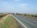 Grantham Road (A607) towards Lincoln - geograph.org.uk - 2829507.jpg 640 × 480; 56 KB
-
 Grantham Road - geograph.org.uk - 3103551.jpg 3,168 × 2,402; 2.08 MB
-
 Grantham Road, North of Waddington - geograph.org.uk - 4209664.jpg 640 × 480; 243 KB
-
 Grantham Road, Waddington - geograph.org.uk - 4209137.jpg 640 × 480; 303 KB
-
 Hangar 5 at RAF Waddington - geograph.org.uk - 4061277.jpg 3,088 × 2,056; 2.25 MB
-
 House and field off Station Road, Waddington - geograph.org.uk - 5995409.jpg 1,024 × 768; 213 KB
-
 Houses on Mere Road, Waddington - geograph.org.uk - 2829484.jpg 640 × 480; 60 KB
-
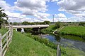 Hykeham Bridge - geograph.org.uk - 4095860.jpg 3,776 × 2,520; 4.3 MB
-
 Icy Witham - geograph.org.uk - 2207171.jpg 2,592 × 1,944; 2.04 MB
-
 Junction to A607 from RAF Waddington - geograph.org.uk - 4645760.jpg 3,696 × 2,448; 2.31 MB
-
 Lancaster Bomber at Waddington Air Show 2013 - geograph.org.uk - 3554680.jpg 2,256 × 1,504; 950 KB
-
 Lowfields byway - geograph.org.uk - 2486157.jpg 640 × 480; 100 KB
-
 Mere Road heading east - geograph.org.uk - 2829487.jpg 640 × 480; 85 KB
-
 Merlin Helicopter at Waddington Air Show 2013 - geograph.org.uk - 3554686.jpg 2,256 × 1,504; 274 KB
-
 New development off Station Road - geograph.org.uk - 5995404.jpg 1,024 × 768; 141 KB
-
 North Hykeham Pump Drain - geograph.org.uk - 4210124.jpg 1,024 × 768; 229 KB
-
 Old buses - geograph.org.uk - 327070.jpg 640 × 427; 62 KB
-
 Old Railway bed - geograph.org.uk - 327120.jpg 640 × 427; 70 KB
-
 Part of the WW2 memorial at Waddington - geograph.org.uk - 6260673.jpg 4,608 × 3,072; 5.98 MB
-
 Passing place on Somerton Gate Lane - geograph.org.uk - 2500948.jpg 1,280 × 960; 445 KB
-
 Piel Emeraude CP-30 G-ARRS at Waddington - geograph.org.uk - 3666585.jpg 3,008 × 2,000; 2.66 MB
-
 RAF Waddington memorial - geograph.org.uk - 6260667.jpg 4,608 × 3,072; 5.99 MB
-
 RAF Waddington memorial - geograph.org.uk - 6260677.jpg 4,608 × 3,072; 6.09 MB
-
 Recreation ground off Station Road - geograph.org.uk - 5995406.jpg 1,024 × 768; 129 KB
-
 Redwood Drive - geograph.org.uk - 2486083.jpg 640 × 480; 81 KB
-
 Redwood Drive - geograph.org.uk - 2486137.jpg 640 × 480; 105 KB
-
 Restricted byway - geograph.org.uk - 2486780.jpg 640 × 480; 145 KB
-
 Skateboard ramps - geograph.org.uk - 5357563.jpg 4,819 × 2,924; 5.19 MB
-
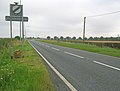
 Sleaford Road (A15) - geograph.org.uk - 3563967.jpg 640 × 480; 55 KB
-
 Somerton Gate Lane - geograph.org.uk - 2500935.jpg 1,280 × 960; 547 KB
-
 Somerton Gate Lane - geograph.org.uk - 2907440.jpg 640 × 480; 61 KB
-
 Somerton Gate Lane - geograph.org.uk - 327112.jpg 640 × 427; 103 KB
-
 Somerton Gate Lane - geograph.org.uk - 327117.jpg 640 × 427; 121 KB
-
 Somerton Gate Lane - geograph.org.uk - 5357578.jpg 4,777 × 3,152; 6.46 MB
-
 Somerton Gate Lane - geograph.org.uk - 5357591.jpg 4,749 × 3,071; 5.6 MB
-

-

-
 St. Michael's church Waddington - geograph.org.uk - 5429330.jpg 3,456 × 2,592; 3.92 MB
-
 Station road, Waddington - geograph.org.uk - 2500888.jpg 1,280 × 960; 285 KB
-
 Taxiway at RAF Waddington - geograph.org.uk - 4061268.jpg 3,696 × 2,448; 2.23 MB
-
 The different ages of straw - geograph.org.uk - 4609387.jpg 1,024 × 768; 220 KB
-
 The top of the Cliff near Waddington - geograph.org.uk - 5995410.jpg 1,024 × 768; 171 KB
-
 The Viking Way from Waddington heading towards Lincoln - geograph.org.uk - 3636252.jpg 3,776 × 2,520; 3.87 MB
-

-

-
 The Wheatsheaf, Waddington - geograph.org.uk - 2829492.jpg 640 × 480; 69 KB
-
 Tornado GR4 at Waddington Airshow 2013 - geograph.org.uk - 3554775.jpg 3,696 × 2,448; 1.62 MB
-
 Track off Somerton Gate Lane - geograph.org.uk - 5357586.jpg 3,264 × 4,928; 5.06 MB
-
 Track to disused Gravel Pits - geograph.org.uk - 2500925.jpg 1,280 × 960; 379 KB
-
 Track to Pumping station on River Witham - geograph.org.uk - 2950937.jpg 1,280 × 853; 361 KB
-
-
 View Towards North Hykeham - geograph.org.uk - 1094623.jpg 640 × 480; 68 KB
-
 Waddington Community Hub and Parish Office - geograph.org.uk - 4609351.jpg 1,024 × 768; 182 KB
-
 Waddington Fire Station - geograph.org.uk - 2829490.jpg 640 × 480; 64 KB
-
 Waddington fire station - geograph.org.uk - 836115.jpg 640 × 427; 228 KB
-
 Waddington lowfields - geograph.org.uk - 2486088.jpg 640 × 480; 112 KB
-
 Waddington Old Village Store - geograph.org.uk - 4609343.jpg 1,024 × 768; 198 KB
-
 Waddington Village Clock - geograph.org.uk - 4609369.jpg 779 × 1,024; 185 KB
-
 Waddington Village Hall - geograph.org.uk - 6235792.jpg 1,846 × 1,156; 1.07 MB
-
 Waddington's memorial clock - geograph.org.uk - 6260681.jpg 4,608 × 3,072; 6.37 MB
-
 Waddington, Grantham Road (A607) - geograph.org.uk - 4209657.jpg 640 × 480; 261 KB
-

-
 War Graves in Waddington churchyard - geograph.org.uk - 5608952.jpg 3,456 × 2,592; 3.84 MB
-
 Witham Washland Control Site - geograph.org.uk - 4095846.jpg 3,776 × 2,520; 3.81 MB
-
 Wrong side down there Red 2 - geograph.org.uk - 1139094.jpg 640 × 375; 43 KB
-
 A15 passes Waddington airfield - geograph.org.uk - 419932.jpg 640 × 480; 133 KB
-
 Across the fields to Highfield Farm - geograph.org.uk - 419955.jpg 640 × 480; 136 KB
-
 Branston Lane - geograph.org.uk - 1443229.jpg 640 × 426; 86 KB
-
 Branston Lane - geograph.org.uk - 1443973.jpg 640 × 426; 91 KB
-
 Branston Lane - geograph.org.uk - 1444009.jpg 640 × 426; 96 KB
-
 Branston Lane - geograph.org.uk - 1444018.jpg 640 × 426; 99 KB
-

-
 Road to Glebe Farm - geograph.org.uk - 494493.jpg 640 × 480; 83 KB
-
 Track and Gas Box - geograph.org.uk - 159502.jpg 640 × 480; 81 KB
-
 Track to wood from B1178 - geograph.org.uk - 419959.jpg 640 × 480; 138 KB
-
 Waddington from Somerton Gate Lane - geograph.org.uk - 327126.jpg 640 × 427; 46 KB
-
 Waddington Hill - geograph.org.uk - 171303.jpg 640 × 480; 79 KB


_towards_Lincoln_-_geograph.org.uk_-_2829507.jpg)


_-_geograph.org.uk_-_3563967.jpg)


_-_geograph.org.uk_-_4209657.jpg)


