Category:Wadhurst
Jump to navigation
Jump to search
town and civil parish in East Sussex, England, UK  Commemoration hall dans High Street | |||||
| Upload media | |||||
| Instance of | |||||
|---|---|---|---|---|---|
| Location | Wealden, East Sussex, South East England, England | ||||
| Area |
| ||||
| official website | |||||
 | |||||
English: Wadhurst is a market town in East Sussex, England. It is the centre of the civil parish of Wadhurst, which also includes the hamlets of Cousley Wood and Tidebrook. Wadhurst is twinned with Aubers in France.
Nederlands: Wadhurst is een plaats in het bestuurlijke gebied Wealden, in het Engelse graafschap East Sussex. De plaats telt 5.057inwoners.
Polski: Wadhurst - miasto w Wielkiej Brytanii, w Anglii, w regionie South East England, w hrabstwie East Sussex. W 2001r. miasto to zamieszkiwało 4818 osób.
Română: Wadhurst este un oraş în comitatul East Sussex, regiunea South East, Anglia. Oraşul se află în districtul Wealden.
Subcategories
This category has the following 22 subcategories, out of 22 total.
C
- Clock House, Wadhurst (7 F)
G
- Gospel Hall, Turner's Green (5 F)
- Greyhound Inn, Wadhurst (5 F)
O
- Oasts in Wadhurst (76 F)
P
S
- South Park, Wadhurst (4 F)
T
- Wadhurst Town Sign (5 F)
V
- The Vicarage, Wadhurst (4 F)
W
- St Peter and St Paul, Wadhurst (73 F)
- Wadhurst Castle (4 F)
- Wadhurst Methodist Church (10 F)
- Wadhurst Park (6 F)
- Wadhurst Town Chapel (4 F)
- Wadhurst Tunnel (1 F)
- Wadhurst War Memorial (3 F)
- White Hart, Wadhurst (5 F)
Media in category "Wadhurst"
The following 200 files are in this category, out of 1,193 total.
(previous page) (next page)-
 A bend in Partridges Lane - geograph.org.uk - 3685339.jpg 3,696 × 2,448; 2.31 MB
-
 A field in the setting sun - geograph.org.uk - 1733985.jpg 640 × 467; 74 KB
-
 A fine tree - geograph.org.uk - 2924521.jpg 640 × 430; 86 KB
-
 A lush green valley - geograph.org.uk - 3685347.jpg 3,696 × 2,448; 2.36 MB
-
 A quiet B2099 - geograph.org.uk - 2038172.jpg 640 × 430; 177 KB
-
 A sheep, Dewhurst Farm - geograph.org.uk - 2038051.jpg 640 × 430; 152 KB
-
-
 A small re-entrant - geograph.org.uk - 2924519.jpg 640 × 430; 56 KB
-
 A small woodland north of Wood's Green - geograph.org.uk - 2187934.jpg 640 × 430; 122 KB
-
 A very large fallow field - geograph.org.uk - 2187886.jpg 640 × 430; 129 KB
-
 Abandoned mobile home at Greenwoods, Woods Green - geograph.org.uk - 5296598.jpg 1,630 × 1,198; 956 KB
-
 Access road to Pennybridge Farm - geograph.org.uk - 3635068.jpg 4,288 × 3,216; 7.51 MB
-
 Access track in Snape Wood - geograph.org.uk - 3646265.jpg 4,288 × 3,216; 7.12 MB
-
 After the harvest - geograph.org.uk - 3077387.jpg 640 × 480; 112 KB
-
 Along the edge of Mab's Wood - geograph.org.uk - 2166466.jpg 640 × 430; 156 KB
-
 An arm of Bewl Water - geograph.org.uk - 2193779.jpg 640 × 430; 113 KB
-
 An Autumnal tree and sheep - geograph.org.uk - 2185126.jpg 640 × 430; 126 KB
-
 An entrance to the park - geograph.org.uk - 6055189.jpg 1,024 × 768; 372 KB
-
 An ex pub - geograph.org.uk - 2865434.jpg 640 × 430; 67 KB
-
 An old shop, Cousley Wood - geograph.org.uk - 2189290.jpg 640 × 430; 132 KB
-
 April Cottage (geograph 6678894).jpg 1,024 × 565; 194 KB
-
 Autumn colours near Wadhurst - geograph.org.uk - 2184960.jpg 640 × 430; 116 KB
-
 Autumn colours, Bewl Water - geograph.org.uk - 2193922.jpg 640 × 430; 132 KB
-
 Autumnal colours, Bewl Water - geograph.org.uk - 2194004.jpg 640 × 430; 180 KB
-
 B2009 to Wadhurst - geograph.org.uk - 2917833.jpg 640 × 430; 94 KB
-
 B2009, Durgate - geograph.org.uk - 2917623.jpg 640 × 430; 86 KB
-
 B2009, Station Rd - geograph.org.uk - 2914437.jpg 640 × 430; 91 KB
-
 B2099 - geograph.org.uk - 2921377.jpg 640 × 430; 59 KB
-
 B2099 approaches junction with Blacksmith's Lane - geograph.org.uk - 2990307.jpg 3,648 × 2,652; 1.55 MB
-
 B2099 bridge carries Tonbridge to Hastings railway-line - geograph.org.uk - 2990450.jpg 3,648 × 2,736; 1.67 MB
-
 B2099 heading north west - geograph.org.uk - 2038164.jpg 640 × 430; 186 KB
-
 B2099 passes Greenman Farm - geograph.org.uk - 2990458.jpg 3,648 × 2,736; 2.13 MB
-
 B2099, Wadhurst - geograph.org.uk - 2921355.jpg 640 × 430; 57 KB
-
 B2100 approaching Wadhurst - geograph.org.uk - 333251.jpg 640 × 480; 112 KB
-
 B2100 Wadhurst Road - geograph.org.uk - 3685410.jpg 3,696 × 2,448; 2.29 MB
-
 B2100, Cousley Wood - geograph.org.uk - 2189276.jpg 640 × 430; 154 KB
-
 B2100, Cousley Wood Rd - geograph.org.uk - 2189262.jpg 640 × 430; 143 KB
-
 B2100, Cousley Wood Rd to Cousley Wood - geograph.org.uk - 2189263.jpg 640 × 430; 190 KB
-
 Balaclava Lane - geograph.org.uk - 4310135.jpg 4,000 × 2,671; 7.75 MB
-
 Balaclava Lane - geograph.org.uk - 4310141.jpg 4,240 × 2,832; 6.53 MB
-
 Banks of Bewl Water Reservoir - geograph.org.uk - 2194439.jpg 640 × 430; 113 KB
-
 Barcaldine and Windrush Cottages - geograph.org.uk - 3673216.jpg 4,288 × 3,216; 4.7 MB
-
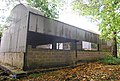
 Barn at Great Shoesmith Farm - geograph.org.uk - 6017407.jpg 5,184 × 3,456; 2.31 MB
-
 Barn in Great Shoesmith Farm - geograph.org.uk - 2393220.jpg 3,072 × 2,304; 1.67 MB
-
 Barn, Earlye Farm - geograph.org.uk - 2167146.jpg 640 × 430; 134 KB
-
 Barn, Great Shoesmith Farm - geograph.org.uk - 2187845.jpg 640 × 430; 152 KB
-
 Barn, Homefield Farm - geograph.org.uk - 2165554.jpg 640 × 430; 136 KB
-
 Barn, Little Pell Farm (geograph 6674375).jpg 1,024 × 684; 210 KB
-
 Barn, Perrins Farm - geograph.org.uk - 2189203.jpg 640 × 430; 129 KB
-
 Barn. Homefield Farm - geograph.org.uk - 2165553.jpg 640 × 430; 164 KB
-
 Barns, Earlye Farm - geograph.org.uk - 2167148.jpg 640 × 430; 122 KB
-
 Bartley Mill Rd - geograph.org.uk - 2264853.jpg 640 × 430; 90 KB
-
 Bassetts Lane - geograph.org.uk - 3716415.jpg 3,696 × 2,448; 2.31 MB
-
 Batts Wood - geograph.org.uk - 177676.jpg 640 × 481; 198 KB
-
 Beaver Cottage, Cousley Wood - geograph.org.uk - 3673156.jpg 4,288 × 3,216; 5.56 MB
-
 Beaver Cottage, Cousley Wood - geograph.org.uk - 3673160.jpg 4,288 × 3,216; 7.04 MB
-
 Beech Wood by the Sussex Border Path - geograph.org.uk - 2165538.jpg 640 × 430; 145 KB
-
 Beechlands - geograph.org.uk - 4771722.jpg 640 × 428; 146 KB
-
 Beechwood - geograph.org.uk - 333264.jpg 480 × 640; 153 KB
-
 Beggars Bush - geograph.org.uk - 3635032.jpg 4,206 × 3,114; 5.55 MB
-
 Belmont House - geograph.org.uk - 2914444.jpg 640 × 430; 69 KB
-
 Belmont House, Durgates - geograph.org.uk - 4312240.jpg 4,240 × 2,832; 6.38 MB
-
 Below Little Pell Farm, Wadhurst - geograph.org.uk - 157985.jpg 640 × 480; 94 KB
-
 Ben Greig Vauxhall - geograph.org.uk - 2139958.jpg 640 × 304; 48 KB
-
 Bench near fire station and war memorial in Wadhurst.jpg 3,264 × 2,448; 3.65 MB
-
 Bench on footpath in Wadhurst.jpg 3,264 × 2,448; 3.41 MB
-
 Bench overlooking Bewl Water - geograph.org.uk - 2193791.jpg 640 × 430; 120 KB
-
 Bend in Dewhurst Lane - geograph.org.uk - 2037996.jpg 640 × 430; 174 KB
-
 Bensfield Farm - geograph.org.uk - 2872572.jpg 640 × 430; 89 KB
-
 Bensfield Farm - geograph.org.uk - 2872575.jpg 640 × 430; 102 KB
-
 Bensfield Farm Cottages - geograph.org.uk - 2872558.jpg 640 × 430; 76 KB
-
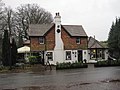 Best Beech Inn - geograph.org.uk - 2727244.jpg 2,272 × 1,704; 1.2 MB
-
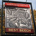 Best Beech sign - geograph.org.uk - 2139887.jpg 640 × 640; 168 KB
-
 Best Beech, Wadhurst - geograph.org.uk - 2139884.jpg 640 × 427; 53 KB
-
 Bewl Bridge Lane - geograph.org.uk - 1815144.jpg 3,072 × 2,304; 2.77 MB
-
 Bewl Reservoir by Newbarn Farm - geograph.org.uk - 5731087.jpg 5,184 × 3,456; 4.05 MB
-
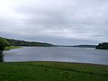
 Bewl Water - geograph.org.uk - 4047350.jpg 3,170 × 1,835; 2.29 MB
-
 Bewl Water - geograph.org.uk - 4172703.jpg 640 × 427; 40 KB
-
 Bewl Water - geograph.org.uk - 5731079.jpg 4,608 × 3,456; 4.83 MB
-
 Bewl Water Dam - geograph.org.uk - 4172731.jpg 640 × 427; 62 KB
-
 Bewl Water Dam - geograph.org.uk - 4435275.jpg 3,648 × 2,736; 1.98 MB
-
 Bewl Water Outdoor Centre - geograph.org.uk - 2194010.jpg 640 × 430; 146 KB
-
 Bewl Water Reservoir - geograph.org.uk - 4488984.jpg 2,706 × 2,706; 1.79 MB
-
 Bewl Water Reservoir beside Great Hook Wood - geograph.org.uk - 3673050.jpg 4,288 × 3,216; 5.6 MB
-
 Bewl Water Reservoir by Little Hook Wood - geograph.org.uk - 4481492.jpg 3,000 × 3,000; 3.64 MB
-
 Bewl Water Reservoir by Little Hook Wood - geograph.org.uk - 4481496.jpg 3,000 × 4,000; 4.21 MB
-
 Bewl Water rowing club - geograph.org.uk - 5731078.jpg 5,184 × 3,456; 3.84 MB
-
 Bewl Water slipway - geograph.org.uk - 4172724.jpg 640 × 427; 44 KB
-
 Bewl Water Woods - geograph.org.uk - 5915512.jpg 4,000 × 3,000; 5.05 MB
-
 Bewl Woods - geograph.org.uk - 2190317.jpg 640 × 430; 196 KB
-
 Bewl Woods - geograph.org.uk - 2191101.jpg 640 × 430; 145 KB
-
 Bewl Woods - geograph.org.uk - 2191104.jpg 640 × 430; 148 KB
-
 Bewlbridge Lane - geograph.org.uk - 3618967.jpg 3,696 × 2,448; 2.27 MB
-
 Birchetts Wood - geograph.org.uk - 3680088.jpg 4,288 × 3,216; 4.37 MB
-
 Bird Lane - geograph.org.uk - 2869186.jpg 640 × 430; 113 KB
-
 Bird Lane - geograph.org.uk - 3088341.jpg 640 × 480; 202 KB
-
 Blackberries on Partridges Lane - geograph.org.uk - 3686199.jpg 3,696 × 2,448; 2.22 MB
-
 Blackman's Wood stream towards Bewl Water - geograph.org.uk - 3672921.jpg 3,216 × 4,288; 7.39 MB
-
 Blacksmith's Lane - geograph.org.uk - 4310911.jpg 2,671 × 3,739; 7.83 MB
-
 Blacksmith's Lane - geograph.org.uk - 4310925.jpg 3,909 × 2,610; 7.51 MB
-
 Blacksmith's Lane near Wadhurst - geograph.org.uk - 2741812.jpg 2,256 × 1,496; 930 KB
-
 Blacksmiths Lane - geograph.org.uk - 3679931.jpg 3,216 × 4,288; 6.68 MB
-
 Bluebells in Sluice Wood - geograph.org.uk - 2393148.jpg 3,072 × 2,304; 3.26 MB
-
 Bluebells, Camden Wood - geograph.org.uk - 2037935.jpg 640 × 430; 212 KB
-
 Boating on Bewl Water - geograph.org.uk - 1945376.jpg 1,600 × 1,200; 401 KB
-
 Boats on Bewl Water Reservoir - geograph.org.uk - 1517265.jpg 640 × 427; 87 KB
-
 Boats, Bewl Valley Sailing Club - geograph.org.uk - 2193895.jpg 640 × 430; 125 KB
-
 Braidwood - geograph.org.uk - 2917819.jpg 640 × 399; 71 KB
-
 Briaris Cottage - geograph.org.uk - 2914704.jpg 640 × 430; 76 KB
-
 Bridge in need of repair - geograph.org.uk - 1170339.jpg 640 × 480; 125 KB
-
 Bridge near Great Shoesmiths Farm - geograph.org.uk - 2187855.jpg 640 × 430; 142 KB
-
 Bridge on Three Oaks Lane - geograph.org.uk - 3647885.jpg 4,288 × 3,216; 4.82 MB
-
 Bridge over railway at Scrag Oak - geograph.org.uk - 2727090.jpg 2,272 × 1,704; 1.25 MB
-
 Bridge, Bartley Mill Rd - geograph.org.uk - 2264843.jpg 640 × 430; 82 KB
-
 Bridleway, Bewl Water - geograph.org.uk - 2193859.jpg 640 × 430; 207 KB
-
 Brinkers Lane - geograph.org.uk - 2921371.jpg 640 × 430; 56 KB
-
 Brinkers Lane - geograph.org.uk - 333254.jpg 640 × 480; 132 KB
-
 Bubble rollers at Bewl Water - geograph.org.uk - 5246156.jpg 1,492 × 902; 516 KB
-
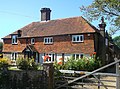
 Buckhurst Farmhouse - geograph.org.uk - 3634630.jpg 4,067 × 3,216; 6.44 MB
-
 Buckhurst Lane - geograph.org.uk - 2038198.jpg 640 × 430; 169 KB
-
 Buckhurst Lane - geograph.org.uk - 2166582.jpg 640 × 430; 170 KB
-
 Buckhurst Lane - geograph.org.uk - 3634430.jpg 4,288 × 3,216; 7.47 MB
-
 Buckhurst Lane - geograph.org.uk - 3685418.jpg 2,448 × 3,696; 2.33 MB
-
 Buckhurst Lane beside Four Acre Shaw - geograph.org.uk - 3634621.jpg 3,216 × 4,288; 7.18 MB
-
 Buckhurst Lane near Buckhurst Farm - geograph.org.uk - 3634664.jpg 4,288 × 3,216; 7.33 MB
-
 Buckhurst Lane to Buckhurst Farm - geograph.org.uk - 3634676.jpg 4,288 × 3,216; 7.29 MB
-

-
 Buckhurst Manor, Buckhurst Lane - geograph.org.uk - 2166500.jpg 640 × 435; 119 KB
-
 Bus Stop, B2099 - geograph.org.uk - 2038202.jpg 640 × 430; 166 KB
-
 Bus Stop, Cousley Wood - geograph.org.uk - 2189288.jpg 640 × 430; 127 KB
-
 Butchers, Sparrow's Green - geograph.org.uk - 3575337.jpg 1,600 × 1,114; 368 KB
-
 Buttercups at Bewl Water - geograph.org.uk - 3599051.jpg 1,600 × 1,200; 476 KB
-
 Butts Lane - geograph.org.uk - 2356098.jpg 640 × 480; 109 KB
-
 Butts Lane beside Gate Wood - geograph.org.uk - 3673111.jpg 4,288 × 3,216; 7.47 MB
-
 Butts Lane to Cousley Wood - geograph.org.uk - 3673146.jpg 4,288 × 2,660; 5.32 MB
-
 Butts Lane to Gate Wood - geograph.org.uk - 3673126.jpg 4,288 × 3,216; 4.94 MB
-
 Camden Wood - geograph.org.uk - 2037892.jpg 640 × 430; 224 KB
-
 Camden Wood - geograph.org.uk - 2037939.jpg 640 × 430; 227 KB
-
 Captains Green, Whitegates Lane - geograph.org.uk - 2185005.jpg 640 × 430; 129 KB
-
 Car park at Wadhurst Station - geograph.org.uk - 4725115.jpg 640 × 426; 71 KB
-
 Catkins near Trewyck Cottage - geograph.org.uk - 6018248.jpg 3,000 × 4,000; 710 KB
-
 Cattle Barn, Great Shoesmiths Farm - geograph.org.uk - 2187846.jpg 640 × 430; 124 KB
-
 Chapel Cottage and Rehoboth Chapel - geograph.org.uk - 3673185.jpg 4,288 × 3,216; 6 MB
-
 Chase Wood - geograph.org.uk - 2167053.jpg 640 × 430; 212 KB
-
 Chase Wood stream bridge near Riverhall House - geograph.org.uk - 3633369.jpg 3,896 × 3,216; 5.32 MB
-
 Chase Wood stream near Riverhall House - geograph.org.uk - 3633411.jpg 3,216 × 4,288; 6.96 MB
-
 Cherry Blossom - geograph.org.uk - 2356011.jpg 640 × 480; 98 KB
-
 Chittinghurst, Wadhurst - geograph.org.uk - 1214410.jpg 640 × 427; 93 KB
-
 Church Gate Cottage - geograph.org.uk - 3680024.jpg 4,288 × 3,216; 6.95 MB
-
 Church House, Wadhurst - geograph.org.uk - 5475536.jpg 640 × 480; 88 KB
-
 Church Street - geograph.org.uk - 5118243.jpg 4,000 × 3,000; 2.72 MB
-
 Churchsettle Farm - geograph.org.uk - 2741805.jpg 2,256 × 1,496; 911 KB
-
 Churchsettle Lane - geograph.org.uk - 2747302.jpg 2,256 × 1,496; 918 KB
-
 Churchsettle Lane - geograph.org.uk - 3807564.jpg 640 × 480; 117 KB
-
 Churchsettle Road - geograph.org.uk - 1343285.jpg 640 × 480; 101 KB
-
 Churchyard of Wadhurst Parish Church - geograph.org.uk - 4312041.jpg 4,000 × 2,671; 6.68 MB
-
 Classic car - geograph.org.uk - 4121886.jpg 683 × 1,024; 164 KB
-
 Clerestory stained glass window, Ss Peter ^ Paul, Wadhurst - geograph.org.uk - 4066996.jpg 1,582 × 3,481; 4.28 MB
-
 Clocktower on old girls school in Wadhurst.jpg 3,264 × 2,448; 1.18 MB
-
 Colesgrove Wood - geograph.org.uk - 2167187.jpg 640 × 430; 213 KB
-
 Colesgrove Wood - geograph.org.uk - 2172983.jpg 640 × 430; 107 KB
-
 Collects Near Wadhurst Park - geograph.org.uk - 3743706.jpg 1,024 × 768; 536 KB
-
 Combe Farm and Drive - geograph.org.uk - 3743792.jpg 1,024 × 768; 621 KB
-
 Combe House Wadhurst Park - geograph.org.uk - 3743677.jpg 1,024 × 768; 453 KB
-
 Combe Manor - geograph.org.uk - 392878.jpg 640 × 428; 127 KB
-
 Combe Manor - geograph.org.uk - 6055182.jpg 1,024 × 768; 293 KB
-
 Combe Manor, Wadhurst, East Sussex - geograph.org.uk - 1170343.jpg 640 × 480; 92 KB
-
 Combewell Wood (Bewl Woods) - geograph.org.uk - 2191102.jpg 640 × 430; 136 KB
-
 Common Green Grasshopper - geograph.org.uk - 3089132.jpg 640 × 480; 73 KB
-
-
 Converted barn, Ravensdale Farm - geograph.org.uk - 2166430.jpg 640 × 430; 167 KB
-
 Coombe Farm House - geograph.org.uk - 3743795.jpg 1,024 × 767; 485 KB
-
 Coombe Farm Oak - geograph.org.uk - 3743805.jpg 1,024 × 767; 333 KB
-
 Coombe Farm Oaks - geograph.org.uk - 3743800.jpg 1,024 × 768; 343 KB
-
 Coombe Lane - geograph.org.uk - 3343438.jpg 2,464 × 1,632; 1.03 MB
-
 Coombe Oast Coombe Lane - geograph.org.uk - 3743720.jpg 1,024 × 768; 460 KB
-
 Coppiced tree near Wadhurst Station - geograph.org.uk - 1580931.jpg 640 × 379; 115 KB
-
 Coppiced trees by Dewhurst Lane - geograph.org.uk - 2037901.jpg 640 × 430; 209 KB
-
 Coppiced trees by the Sussex Border Path - geograph.org.uk - 2166495.jpg 640 × 430; 207 KB
-
 Coppiced trees, Shoesmith's Wood - geograph.org.uk - 2037886.jpg 640 × 430; 222 KB
-
 Coppicing, Beech Wood - geograph.org.uk - 2165542.jpg 640 × 430; 205 KB
-
 Copstone Cottage - geograph.org.uk - 3673174.jpg 4,175 × 3,115; 6.31 MB
-
 Copstone Shaw - geograph.org.uk - 4354458.jpg 640 × 427; 116 KB
-
 Corn field off Bodiam Road - geograph.org.uk - 6018255.jpg 4,000 × 3,000; 3.58 MB
-
 Costcutter, Sparrows Green Road - geograph.org.uk - 3088339.jpg 640 × 480; 105 KB
-
 Cottage north off Towngate Farm - geograph.org.uk - 2877216.jpg 640 × 430; 79 KB
-
 Cottage on Brinkers Lane - geograph.org.uk - 3680046.jpg 4,288 × 3,216; 3.39 MB
-
 Cottage, Cousley Wood - geograph.org.uk - 3673225.jpg 4,288 × 3,216; 4.89 MB
-
 Countryside around Bewl Water - geograph.org.uk - 2356108.jpg 640 × 480; 96 KB
-
 Countryside by the Sussex Border Path - geograph.org.uk - 2166601.jpg 640 × 430; 126 KB
-
 Countryside near Earlye Farm - geograph.org.uk - 2167122.jpg 640 × 430; 140 KB
-

-
 Countryside south of Wadhurst - geograph.org.uk - 2218224.jpg 640 × 430; 111 KB
-
 Cousley Wood Rd and Monk's Lane junction - geograph.org.uk - 2189266.jpg 640 × 430; 147 KB
-
 Cowl of Oast House - geograph.org.uk - 6017420.jpg 3,213 × 3,213; 366 KB
-
 Cowl of Oast House - geograph.org.uk - 6017435.jpg 2,628 × 3,942; 541 KB
-
 Cricket Pavilion, Cousley Wood - geograph.org.uk - 2189279.jpg 640 × 430; 117 KB
-
 Cropfield off Bartley Mill Road - geograph.org.uk - 1357626.jpg 640 × 427; 97 KB
-

-
 Crossroads near Lower Cousley Wood - geograph.org.uk - 1658556.jpg 640 × 479; 99 KB


.jpg)


.jpg)


_-_geograph.org.uk_-_2191102.jpg)


