Category:Waen
Jump to navigation
Jump to search
community in Denbighshire, Wales   | |||||
| Upload media | |||||
| Pronunciation audio | |||||
|---|---|---|---|---|---|
| Instance of | |||||
| Location | Denbighshire, Wales | ||||
| Population |
| ||||
| Area |
| ||||
 | |||||
Media in category "Waen"
The following 54 files are in this category, out of 54 total.
-
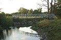 "Aluminium" Footbridge over the River Clwyd - geograph.org.uk - 1945275.jpg 2,592 × 1,728; 1.06 MB
-
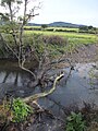
 A bend in the river Clwyd - geograph.org.uk - 2735782.jpg 640 × 480; 149 KB
-
 A55 approaching Junction 27A - geograph.org.uk - 3157301.jpg 640 × 430; 54 KB
-
 A55 Chapel - geograph.org.uk - 2181520.jpg 4,000 × 3,000; 5.12 MB
-
 A55 eastbound near Junction 28 - geograph.org.uk - 2344743.jpg 640 × 480; 38 KB
-
 A55 Junction 27A (St Asaph) - geograph.org.uk - 5615981.jpg 640 × 427; 366 KB
-
 A55, Junction 27A - geograph.org.uk - 3157305.jpg 640 × 430; 60 KB
-
 A55, westbound - geograph.org.uk - 3157303.jpg 640 × 430; 64 KB
-
 A55-Chester Street exit westbound - geograph.org.uk - 2231273.jpg 640 × 480; 45 KB
-
 Adwy agored - An open gateway - geograph.org.uk - 2068766.jpg 640 × 511; 108 KB
-
 Behind Bars - geograph.org.uk - 2181510.jpg 3,000 × 4,000; 5.06 MB
-
 Bodeugan Bach - geograph.org.uk - 2181528.jpg 4,000 × 3,000; 4.85 MB
-

-
 Bridge over the A55 - geograph.org.uk - 3157294.jpg 640 × 430; 51 KB
-
 Bryn Polyn Farm - geograph.org.uk - 1965468.jpg 2,592 × 1,728; 1.09 MB
-

-
 Clouds Round About - geograph.org.uk - 2181513.jpg 4,000 × 3,000; 4.85 MB
-
 Copse and felled trees - geograph.org.uk - 6057775.jpg 4,000 × 3,000; 2.85 MB
-

-
 Cyrchynen - geograph.org.uk - 2735791.jpg 640 × 453; 85 KB
-
-
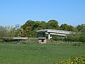
 Farm buildings near Rhuallt - geograph.org.uk - 1139693.jpg 640 × 521; 108 KB
-
 Felin Wynt, near St Asaph - geograph.org.uk - 2735797.jpg 640 × 480; 101 KB
-

-
 Field near St Asaph - geograph.org.uk - 2731565.jpg 640 × 480; 96 KB
-
 Flood marker on the Clwyd at St Asaph - geograph.org.uk - 2735833.jpg 640 × 480; 135 KB
-
 Flood water at Pont Dafydd - geograph.org.uk - 3791240.jpg 640 × 480; 106 KB
-
 Flooded field east of St Asaph - geograph.org.uk - 2788611.jpg 640 × 480; 58 KB
-
 Footbridge and stile on the Clwydian Way - geograph.org.uk - 2735794.jpg 480 × 640; 162 KB
-
-
 Footbridge over the A55 Expressway - geograph.org.uk - 1736764.jpg 3,648 × 2,736; 3.64 MB
-
 Ford - River Clwyd - geograph.org.uk - 1945328.jpg 2,592 × 1,728; 1.76 MB
-
 Junction 27A for St Asaph - geograph.org.uk - 6144172.jpg 640 × 427; 85 KB
-
 Keep calm and carry on.... - geograph.org.uk - 2731561.jpg 640 × 480; 109 KB
-
 Longhorn cattle near St Asaph - geograph.org.uk - 2731559.jpg 640 × 480; 97 KB
-
 Milestone, old Holywell Rd - geograph.org.uk - 6613170.jpg 677 × 900; 627 KB
-

-
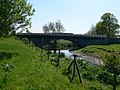
 Old bridge, new bridge - geograph.org.uk - 2735799.jpg 640 × 480; 99 KB
-
 Over Sail - geograph.org.uk - 2238476.jpg 4,000 × 3,000; 4.9 MB
-

-
 Pont Dafydd - geograph.org.uk - 2735802.jpg 480 × 640; 121 KB
-
 Pont Dafydd - geograph.org.uk - 5625345.jpg 640 × 427; 381 KB
-
 Red Top - geograph.org.uk - 2238493.jpg 4,000 × 3,000; 5.95 MB
-
 Rhuallt turning from A55 - geograph.org.uk - 6144157.jpg 640 × 427; 77 KB
-
 River Clwyd from Pont Llannerch - geograph.org.uk - 2305573.jpg 1,280 × 856; 261 KB
-
 River Clwyd North of Pont Dafydd - geograph.org.uk - 5157958.jpg 1,024 × 768; 193 KB
-
 Road off the A55, Waen Gate - geograph.org.uk - 3157298.jpg 640 × 436; 48 KB
-
-
 Tourist signs approaching junc 27A - geograph.org.uk - 6144167.jpg 640 × 427; 86 KB
-
 Trunk Junction - geograph.org.uk - 2181531.jpg 4,000 × 3,000; 5.87 MB
-
 Ty Ucha - geograph.org.uk - 2681226.jpg 640 × 480; 50 KB
-
 Wales Denbighshire Community Waen map.svg 512 × 773; 560 KB
-
 White Circle - geograph.org.uk - 2181517.jpg 4,000 × 3,000; 4.8 MB
-
 Ysgol Sabbothol - geograph.org.uk - 2181524.jpg 4,000 × 3,000; 5.18 MB


_-_geograph.org.uk_-_5615981.jpg)


