Category:Wards of the City of Leeds
Jump to navigation
Jump to search
Media in category "Wards of the City of Leeds"
The following 36 files are in this category, out of 36 total.
-
 Adel and Wharfedale Ward.jpg 965 × 791; 125 KB
-
 Leeds UK ward map 2010 (blank).svg 1,425 × 1,086; 623 KB
-
 Leeds UK ward map 2018 (blank).svg 1,425 × 1,086; 626 KB
-
 Leeds UK ward map highlighting Adel and Wharfedale.svg 1,425 × 1,086; 626 KB
-
 Leeds UK ward map highlighting Alwoodley.svg 1,425 × 1,086; 626 KB
-
 Leeds UK ward map highlighting Ardsley and Robin Hood.svg 1,425 × 1,086; 626 KB
-
 Leeds UK ward map highlighting Armley.svg 1,425 × 1,086; 626 KB
-
 Leeds UK ward map highlighting Beeston and Holbeck.svg 1,425 × 1,086; 626 KB
-
 Leeds UK ward map highlighting Bramley and Stanningley.svg 1,425 × 1,086; 626 KB
-
 Leeds UK ward map highlighting Burmantofts and Richmond Hill.svg 1,425 × 1,086; 626 KB
-
 Leeds UK ward map highlighting Calverley and Farsley.svg 1,425 × 1,086; 626 KB
-
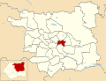
 Leeds UK ward map highlighting Chapel Allerton.svg 1,425 × 1,086; 626 KB
-
 Leeds UK ward map highlighting Cross Gates and Whinmoor.svg 1,425 × 1,086; 626 KB
-
 Leeds UK ward map highlighting Farnley and Wortley.svg 1,425 × 1,086; 626 KB
-
 Leeds UK ward map highlighting Garforth and Swillington.svg 1,425 × 1,086; 626 KB
-
 Leeds UK ward map highlighting Gipton and Harehills.svg 1,425 × 1,086; 626 KB
-
 Leeds UK ward map highlighting Guiseley and Rawdon.svg 1,425 × 1,086; 626 KB
-
 Leeds UK ward map highlighting Harewood.svg 1,425 × 1,086; 626 KB
-
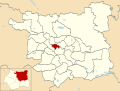 Leeds UK ward map highlighting Headingley and Hyde Park.svg 1,425 × 1,086; 626 KB
-
 Leeds UK ward map highlighting Horsforth.svg 1,425 × 1,086; 626 KB
-
 Leeds UK ward map highlighting Hunslet and Riverside.svg 1,425 × 1,086; 626 KB
-
 Leeds UK ward map highlighting Killingbeck and Seacroft.svg 1,425 × 1,086; 626 KB
-
 Leeds UK ward map highlighting Kippax and Methley.svg 1,425 × 1,086; 626 KB
-
 Leeds UK ward map highlighting Kirkstall.svg 1,425 × 1,086; 626 KB
-
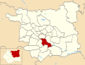
 Leeds UK ward map highlighting Little London and Woodhouse.svg 1,425 × 1,086; 626 KB
-
 Leeds UK ward map highlighting Middleton Park.svg 1,425 × 1,086; 626 KB
-
 Leeds UK ward map highlighting Moortown.svg 1,425 × 1,086; 626 KB
-
 Leeds UK ward map highlighting Morley North.svg 1,425 × 1,086; 626 KB
-
 Leeds UK ward map highlighting Morley South.svg 1,425 × 1,086; 626 KB
-
 Leeds UK ward map highlighting Otley and Yeadon.svg 1,425 × 1,086; 626 KB
-
 Leeds UK ward map highlighting Pudsey.svg 1,425 × 1,086; 626 KB
-
 Leeds UK ward map highlighting Rothwell.svg 1,425 × 1,086; 626 KB
-
 Leeds UK ward map highlighting Roundhay.svg 1,425 × 1,086; 626 KB
-
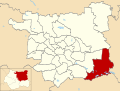
 Leeds UK ward map highlighting Temple Newsam.svg 1,425 × 1,086; 626 KB
-
 Leeds UK ward map highlighting Weetwood.svg 1,425 × 1,086; 626 KB
-
 Leeds UK ward map highlighting Wetherby.svg 1,425 × 1,086; 626 KB


.svg)
.svg)