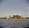
Category:Warmond
Vai alla navigazione
Vai alla ricerca
village and former municipality in South Holland, the Netherlands | |||||
| Carica un file multimediale | |||||
| File audio dell'elemento | |||||
|---|---|---|---|---|---|
| Istanza di | |||||
| Luogo |
| ||||
| Popolazione |
| ||||
| sito web ufficiale | |||||
 | |||||
Sottocategorie
Questa categoria contiene le 10 sottocategorie indicate di seguito, su un totale di 10.
File nella categoria "Warmond"
Questa categoria contiene 75 file, indicati di seguito, su un totale di 75.
-
Warmond wapen 1816.svg 248 × 274; 7 KB
-
Warmond wapen.svg 1 017 × 725; 449 KB
-
Flag of Warmond.svg 450 × 300; 2 KB
-
Warmond flag outline.png 450 × 300; 1 KB
-
Spoorwegongeval bij Warmond (1980).jpg 2 631 × 1 973; 2,7 MB
-
31 bloemen van de Agave victoriae reginae..JPG 1 200 × 1 600; 737 KB
-
35 bloemen van de Agave victoriae reginae.JPG 4 288 × 3 216; 4,44 MB
-
Afgemeerde lelievletten bij het Boterhuiseiland.jpg 4 032 × 3 024; 4,4 MB
-
Beby hooivaarts in warmond - panoramio.jpg 2 256 × 1 496; 959 KB
-
Boerderij tussen de bomen nr. NC 4 - Warmond - 20483218 - RCE.jpg 1 200 × 900; 152 KB
-
Bos Huys te Warmont.jpg 600 × 150; 195 KB
-
Bushalte Station Sassenheim.jpg 2 880 × 1 616; 956 KB
-
Daisies - panoramio.jpg 2 592 × 1 944; 1,68 MB
-
Detail kozijn wateras deur met buitenstoel - Warmond - 20250016 - RCE.jpg 1 200 × 1 200; 260 KB
-
Exterieur - Warmond - 20249902 - RCE.jpg 1 200 × 791; 304 KB
-
Foggy sea - panoramio.jpg 2 272 × 1 704; 2,13 MB
-
GC Kagerzoom2.JPG 2 816 × 2 112; 2,89 MB
-
Gemeentewapens van Warmond, Vianen, Woerden en Haarlem, RP-T-00-479-49(V).jpg 2 032 × 1 136; 259 KB
-
Gevel aan de Dorpsstraat naar het noord-oosten - Warmond - 20250009 - RCE.jpg 899 × 1 200; 208 KB
-
Gevel aan de Dorpsstraat naar het noord-oosten - Warmond - 20250010 - RCE.jpg 1 200 × 868; 152 KB
-
Godslamp - Warmond - 20249893 - RCE.jpg 595 × 1 200; 146 KB
-
Haaswijk", zijgevel - Warmond - 20249983 - RCE.jpg 1 200 × 796; 269 KB
-
Het dorp Warmond met rechts een theekoepel, RP-T-1888-A-1741.jpg 6 322 × 3 786; 2,95 MB
-
Hoekwater polderkaart - Hofpolder (Warmond).PNG 419 × 321; 367 KB
-
Hoekwater polderkaart - Veerpolder (Warmond).PNG 431 × 320; 383 KB
-
Hoekwater polderkaart - Voorhofpolder (Warmond).PNG 384 × 320; 334 KB
-
Huis te Warmond, RP-T-1948-150.jpg 4 754 × 3 834; 2,85 MB
-
Kaag Sociëteit (Kager plassen, Netherlands 2016) (27463681323).jpg 2 048 × 1 152; 774 KB
-
Kaagerplassen - panoramio - Lucas Mevius.jpg 2 592 × 1 944; 1,74 MB
-
Kaagerplassen - panoramio.jpg 2 592 × 1 944; 2,34 MB
-
Koningin Beatrix krijgt een bloemetje aangeboden in Warmond, Bestanddeelnr 932-5689.jpg 3 669 × 2 437; 1,62 MB
-
Netherlands, Kagerplassen, Koudenhoorn, recreatiestrand.JPG 2 144 × 1 424; 822 KB
-
Netherlands, Kagerplassen, map of 1617.jpg 6 494 × 4 083; 10,1 MB
-
Netherlands, Kagerplassen, Zijp (1).JPG 2 144 × 1 424; 728 KB
-
Netherlands, Kagerplassen, Zijp (2).JPG 2 144 × 1 424; 815 KB
-
Netherlands, Warmond, Broek- en Simontjespolder.JPG 2 144 × 1 424; 782 KB
-
Netherlands, Warmond, Lakerpolder, Tuinder- of Kogjespolder.jpg 5 488 × 3 504; 3,01 MB
-
Netherlands, Zijl (4).jpg 1 176 × 1 540; 1 014 KB
-
NIMH - 2011 - 5293 - Aerial photograph of Warmond, The Netherlands.jpg 4 000 × 2 682; 2,85 MB
-
NIMH - 2155 047586 - Aerial photograph of Warmond, The Netherlands.jpg 3 708 × 2 572; 2,24 MB
-
Nl-Warmond-article.ogg 9 min 40 s; 5,76 MB
-
Nl-Warmond.ogg 1,8 s; 21 KB
-
Overzicht gevelwand - Warmond - 20250031 - RCE.jpg 1 200 × 798; 200 KB
-
Overzicht Kagerplassen - Warmond - 20365471 - RCE.jpg 1 200 × 1 198; 164 KB
-
Overzicht Kogjespolder - Warmond - 20365472 - RCE.jpg 1 200 × 1 190; 177 KB
-
Sailing on the Kaag (Warmond, The Netherlands 2019) (48731620981).jpg 2 832 × 2 018; 1,38 MB
-
Sailing on the Kaag (Warmond, The Netherlands 2019) (48731621011).jpg 3 264 × 1 972; 1,8 MB
-
Stork in love.jpg 512 × 640; 93 KB
-
Sunset at Kaag lake (Warmond, The Netherlands 2018) (28941693307).jpg 5 552 × 2 584; 2,77 MB
-
Sunset at Kaag lake (Warmond, The Netherlands 2018) (28941693947).jpg 5 216 × 2 584; 2,67 MB
-
Sunset at Kaag lake (Warmond, The Netherlands 2018) (42973679585).jpg 3 200 × 1 992; 1,43 MB
-
Sunset at Kaag lake (Warmond, The Netherlands 2018) (43160659764).jpg 3 264 × 1 642; 1,22 MB
-
Swan - panoramio.jpg 2 592 × 1 944; 2,69 MB
-
Tussen Oud Ade en Warmond, polderpanorama bij Huize Brugzicht foto7 2017-04-09 10.47.jpg 4 352 × 2 800; 7,55 MB
-
V1 lanceerbaan Warmond 1.JPG 5 184 × 3 888; 7,44 MB
-
V1 lanceerbaan Warmond 2.JPG 5 184 × 3 888; 7,32 MB
-
Voor- en gedeelte rechter zijgevel - Warmond - 20249984 - RCE.jpg 1 200 × 790; 329 KB
-
Voor- en zijgevel nr. KB 5 - Warmond - 20483214 - RCE.jpg 1 200 × 900; 282 KB
-
Voorgevel - Warmond - 20249982 - RCE.jpg 1 200 × 789; 266 KB
-
Voorgevel - Warmond - 20472619 - RCE.jpg 1 200 × 900; 237 KB
-
Warmond - Koudenhoornbrug.jpg 6 000 × 4 000; 10,16 MB
-
Warmond vanaf de Kagerplassen.jpg 3 486 × 992; 827 KB
-
Warmond vlag voor 1965.svg 450 × 300; 2 KB
-
Warmond, Netherlands - panoramio (1).jpg 1 496 × 2 256; 1,28 MB
-
Warmond, Netherlands - panoramio (2).jpg 1 952 × 3 264; 1,7 MB
-
Warmond, Netherlands - panoramio.jpg 1 496 × 2 256; 1,69 MB
-
Weiland met koeien en kerktoren achter geboomte - Warmond - 20319239 - RCE.jpg 1 200 × 829; 143 KB
-
Zij- en voorgevel nr. KB 3 - Warmond - 20483213 - RCE.jpg 1 200 × 900; 261 KB
-
Zijgevel nr. KB 4 - Warmond - 20483212 - RCE.jpg 1 200 × 900; 261 KB


