Category:Warthegau
Jump to navigation
Jump to search
administrative division of Nazi Germany in incorporated Polish territories | |||||
| Upload media | |||||
| Instance of | |||||
|---|---|---|---|---|---|
| Location | Nazi Germany | ||||
| Capital | |||||
| Inception |
| ||||
| Dissolved, abolished or demolished date |
| ||||
| Area |
| ||||
| Replaces | |||||
| Replaced by |
| ||||
 | |||||
Subcategories
This category has the following 6 subcategories, out of 6 total.
Media in category "Warthegau"
The following 23 files are in this category, out of 23 total.
-
De-Warthegau.ogg 1.8 s; 18 KB
-
 Bundesarchiv Bild 137-058154, Wartheland, Umsiedler aus Ostpolen.jpg 796 × 530; 71 KB
-
 Bundesarchiv Bild 137-058160, Wartheland, Umsiedler aus Ostpolen.jpg 798 × 534; 71 KB
-
-
 Bundesarchiv R 49 Bild-1470, Gnesen, Umsiedler aus Galizien.jpg 792 × 551; 67 KB
-
 Execution of Poles in Leszno.jpg 703 × 620; 229 KB
-
 Execution of Poles in Szubin.jpg 1,300 × 983; 662 KB
-
 Execution of Polish priest in Kalisz 01.jpg 1,291 × 1,008; 686 KB
-
 Execution of Polish priest in Kalisz 02.jpg 1,298 × 1,149; 786 KB
-
 Grossdeutsches Reich NS Administration 1944.png 2,615 × 2,030; 250 KB
-
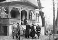
 Koło - Adolf-Hitler-Platz.jpg 1,533 × 954; 527 KB
-
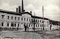 Koło - fabryka fajansu (1941).jpg 1,538 × 1,000; 734 KB
-
 Koło - Synagoga 1939.jpg 766 × 528; 63 KB
-
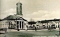
 Koło - ulica Sienkiewicza.jpg 1,546 × 985; 693 KB
-
 Koło - zniszczony most na Warcie 2.jpg 1,539 × 966; 704 KB
-
 Koło - zniszczony most na Warcie.jpg 1,555 × 994; 725 KB
-
 ASK Krotoschin IMG 0179.jpg 1,617 × 1,030; 902 KB
-
 Medallion Urnenfund bei Litzmannstadt.png 432 × 432; 105 KB
-

-
-

-

-
 ZarzadzenieSS-Poznan-1939-Intelligenzaktion-Posen.jpg 2,805 × 1,184; 1.04 MB


.jpg)


_Gaupropagandaleitung_NSDAP_Warthengau_Druck_Muenchen_Postkarte_Ackerpflug_Schwert_Reichsadler_Nazi_propaganda_postcard_Auktionshaus_Weiser_2416_Unsigned_No_known_copyright_restrictions.jpg)
