Category:Wasagaming, Manitoba
Jump to navigation
Jump to search
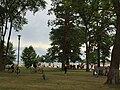
English: Wasagaming (also known as Clear Lake) is the main town-site in Riding Mountain National Park. It is located at the south gate of Riding Mountain National Park along Highway 10. The town-site lies on the south shores of Clear Lake, the largest lake in Riding Mountain National Park. It is a popular tourist destination.
human settlement in Manitoba, Canada  | |||||
| Upload media | |||||
| Instance of | |||||
|---|---|---|---|---|---|
| Located in protected area | |||||
| Location | Unorganized Division No. 17, Manitoba, Canada | ||||
| Inception |
| ||||
| Elevation above sea level |
| ||||
 | |||||
Subcategories
This category has the following 8 subcategories, out of 8 total.
C
- Casa Loma (Wasagaming) (1 F)
R
W
- Wasagaming Bandstand (2 F)
- Wasagaming staff residence (1 F)
- Wasagaming Tennis Clubhouse (7 F)
Media in category "Wasagaming, Manitoba"
The following 12 files are in this category, out of 12 total.
-
 "Clear Lake." Man.jpg 3,635 × 2,379; 1.89 MB
-
 Wasagaming Main Beach (Facing Clear Lake).jpg 5,312 × 2,988; 4 MB
-
 Wasagaming Main Beach (Facing the pier).jpg 5,312 × 2,988; 3.79 MB
-
 Wasagaming, Manitoba.IMG 0893.jpg 3,264 × 2,448; 320 KB
-
 Wasagaming, Manitoba.IMG 0894.jpg 3,264 × 2,448; 974 KB
-
 Wasagaming, Manitoba.IMG 0902.jpg 3,264 × 2,448; 778 KB
-
 Wasagaming, Manitoba.IMG 2689.jpg 3,264 × 2,448; 2.09 MB
-
 Wasagaming, Manitoba.IMG 2716 (2).jpg 3,264 × 1,640; 1.38 MB
-
 Wasagamingbandstand.JPG 2,272 × 1,704; 1.67 MB
-
 Wasagamingdrive.jpg 2,272 × 1,704; 1,009 KB
-
 Wasagamingseasonalcabins.jpg 2,272 × 1,704; 1.04 MB
-
 Waterside path in Wasagaming - panoramio.jpg 1,728 × 1,152; 634 KB
.jpg)


.jpg)


.jpg)