Category:Wasserbourg
Jump to navigation
Jump to search
commune in Haut-Rhin, France  .svg)  | |||||
| Upload media | |||||
| Pronunciation audio | |||||
|---|---|---|---|---|---|
| Instance of | |||||
| Located in protected area | |||||
| Location |
| ||||
| Population |
| ||||
| Area |
| ||||
| official website | |||||
 | |||||
Subcategories
This category has the following 5 subcategories, out of 5 total.
B
- Blue sky in Wasserbourg (1 F)
C
- Château du Wassenberg (1 F)
E
M
- Mairie de Wasserbourg (2 F)
- Maps of Wasserbourg (3 F)
Media in category "Wasserbourg"
The following 12 files are in this category, out of 12 total.
-

-
 David Ortlieb-Wasserbourg.jpg 2,887 × 2,179; 1.44 MB
-
 Le Krebsbach à Wasserbourg.jpg 1,704 × 2,272; 2.04 MB
-
 Population - Municipality code 68358.svg 475 × 355; 12 KB
-
 Rue de l'église. Wasserbourg (2).jpg 2,171 × 1,627; 1.34 MB
-
 Rue de l'église. Wasserbourg.jpg 2,126 × 1,593; 1.3 MB
-
 Vu de Wasserbourg depuis le Buchwald.jpg 5,472 × 3,648; 7.4 MB
-
 Blason de la ville de Wasserbourg (68).svg 600 × 660; 133 KB
-
 Wasserbourg. Crête du Grothkopf. 2014-06-06.jpg 4,000 × 2,880; 2.94 MB
-
 Wasserbourg. Grothkopf. (2). 2014-06-06.jpg 4,000 × 2,848; 3.53 MB
-
 Wasserbourg. Grothkopf. (4). 2014-06-06.jpg 4,000 × 3,000; 4.69 MB
-
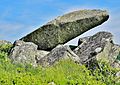
 Wasserbourg. Rochers du Steinberg. (3). 2014-06-06.jpg 4,000 × 2,866; 2.67 MB
_1816_by_David_Ortlieb_(1797-1875)_-_Oil_on_Canvas.jpg)


.jpg)


._2014-06-06.jpg)
._2014-06-06.jpg)
._2014-06-06.jpg)