Category:Wasserturmstr 12 (Hohnstädt)
Jump to navigation
Jump to search
| Object location | | View all coordinates using: OpenStreetMap |
|---|
.jpg) | |||||
| Upload media | |||||
| Instance of | |||||
|---|---|---|---|---|---|
| Location | Hohnstädt, Grimma, Landkreis Leipzig, Saxony, Germany | ||||
| Street address |
| ||||
| Heritage designation | |||||
| Inception |
| ||||
 | |||||
| (Wikidata) |
Media in category "Wasserturmstr 12 (Hohnstädt)"
The following 2 files are in this category, out of 2 total.
-
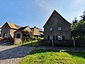
 Wasserturmstr 10-12 (Hohnstädt).jpg 4,032 × 3,024; 2.9 MB
-
 Wasserturmstr 12 (Hohnstädt).jpg 4,608 × 3,456; 5.49 MB
.jpg)