Category:Water tower (Lauwerhof Utrecht)
Jump to navigation
Jump to search
| Object location | | View all coordinates using: OpenStreetMap |
|---|
 | |||||
| Upload media | |||||
| Instance of | |||||
|---|---|---|---|---|---|
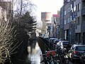
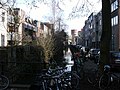
| Location | Utrecht, Netherlands | ||||
| Street address |
| ||||
| Located on street |
| ||||
| Architect | |||||
| Headquarters location | |||||
| Heritage designation |
| ||||
 | |||||
Nederlands: De Watertoren aan het Lauwerhof is een watertoren in het centrum van de Nederlandse stad Utrecht.
English: The Water tower to the Lauwerhof is a water tower in the center of the Dutch city of Utrecht.
|
This is a category about rijksmonument number 514252
|
| Address |
|
Media in category "Water tower (Lauwerhof Utrecht)"
The following 11 files are in this category, out of 11 total.
-
 Bovenbouw - Utrecht - 20235332 - RCE.jpg 1,200 × 1,192; 199 KB
-
 Breedstraatbuurt, Utrecht, Netherlands - panoramio (8).jpg 2,176 × 3,264; 1.66 MB
-
 Exterieur OVERZICHT - Utrecht - 20339929 - RCE.jpg 1,172 × 1,200; 282 KB
-
 Onderbouw - Utrecht - 20235333 - RCE.jpg 953 × 1,200; 211 KB
-
 Utrecht - Oosterstroom and Gruttersdijk closeup watertower.jpg 3,264 × 2,448; 1.67 MB
-
 Utrecht - Oosterstroom and Gruttersdijk.jpg 3,264 × 2,448; 1.21 MB
-
 Utrecht - Watertoren Lauwerhof - 20220223 PvE (Q2621420).jpg 2,487 × 4,421; 7.93 MB
-
 Utrecht, de watertoren aan het Lauwerhof RM514252 foto3 2015-11-01 13.59.jpg 3,072 × 4,076; 7.53 MB
-
 Water tower (Lauwerhof Utrecht).jpg 2,852 × 4,166; 9.23 MB
-
 Watertoren - Utrecht - 20339928 - RCE.jpg 1,179 × 1,200; 246 KB
-
 Watertoren Lauwerhof.jpg 1,704 × 2,272; 1.12 MB

.jpg)


.jpg)

.jpg)
