Category:Watercourses in the City of Wakefield
Jump to navigation
Jump to search
Subcategories
This category has the following 18 subcategories, out of 18 total.
Media in category "Watercourses in the City of Wakefield"
The following 16 files are in this category, out of 16 total.
-
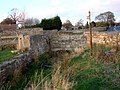 Bridge on Wrangbrook Lane - geograph.org.uk - 611223.jpg 640 × 480; 97 KB
-
 Cold Hiendley Reservoir Outflow - geograph.org.uk - 491205.jpg 640 × 480; 133 KB
-
 Footbridge over Pugney's Drain - geograph.org.uk - 5298828.jpg 1,600 × 1,200; 885 KB
-
 Footbridge over unnamed stream - geograph.org.uk - 1832799.jpg 640 × 480; 361 KB
-
 Lofthouse Colliery Nature Park Tour (27) - geograph.org.uk - 1630737.jpg 640 × 475; 339 KB
-
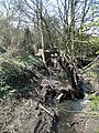
 Public footpath and issue-fed stream - geograph.org.uk - 6431603.jpg 1,600 × 1,200; 815 KB
-
 Pugney's Drain, Wakefield - geograph.org.uk - 3083664.jpg 800 × 600; 172 KB
-
 Road Bridge over Water Course, Westgate End, Wakefield - geograph.org.uk - 3545515.jpg 4,608 × 3,456; 3.25 MB
-
 Sewer pipe - geograph.org.uk - 1832996.jpg 480 × 640; 435 KB
-
 Stream - Henry Street - geograph.org.uk - 3882101.jpg 640 × 480; 137 KB
-
 Stream - Henry Street - geograph.org.uk - 3882103.jpg 640 × 480; 123 KB
-
 Unsigned footpath (4) - geograph.org.uk - 2402516.jpg 768 × 1,024; 938 KB
-
 Wash Dike - geograph.org.uk - 5674666.jpg 3,461 × 2,261; 1.68 MB
-
 Wash Dike, Knottingley Road, Pontefract - geograph.org.uk - 2342080.jpg 1,152 × 864; 760 KB
-
 Water level gauge, Wakefield Beck - geograph.org.uk - 2647934.jpg 2,592 × 3,872; 2.13 MB
-
 Watercourse, Normanton Golf Club - geograph.org.uk - 6431640.jpg 1,600 × 1,200; 534 KB


_-_geograph.org.uk_-_1630737.jpg)


_-_geograph.org.uk_-_2402516.jpg)


