Category:Waterloo, Perth and Kinross
Jump to navigation
Jump to search
English: Waterloo is a small hamlet in Perth and Kinross, Scotland approximately 1/2 a mile to a mile north of Bankfoot on the old A9.
village in Perth and Kinross, Scotland, UK  | |||||
| Upload media | |||||
| Instance of | |||||
|---|---|---|---|---|---|
| Location |
| ||||
 | |||||
Media in category "Waterloo, Perth and Kinross"
The following 48 files are in this category, out of 48 total.
-
 Cults Stone Row - geograph.org.uk - 906152.jpg 640 × 480; 87 KB
-
 Edward VII Post box - geograph.org.uk - 364245.jpg 477 × 640; 96 KB
-
 Highland Railway - geograph.org.uk - 279283.jpg 640 × 480; 60 KB
-
 Hyacinthoides non-scripta - geograph.org.uk - 440265.jpg 640 × 480; 152 KB
-
 Snowdrops beside Broomhill Burn - geograph.org.uk - 727024.jpg 640 × 414; 262 KB
-
 Standing stones at East Cult Farm - geograph.org.uk - 364194.jpg 640 × 480; 94 KB
-
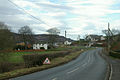 Waterloovillage.jpg 640 × 426; 65 KB
-
 Woodpile by Glenshuch Wood - geograph.org.uk - 440219.jpg 640 × 480; 89 KB
-
 Agriculture polluting atmosphere - geograph.org.uk - 427404.jpg 640 × 480; 51 KB
-
 Airleywight House - geograph.org.uk - 639014.jpg 640 × 428; 50 KB
-
 Auchtergaven Church - geograph.org.uk - 627166.jpg 640 × 427; 83 KB
-
 Auchtergaven Church - geograph.org.uk - 627179.jpg 640 × 427; 38 KB
-

-
 Auchtergaven Primary School - geograph.org.uk - 621423.jpg 640 × 427; 67 KB
-
 Bungalows, Pass of Birnam - geograph.org.uk - 278738.jpg 640 × 480; 70 KB
-
 Charge - geograph.org.uk - 440160.jpg 640 × 480; 61 KB
-
 Cleared boulder - geograph.org.uk - 440164.jpg 640 × 480; 119 KB
-
 Coral Corner - geograph.org.uk - 621410.jpg 640 × 427; 143 KB
-
 Coralgrove - geograph.org.uk - 621412.jpg 640 × 427; 102 KB
-
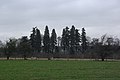
 Coronation Park - geograph.org.uk - 621418.jpg 640 × 427; 79 KB
-
 Cowford - geograph.org.uk - 278596.jpg 640 × 480; 79 KB
-
 Dungarthill Estate road - geograph.org.uk - 540757.jpg 640 × 480; 119 KB
-
 Fordie Hill wood - geograph.org.uk - 364229.jpg 477 × 640; 160 KB
-
 Gate, West Cult - geograph.org.uk - 440270.jpg 640 × 480; 65 KB
-
 Large reentrant - geograph.org.uk - 440279.jpg 640 × 480; 81 KB
-
 Last control, Newtyle Hill - geograph.org.uk - 440228.jpg 640 × 480; 108 KB
-
 Lochan on Newtyle Hill - geograph.org.uk - 547930.jpg 640 × 480; 93 KB
-
 Lone birch - geograph.org.uk - 440284.jpg 640 × 480; 60 KB
-
 May, Logiebride - geograph.org.uk - 540113.jpg 640 × 480; 77 KB
-
 Monolith - geograph.org.uk - 364199.jpg 477 × 640; 88 KB
-
 Over Blelock - geograph.org.uk - 440157.jpg 640 × 480; 75 KB
-
 Over Blelock - geograph.org.uk - 440158.jpg 640 × 480; 72 KB
-
 Plough patterns and sheep - geograph.org.uk - 364241.jpg 640 × 480; 91 KB
-
 Ploughing contours - geograph.org.uk - 364257.jpg 640 × 480; 118 KB
-
 Reentrant - geograph.org.uk - 440267.jpg 640 × 480; 154 KB
-
 Rhododendrons, Dungarthill - geograph.org.uk - 440252.jpg 640 × 480; 171 KB
-
 Stare Dam - geograph.org.uk - 330211.jpg 640 × 480; 78 KB
-
 Stubble field - geograph.org.uk - 364264.jpg 640 × 480; 111 KB
-
 Summer comes to Dungarthill - geograph.org.uk - 440242.jpg 640 × 480; 164 KB
-
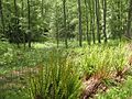
 Tavern Wood - geograph.org.uk - 278392.jpg 640 × 480; 61 KB
-
 The Whins of Fordie - geograph.org.uk - 364223.jpg 640 × 480; 67 KB
-
 Trig Point at East Cult Farm - geograph.org.uk - 364208.jpg 477 × 640; 118 KB
-
 View to the South towards Perth - geograph.org.uk - 364202.jpg 640 × 480; 90 KB
-
 Way out - geograph.org.uk - 440246.jpg 640 × 480; 146 KB
-
 West Cult - geograph.org.uk - 440277.jpg 640 × 480; 68 KB
-
 Witch's Stone - geograph.org.uk - 465459.jpg 415 × 640; 119 KB
-
 Woodland, Dungarthill - geograph.org.uk - 440235.jpg 640 × 480; 155 KB
-
 Woodland, Dungarthill - geograph.org.uk - 440239.jpg 480 × 640; 154 KB


