Category:Waterstock
Jump to navigation
Jump to search
village and civil parish in South Oxfordshire district, Oxfordshire, England  | |||||
| Upload media | |||||
| Instance of | |||||
|---|---|---|---|---|---|
| Location | South Oxfordshire, Oxfordshire, South East England, England | ||||
 | |||||
Subcategories
This category has the following 2 subcategories, out of 2 total.
W
- St Leonard's Church, Waterstock (10 F)
- Wheatley Services (24 F)
Media in category "Waterstock"
The following 132 files are in this category, out of 132 total.
-
-
 1914-18 war memorial in Waterstock - geograph.org.uk - 2667333.jpg 3,872 × 2,592; 6.26 MB
-
 A field of winter wheat - geograph.org.uk - 2669755.jpg 3,872 × 2,592; 5.69 MB
-
-
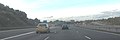
 A418 - M40 - geograph.org.uk - 2565567.jpg 2,560 × 1,920; 2.42 MB
-
 A418 bridge, M40 junction 8 - geograph.org.uk - 2896037.jpg 640 × 480; 55 KB
-
 A418 crosses the M40 near Wheatley - geograph.org.uk - 192048.jpg 640 × 479; 81 KB
-
 A418 roundabout above the A40 - geograph.org.uk - 1919277.jpg 640 × 403; 40 KB
-
 A418 west of Oxford services - geograph.org.uk - 2367490.jpg 640 × 480; 74 KB
-
 Arriving at the Wheatley roundabouts - geograph.org.uk - 2667306.jpg 3,872 × 2,592; 3.36 MB
-
 Benchmark on outbuilding west of The Fox - geograph.org.uk - 3691811.jpg 683 × 1,024; 172 KB
-
 Bow Bridge - geograph.org.uk - 705432.jpg 640 × 425; 118 KB
-
-
 Buckinghamshire boundary stone on Ickford Bridge - geograph.org.uk - 4974607.jpg 1,550 × 2,069; 1.17 MB
-
 Car boot sale at Waterstock Golf Club - geograph.org.uk - 3539423.jpg 1,500 × 1,000; 203 KB
-
 Car boot sale at Waterstock Golf Club - geograph.org.uk - 3539424.jpg 1,500 × 1,000; 231 KB
-
 Car boot sale at Waterstock Golf Club - geograph.org.uk - 3539425.jpg 1,500 × 1,000; 240 KB
-
 Car Park Scene - geograph.org.uk - 5638034.jpg 800 × 600; 122 KB
-
 Christmas Services View - geograph.org.uk - 5638029.jpg 800 × 600; 110 KB
-
 Church Farm and the Rectory from the churchyard - geograph.org.uk - 3852227.jpg 1,116 × 1,000; 979 KB
-
 Coach Parking, Oxford Services - geograph.org.uk - 3600937.jpg 640 × 480; 223 KB
-
 Days Inn Motel at Oxford Services, M40 - geograph.org.uk - 3552584.jpg 2,000 × 1,333; 626 KB
-
 Drain running into River Thame at Ickford Bridge - geograph.org.uk - 3852115.jpg 1,000 × 1,333; 1.3 MB
-
 Eastern roundabout, M40 junction 8 - geograph.org.uk - 2896041.jpg 640 × 480; 56 KB
-
 Entrance to Waterstock Golf Club - geograph.org.uk - 2690189.jpg 640 × 430; 48 KB
-
 Exit for M40 on the A418, Wheatley - geograph.org.uk - 2522046.jpg 1,600 × 1,200; 573 KB
-
 Fields by Waterstock Mill - geograph.org.uk - 2667323.jpg 3,872 × 2,592; 5.91 MB
-
 Fields in the Thame Valley - geograph.org.uk - 3539427.jpg 1,500 × 1,000; 216 KB
-
 Flooded farmland next to Ickford Bridge - geograph.org.uk - 3852121.jpg 1,296 × 1,000; 936 KB
-
 Floods stretch to the distance from Ickford Bridge - geograph.org.uk - 3852155.jpg 1,333 × 1,000; 1.04 MB
-

-

-
 Footpath to Ickford - geograph.org.uk - 2669787.jpg 3,872 × 2,592; 4.24 MB
-
 Fountains at Oxford Services - geograph.org.uk - 4517524.jpg 4,387 × 3,456; 5.67 MB
-
 Gates on the track - geograph.org.uk - 2533280.jpg 1,500 × 1,000; 179 KB
-
 Grandstand by training ring - geograph.org.uk - 1065914.jpg 640 × 480; 107 KB
-
 Horse training ring in Waterstock - geograph.org.uk - 1724851.jpg 1,500 × 1,000; 298 KB
-
 Ickford Bridge - geograph.org.uk - 2669806.jpg 3,872 × 2,592; 4.47 MB
-
 Ickford Bridge - geograph.org.uk - 2669849.jpg 3,872 × 2,592; 6.11 MB
-
 Ickford Bridge - Western parapet in floods - geograph.org.uk - 3852105.jpg 1,137 × 1,000; 1.07 MB
-
 Ickford Bridge looking towards Whirlpool Arch - geograph.org.uk - 3716981.jpg 1,024 × 683; 216 KB
-
 Ickford Road towards Ickford Bridge - geograph.org.uk - 3313701.jpg 640 × 480; 224 KB
-
 Ickford, River Thame - geograph.org.uk - 4991878.jpg 1,024 × 768; 176 KB
-
 Ivied trees - geograph.org.uk - 3862018.jpg 480 × 640; 169 KB
-
 Junction on the A418 - geograph.org.uk - 3857522.jpg 640 × 480; 133 KB
-
 Lane by Waterstock church - geograph.org.uk - 3862038.jpg 640 × 480; 163 KB
-
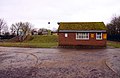
 Little-used phone box - geograph.org.uk - 3857534.jpg 640 × 480; 138 KB
-
 London Road at the junction of Oxford Road - geograph.org.uk - 4864629.jpg 2,048 × 1,536; 960 KB
-
 M40 junction 8A - geograph.org.uk - 3125898.jpg 3,388 × 2,224; 879 KB
-
 M40 looking south - geograph.org.uk - 2690196.jpg 640 × 407; 58 KB
-

-
 M40 Motorway-Oxford Services - geograph.org.uk - 3968729.jpg 1,024 × 768; 154 KB
-
 M40 northbound after Junction 8a - geograph.org.uk - 2900483.jpg 640 × 480; 53 KB
-
 M40 Services Path - geograph.org.uk - 4804827.jpg 800 × 600; 92 KB
-
 M40 south near Junction 8A - geograph.org.uk - 2831089.jpg 640 × 481; 37 KB
-
 M40 southbound at junction 8A - geograph.org.uk - 2213093.jpg 640 × 480; 297 KB
-
 M40, Junction 8a - geograph.org.uk - 2458423.jpg 640 × 364; 39 KB
-
 M40, Junction 8a - geograph.org.uk - 2900480.jpg 640 × 480; 45 KB
-
 M40, Oxford Service Area - geograph.org.uk - 3600943.jpg 640 × 480; 241 KB
-
 M40, southbound - geograph.org.uk - 5648561.jpg 640 × 407; 38 KB
-
 Mowing the grass at Oxford Services - geograph.org.uk - 2398767.jpg 3,264 × 2,448; 3.48 MB
-
 Oxford M40 Services - geograph.org.uk - 2783090.jpg 2,816 × 2,112; 1.32 MB
-
 Oxford Service Area, M40 - geograph.org.uk - 3600929.jpg 640 × 480; 267 KB
-
 Oxford Services - geograph.org.uk - 3600951.jpg 640 × 480; 331 KB
-
 Oxford Services - geograph.org.uk - 4517527.jpg 4,340 × 2,856; 4.96 MB
-
 Oxford Services - geograph.org.uk - 4598375.jpg 1,024 × 576; 100 KB
-
 Oxford Services M40 - geograph.org.uk - 4091595.jpg 1,600 × 1,064; 320 KB
-
 Oxford services, car park - geograph.org.uk - 2398758.jpg 3,264 × 2,448; 1.86 MB
-
 Oxfordshire Everglades - geograph.org.uk - 3852146.jpg 1,333 × 1,000; 1.35 MB
-
 Part of Waterstock Golf Course - geograph.org.uk - 2667317.jpg 3,872 × 2,592; 3.57 MB
-
 Pasture, Waterstock - geograph.org.uk - 2810211.jpg 640 × 480; 179 KB
-
 Pasture, Waterstock - geograph.org.uk - 2810315.jpg 640 × 480; 140 KB
-
 Path by the sewage works - geograph.org.uk - 2669746.jpg 3,872 × 2,592; 5.55 MB
-

-
 Rhenish-helm roofed pump house, Waterstock - geograph.org.uk - 3852199.jpg 1,005 × 1,000; 695 KB
-
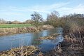
 River Thame - geograph.org.uk - 3482013.jpg 2,048 × 1,536; 552 KB
-
 River Thame and inundated fields by Ickford Bridge - geograph.org.uk - 3852099.jpg 1,333 × 1,000; 1.26 MB
-
 River Thame at Ickford Bridge - geograph.org.uk - 673242.jpg 640 × 480; 86 KB
-
 River Thame floods at Ickford Bridge - geograph.org.uk - 3852092.jpg 1,062 × 1,000; 825 KB
-
 River Thame floods to the east of Ickford Bridge - geograph.org.uk - 3852152.jpg 1,333 × 1,000; 1.24 MB
-
 River Thame from Ickford Bridge - geograph.org.uk - 3313708.jpg 640 × 480; 225 KB
-
 River Thame near Waterstock - geograph.org.uk - 5655272.jpg 3,888 × 2,592; 3.22 MB
-

-
 Rocks and Trucks, Oxford Services - geograph.org.uk - 5655296.jpg 3,218 × 2,398; 2.57 MB
-

-
 Services Car Park - geograph.org.uk - 5638031.jpg 800 × 600; 91 KB
-
 Services Entrance - geograph.org.uk - 2993652.jpg 800 × 600; 130 KB
-
 Services Fountain - geograph.org.uk - 5776587.jpg 800 × 600; 168 KB
-
 Services Hotel - geograph.org.uk - 5776593.jpg 800 × 588; 100 KB
-
 Sewage works near Waterstock - geograph.org.uk - 1727810.jpg 1,500 × 979; 187 KB
-
 St Leonard's - Northern façade - geograph.org.uk - 3852218.jpg 1,333 × 1,000; 1 MB
-
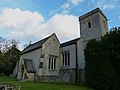
 St Leonard's Church, Waterstock - geograph.org.uk - 2234342.jpg 3,072 × 2,304; 3.79 MB
-
 St Leonard's Church, Waterstock - geograph.org.uk - 2667329.jpg 3,872 × 2,592; 5.58 MB
-
 St Leonard's from track on northern side - geograph.org.uk - 3852212.jpg 1,333 × 1,000; 949 KB
-
 Starbucks Drive Thru, Oxford Services - geograph.org.uk - 5655286.jpg 3,435 × 2,294; 2.19 MB
-
 Sunset over Wheatley Services - geograph.org.uk - 1996089.jpg 3,488 × 2,616; 2.15 MB
-
 Thatched cottage in Waterstock - geograph.org.uk - 2669709.jpg 3,872 × 2,592; 4.74 MB
-
 The A418 heading towards Tiddington - geograph.org.uk - 710282.jpg 640 × 425; 78 KB
-

-
 The entrance to Waterstock Golf Course - geograph.org.uk - 2522121.jpg 1,600 × 1,200; 630 KB
-
 The footpath to Ickford crosses the road to Tiddington - geograph.org.uk - 1727818.jpg 1,500 × 1,000; 252 KB
-
 The Fountains, Oxford Service Area - geograph.org.uk - 3600946.jpg 640 × 480; 326 KB
-
 The Fox, Tiddington - geograph.org.uk - 2167382.jpg 3,713 × 2,342; 1.28 MB
-
 The Fox, Tiddington - geograph.org.uk - 2807848.jpg 800 × 600; 86 KB
-
 The lane into Waterstock - geograph.org.uk - 717108.jpg 640 × 526; 122 KB
-
 The M40 at junction 8A - geograph.org.uk - 3719627.jpg 3,966 × 1,324; 1.06 MB
-
 The main street through Waterstock - geograph.org.uk - 1724852.jpg 1,500 × 969; 198 KB
-

-
 The road to Waterstock - geograph.org.uk - 1724853.jpg 1,500 × 1,000; 199 KB
-
 The view towards the River Thame - geograph.org.uk - 2533279.jpg 1,500 × 1,000; 287 KB
-
 The Welcome Break at Oxford Services - geograph.org.uk - 6396469.jpg 1,632 × 918; 497 KB
-
 Thirteen coach parking bays - geograph.org.uk - 3552040.jpg 2,000 × 2,000; 622 KB
-
 Tree stump by the Thame - geograph.org.uk - 4582384.jpg 3,948 × 2,664; 2.51 MB
-

-
 View across the River Thame - geograph.org.uk - 2667320.jpg 3,872 × 2,592; 3.47 MB
-
 Waterstock church - geograph.org.uk - 3857513.jpg 640 × 480; 165 KB
-
 Waterstock Golf Course - geograph.org.uk - 1065855.jpg 640 × 480; 74 KB
-
 Waterstock House Training Centre - geograph.org.uk - 2667326.jpg 3,872 × 2,592; 5.23 MB
-
 Waterstock Training Centre - geograph.org.uk - 4543559.jpg 3,888 × 2,592; 1.55 MB
-
 Weir in the Garden - geograph.org.uk - 4543553.jpg 3,644 × 2,412; 2.98 MB
-
 Approaching the M40 Junction 8A - geograph.org.uk - 710242.jpg 640 × 425; 54 KB
-
 Autumn splendour in Waterstock - geograph.org.uk - 717157.jpg 640 × 503; 140 KB
-
 Edon Business Park, Wheatley - geograph.org.uk - 192045.jpg 640 × 479; 85 KB
-
 Footpath to Ickford - geograph.org.uk - 705418.jpg 640 × 425; 129 KB
-
-
 Joining the M40 North - geograph.org.uk - 599799.jpg 640 × 480; 81 KB
-
 Jubilee Covert - geograph.org.uk - 719619.jpg 640 × 425; 105 KB
-
 Junction 8a, M40 - geograph.org.uk - 7025.jpg 640 × 480; 96 KB
-
 Lake by Lower Chilworth Farm - geograph.org.uk - 115514.jpg 640 × 480; 111 KB
-
 Pond at Oxford service area - geograph.org.uk - 192044.jpg 640 × 480; 137 KB
-
-
 Wheat field, near Wheatley - geograph.org.uk - 190857.jpg 640 × 480; 83 KB


