Category:Watford, Northamptonshire
Jump to navigation
Jump to search
English: Watford is a village and civil parish in the West Northamptonshire district of the ceremonial county of Northamptonshire in England. It should not be confused with the more significant town of Watford in Hertfordshire which is some 50 miles to the south.
Norsk bokmål: Watford er en landsby i distriktet West Northamptonshire i Northamptonshire, England. Den er kjent av mange fordi den ligger rett ved det store motorveiserviceområdet Watford Gap, det første av mange slike områder i Storbritannia.
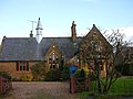
village and civil parish in Northamptonshire, United Kingdom  Eglwys Sant Pedr a Sant Paul, Watford | |||||
| Upload media | |||||
| Instance of | |||||
|---|---|---|---|---|---|
| Location | West Northamptonshire, Northamptonshire, East Midlands, England | ||||
| Population |
| ||||
| Area |
| ||||
 | |||||
Subcategories
This category has the following 4 subcategories, out of 4 total.
W
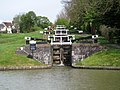
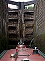
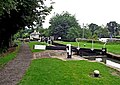
- Watford Locks (55 F)
Media in category "Watford, Northamptonshire"
The following 200 files are in this category, out of 270 total.
(previous page) (next page)-
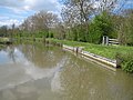
 A frozen Grand Union Canal - geograph.org.uk - 2202144.jpg 640 × 427; 101 KB
-
 A5 heading north - geograph.org.uk - 5647589.jpg 640 × 428; 97 KB
-
 A5 heading north - geograph.org.uk - 5647606.jpg 640 × 428; 92 KB
-
 A5 Watling Street Bridge No 5 - geograph.org.uk - 4601506.jpg 800 × 580; 172 KB
-
 Alongside Watford Covert - geograph.org.uk - 2108683.jpg 4,000 × 3,000; 2.9 MB
-
 Approaching junction 17 - geograph.org.uk - 6527292.jpg 3,550 × 2,366; 1.4 MB
-
 Ashby's Bridge (No 7), from the south-west - geograph.org.uk - 5563705.jpg 1,024 × 768; 254 KB
-
 Ashby's Bridge No 7 - geograph.org.uk - 4597449.jpg 800 × 578; 159 KB
-
 Ashby's Bridge north-west of Watford in Northamptonshire - geograph.org.uk - 5865388.jpg 1,600 × 1,000; 1.9 MB
-
-
 At the foot of Watford Locks staircase - geograph.org.uk - 2145268.jpg 1,024 × 768; 260 KB
-
 At Watford Gap M1 Services - southbound - geograph.org.uk - 4804021.jpg 3,701 × 4,934; 4.22 MB
-
 B5385 meets A5 - geograph.org.uk - 5633924.jpg 640 × 480; 54 KB
-
 Below Watford Locks - geograph.org.uk - 4666098.jpg 1,280 × 851; 315 KB
-
 Bend on Crick Road, West Haddon - geograph.org.uk - 5408882.jpg 2,186 × 1,558; 1.21 MB
-
 Beneath the M1 motorway bridge - geograph.org.uk - 4597479.jpg 800 × 600; 164 KB
-
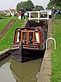
 Boat and Butty, Watford Locks - geograph.org.uk - 611477.jpg 640 × 538; 57 KB
-
 Bottom lock at Watford Locks, Grand Union Canal - geograph.org.uk - 6508635.jpg 1,800 × 1,200; 332 KB
-
 Bridge 5A, from the south - geograph.org.uk - 5537726.jpg 1,024 × 768; 272 KB
-
 Bridge 6H - Progress or no^ - geograph.org.uk - 3108643.jpg 3,025 × 1,938; 964 KB
-
 Bridge 9, Leicester Section - Grand Union Canal - geograph.org.uk - 5572134.jpg 1,280 × 851; 508 KB
-

-
 Bridleway at Ryehill Lodge - geograph.org.uk - 223987.jpg 640 × 480; 119 KB
-
 Broken signpost near Silsworth Lodge - geograph.org.uk - 2107144.jpg 4,000 × 3,000; 2.84 MB
-
 Burnums Farm - geograph.org.uk - 3907761.jpg 640 × 480; 54 KB
-

-

-

-
 Canal by Watford Gap - geograph.org.uk - 4100318.jpg 640 × 478; 196 KB
-

-
 Canal south of Watford in Northamptonshire - geograph.org.uk - 5858082.jpg 1,024 × 1,024; 1.46 MB
-
 Car Park at Watford Gap Service Area - geograph.org.uk - 5111114.jpg 640 × 480; 358 KB
-
 Caravan sales - geograph.org.uk - 3907741.jpg 640 × 480; 64 KB
-
 Clump of trees - geograph.org.uk - 5708497.jpg 640 × 426; 40 KB
-
 Country road - geograph.org.uk - 5633878.jpg 640 × 480; 88 KB
-

-
 Decision Time - geograph.org.uk - 2899539.jpg 640 × 480; 59 KB
-
 Fancy bridge over shallow dry ditch - geograph.org.uk - 2107130.jpg 4,000 × 3,000; 2.82 MB
-
 Farm buildings, Watford Gap - geograph.org.uk - 3907786.jpg 640 × 480; 54 KB
-
 Farmland - geograph.org.uk - 4761644.jpg 640 × 362; 42 KB
-
 Farmland at Watford Gap - geograph.org.uk - 223983.jpg 640 × 480; 97 KB
-

-
 Farmland near Foxholes - geograph.org.uk - 2734935.jpg 640 × 360; 28 KB
-
 Farmland near Long Buckby - geograph.org.uk - 2236375.jpg 640 × 430; 104 KB
-
 Farmland near Watford - geograph.org.uk - 2236364.jpg 640 × 301; 65 KB
-
 Farmland near Watford - geograph.org.uk - 4279740.jpg 1,280 × 851; 385 KB
-
 Farmland near Watford - geograph.org.uk - 4282830.jpg 1,280 × 851; 290 KB
-
 Farmland near Watford - geograph.org.uk - 6645095.jpg 1,280 × 851; 1.73 MB
-
 Farmland near Watford Covert - geograph.org.uk - 2236354.jpg 640 × 335; 63 KB
-
 Farmland towards the M1 - geograph.org.uk - 3907757.jpg 640 × 387; 36 KB
-
 Farmland, Burnham Farm - geograph.org.uk - 2846223.jpg 640 × 418; 48 KB
-
 Field between the A5 and M5 - geograph.org.uk - 4360434.jpg 640 × 430; 48 KB
-
 Field by the West Coast Main line - geograph.org.uk - 4335343.jpg 640 × 430; 42 KB
-

-
 Five lanes wide - geograph.org.uk - 2899544.jpg 640 × 480; 53 KB
-
 Footbridge over the M1 at Watford Gap Services - geograph.org.uk - 3400610.jpg 3,648 × 2,736; 2.21 MB
-
 Footpath crossing the Rugby-Northampton railway - geograph.org.uk - 2108803.jpg 4,000 × 3,000; 2.93 MB
-
 Footpath from Watford follows the hedge - geograph.org.uk - 2236369.jpg 640 × 430; 108 KB
-
 Ford at Ashby St Ledgers - geograph.org.uk - 5287639.jpg 3,000 × 1,684; 5.07 MB
-
 Fuel forecourt, Watford Gap Service Area - geograph.org.uk - 5111108.jpg 640 × 427; 307 KB
-
 Grand Union Canal - geograph.org.uk - 3136295.jpg 1,600 × 1,200; 426 KB
-

-

-
-

-

-
 Grand Union Canal Leicester Line - Lock House - geograph.org.uk - 3108612.jpg 3,072 × 2,048; 1.64 MB
-

-
 Grand Union Canal near Watford Gap - geograph.org.uk - 4100319.jpg 640 × 472; 178 KB
-

-

-

-

-

-
 Grand Union Canal, Leicester Section - geograph.org.uk - 3487060.jpg 640 × 479; 76 KB
-
 Grand Union Canal, Leicester Section - geograph.org.uk - 3487378.jpg 640 × 480; 62 KB
-

-

-

-

-
-

-

-
-

-

-

-
 Home Farm Footbridge No 9 - geograph.org.uk - 4597393.jpg 800 × 600; 142 KB
-

-
 Housing by Watford Top Lock in Northamptonshire - geograph.org.uk - 5865257.jpg 1,280 × 960; 1.29 MB
-
 In the Watford staircase locks, Northamptonshire - geograph.org.uk - 5864746.jpg 960 × 1,280; 1.39 MB
-
 In the Watford staircase locks, Northamptonshire - geograph.org.uk - 5865221.jpg 960 × 1,280; 1.2 MB
-
 In the Watford staircase locks, Northamptonshire - geograph.org.uk - 5865224.jpg 960 × 1,280; 1.41 MB
-
 Jurassic Way alongside Watford Locks - geograph.org.uk - 2166285.jpg 4,000 × 3,000; 2.8 MB
-
 Kilsby Road Bridge near Watford Gap - geograph.org.uk - 6264177.jpg 800 × 533; 492 KB
-
 Kilsby Road Bridge No 8 - geograph.org.uk - 4597408.jpg 800 × 600; 157 KB
-

-

-
 Kilsby Road Bridge, Leicester Canal - geograph.org.uk - 4282457.jpg 1,280 × 851; 373 KB
-
 Kilsby Road Bridge, Leicester Canal - geograph.org.uk - 4282763.jpg 1,280 × 851; 356 KB
-
 Kilsby Road Bridge, Leicester Canal - geograph.org.uk - 4282827.jpg 1,280 × 851; 320 KB
-

-
 Kilsby Road Bridge, M1 - geograph.org.uk - 4689772.jpg 640 × 393; 25 KB
-
 Kilsby Road Bridge, M1 - geograph.org.uk - 4711889.jpg 640 × 369; 33 KB
-
 Lane near the Kilsby Railway Tunnel - geograph.org.uk - 4605406.jpg 800 × 565; 149 KB
-
 Large arable field near Watford Rd - geograph.org.uk - 2236352.jpg 640 × 358; 45 KB
-
 Leicester Canal, near Watford - geograph.org.uk - 5570461.jpg 1,280 × 851; 494 KB
-
 Leicester Canal, near Watford - geograph.org.uk - 5572325.jpg 1,280 × 851; 500 KB
-
 Leicester Canal, Watford - geograph.org.uk - 4278665.jpg 1,280 × 851; 312 KB
-
 Leicester Canal, Watford Gap - geograph.org.uk - 2483141.jpg 1,280 × 856; 232 KB
-
 Leicester Canal, Watford Gap - geograph.org.uk - 2483150.jpg 1,280 × 856; 284 KB
-
 Leicester Canal, Watford Gap - geograph.org.uk - 2483358.jpg 856 × 1,280; 313 KB
-
 Leicester Section Bridge 5 - geograph.org.uk - 3108562.jpg 2,927 × 1,895; 1.34 MB
-
 Leicester Section Bridge 6 - geograph.org.uk - 3108570.jpg 3,072 × 2,048; 1.95 MB
-
 Leicester Section Bridge 7 - geograph.org.uk - 3109319.jpg 3,072 × 2,048; 1.72 MB
-
 Leicester Section Bridge 8 - geograph.org.uk - 3109325.jpg 2,995 × 1,998; 1.49 MB
-
 Leicester Section Bridge 9 - geograph.org.uk - 3109330.jpg 2,997 × 1,998; 1.35 MB
-
 Leicester Section Bridge 9A - geograph.org.uk - 3109336.jpg 2,875 × 1,947; 1.42 MB
-
-
 Lock cottage near Watford in Northamptonshire - geograph.org.uk - 5864666.jpg 1,280 × 960; 1.57 MB
-
 Lock cottage near Watford in Northamptonshire - geograph.org.uk - 5864668.jpg 1,280 × 867; 1.29 MB
-
 Lock Cottage, Watford Locks - geograph.org.uk - 567043.jpg 640 × 633; 122 KB
-

-
-
 Lock No 4 at the Watford staircase in Northamptonshire - geograph.org.uk - 5864200.jpg 1,280 × 853; 1,017 KB
-
-
 Looking down Watford staircase locks - geograph.org.uk - 570379.jpg 640 × 365; 77 KB
-
 Looking towards Watford Covert - geograph.org.uk - 2108703.jpg 4,000 × 3,000; 2.85 MB
-
 M1 approaching Watford Gap Services - geograph.org.uk - 4711893.jpg 640 × 426; 46 KB
-
 M1 Junction 17 - geograph.org.uk - 4278750.jpg 1,280 × 851; 329 KB
-

-
 M1 motorway at Watford Gap services - geograph.org.uk - 2899513.jpg 640 × 480; 54 KB
-

-
-
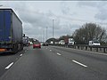
 M1 motorway north of Watford Gap - geograph.org.uk - 2899523.jpg 640 × 480; 56 KB
-
 M1, southbound - geograph.org.uk - 4690203.jpg 640 × 469; 53 KB
-
 M45 to Coventry - geograph.org.uk - 6527287.jpg 3,460 × 2,306; 1.06 MB
-
 Marina Cottage, Watford Locks - geograph.org.uk - 4666341.jpg 1,280 × 851; 487 KB
-
 Muddy underpass below the M1 - geograph.org.uk - 2166281.jpg 4,000 × 3,000; 2.88 MB
-
-
 North along the Grand Union Canal - geograph.org.uk - 4597387.jpg 800 × 585; 142 KB
-
 Norton Junction, Grand Union Canal - geograph.org.uk - 7786.jpg 640 × 480; 114 KB
-
 Not the place to moor for the night - geograph.org.uk - 3108565.jpg 2,730 × 1,930; 1.32 MB
-
 Parked in the fast lane again - geograph.org.uk - 598973.jpg 640 × 480; 108 KB
-
 Parkland near Watford - geograph.org.uk - 1607089.jpg 640 × 480; 131 KB
-
 Parkland of Watford Court (geograph 2108783).jpg 4,000 × 3,000; 2.91 MB
-
 Pasture near Watford, Northamptonshire - geograph.org.uk - 860275.jpg 640 × 480; 140 KB
-
 Pasture west of Watford in Northamptonshire - geograph.org.uk - 5860627.jpg 1,280 × 811; 970 KB
-
 Path to the Leicester Canal - geograph.org.uk - 4279824.jpg 1,280 × 851; 324 KB
-

-
 Pylon and farmland - geograph.org.uk - 4849079.jpg 640 × 426; 44 KB
-
 Railway Bridge near Long Buckby - geograph.org.uk - 183253.jpg 640 × 480; 102 KB
-
 Road through Watford - geograph.org.uk - 5216203.jpg 480 × 640; 66 KB
-

-
 Rugby-Northampton Railway - geograph.org.uk - 1605789.jpg 640 × 480; 103 KB
-

-

-
 Sheep grazing - geograph.org.uk - 4849090.jpg 640 × 426; 47 KB
-

-
 Sheep next to the Grand Union Canal - geograph.org.uk - 4597370.jpg 800 × 600; 219 KB
-

-
 Sheep pastures near Watford Gap - geograph.org.uk - 5537771.jpg 1,024 × 768; 153 KB
-
-
 Side Pond, Watford Locks - geograph.org.uk - 570363.jpg 640 × 384; 65 KB
-

-

-

-

-

-

-
 Snowscene near Watford Rd - geograph.org.uk - 2235888.jpg 640 × 371; 41 KB
-
 Staircase Locks at Watford, Northamptonshire - geograph.org.uk - 5863569.jpg 960 × 1,280; 1.39 MB
-
 Staircase locks near Watford in Northamptonshire - geograph.org.uk - 5863528.jpg 1,280 × 960; 1.36 MB
-
 Staircase locks near Watford in Northamptonshire - geograph.org.uk - 5864175.jpg 960 × 1,280; 1.4 MB
-
 Station Road - geograph.org.uk - 5633923.jpg 640 × 480; 53 KB
-
 Sunset over car park of Watford Gap services, southbound - geograph.org.uk - 6019954.jpg 1,600 × 1,200; 717 KB
-
 The A5 just south of the Grand Union Canal - geograph.org.uk - 6289118.jpg 1,600 × 1,200; 411 KB
-
 The A5 near Watford Gap - geograph.org.uk - 2202158.jpg 640 × 427; 92 KB
-
 The Grand Union Canal - geograph.org.uk - 4685489.jpg 4,988 × 3,669; 5.16 MB
-
 The Jurassic Way north from Watford - geograph.org.uk - 2108789.jpg 4,000 × 3,000; 2.9 MB
-
 The M1 near Watford Gap - geograph.org.uk - 3907780.jpg 640 × 480; 62 KB
-
 The uppermost side pond at Watford Locks - geograph.org.uk - 5537761.jpg 1,024 × 768; 239 KB
-
 Top of Watford Locks - geograph.org.uk - 5571870.jpg 1,280 × 851; 463 KB
-
 Tranquil scene above Watford locks - geograph.org.uk - 3422997.jpg 640 × 482; 109 KB
-
 Tree by Crick Road, West Haddon - geograph.org.uk - 5410646.jpg 2,304 × 1,728; 1.35 MB
-
 Tree by Watling Street near Watford Gap - geograph.org.uk - 6147513.jpg 1,280 × 1,920; 1.63 MB
-
 Trees along the Grand Union Canal - geograph.org.uk - 4335351.jpg 640 × 430; 43 KB
-
 Trees and Barn - geograph.org.uk - 2202138.jpg 640 × 427; 99 KB
-
 Two of the side ponds at Watford Locks - geograph.org.uk - 5537741.jpg 1,024 × 768; 242 KB
-
 Venture - geograph.org.uk - 6507338.jpg 1,024 × 669; 155 KB
-
 Watford - geograph.org.uk - 86393.jpg 640 × 480; 76 KB
-
 Watford - geograph.org.uk - 86453.jpg 640 × 480; 168 KB
-
 Watford Bottom Lock - geograph.org.uk - 5572335.jpg 1,280 × 851; 566 KB
-
 Watford Bottom Lock in Northamptonshire - geograph.org.uk - 5860628.jpg 1,280 × 899; 1.34 MB
-
 Watford Court (geograph 2716001).jpg 640 × 480; 139 KB
-
 Watford Farmland (geograph 2716987).jpg 640 × 480; 54 KB
-
 Watford Farmland - geograph.org.uk - 2714511.jpg 640 × 480; 67 KB
-
 Watford Farmland - geograph.org.uk - 2716972.jpg 640 × 480; 77 KB
-
 Watford Farmland - geograph.org.uk - 2722669.jpg 640 × 480; 49 KB
-
 Watford Footpath - geograph.org.uk - 1738198.jpg 640 × 341; 44 KB


,_from_the_south-west_-_geograph.org.uk_-_5563705.jpg)


_-_geograph.org.uk_-_3487106.jpg)
_-_geograph.org.uk_-_3487389.jpg)


_Old_Roman_Road_-_geograph.org.uk_-_3907751.jpg)


.jpg)


.jpg)
.jpg)


