Category:Watlington, Oxfordshire
Jump to navigation
Jump to search
market town and civil parish in South Oxfordshire district, Oxfordshire, England  | |||||
| Upload media | |||||
| Instance of | |||||
|---|---|---|---|---|---|
| Location | South Oxfordshire, Oxfordshire, South East England, England | ||||
| Area |
| ||||
| official website | |||||
 | |||||
Subcategories
This category has the following 12 subcategories, out of 12 total.
2
- 2010 in Watlington, Oxfordshire (10 F)
- 2023 in Watlington, Oxfordshire (12 F)
C
- Couching Street, Watlington (7 F)
H
L
- St Leonard's Church, Watlington (20 F)
P
W
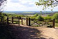
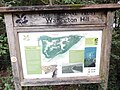
- Watlington Hill (22 F)
- Watlington Town Hall (10 F)
Media in category "Watlington, Oxfordshire"
The following 175 files are in this category, out of 175 total.
-

-
 Along the B480 (Patemore Lane) at Pishill Bottom - geograph.org.uk - 3068106.jpg 766 × 1,024; 258 KB
-
 B4009 entering Watlington - geograph.org.uk - 3923909.jpg 640 × 499; 50 KB
-
 B4009 leaves Watlington as Britwell Road - geograph.org.uk - 2894369.jpg 3,648 × 2,736; 1.65 MB
-
 B480 approaching Cuxham - geograph.org.uk - 6423114.jpg 1,024 × 684; 434 KB
-
 B480 Howe Hill - geograph.org.uk - 6423128.jpg 1,024 × 684; 449 KB
-
 B480 Howe Road - geograph.org.uk - 6423120.jpg 1,024 × 684; 427 KB
-
 B480 Howe Road - geograph.org.uk - 6423125.jpg 1,024 × 684; 421 KB
-
 B480 Patemore Lane - geograph.org.uk - 6423304.jpg 1,024 × 684; 541 KB
-
 B480 Patemore Lane, Pishill Bottom - geograph.org.uk - 6423318.jpg 1,024 × 684; 452 KB
-
 Barn near Dame Alice Farm - geograph.org.uk - 3447235.jpg 640 × 427; 169 KB
-
 Bench Mark on Hill Road - geograph.org.uk - 3444700.jpg 2,736 × 3,648; 1.97 MB
-
 Blocks on the Ridgeway - geograph.org.uk - 1888477.jpg 1,500 × 1,000; 323 KB
-
 Bridleway (Shakespeare's Way) descending Howe Hill - geograph.org.uk - 6462404.jpg 3,024 × 4,032; 6.09 MB
-
 Bridleway down past Woods Farm - geograph.org.uk - 1308361.jpg 640 × 480; 74 KB
-
 Bridleway from Cookley Green - geograph.org.uk - 3447244.jpg 640 × 427; 208 KB
-
 Bridleway to Cookley Green - geograph.org.uk - 3447250.jpg 640 × 427; 213 KB
-
 Bridleway to Easington - geograph.org.uk - 1873533.jpg 1,500 × 1,000; 457 KB
-
 Bridleway to Easington - geograph.org.uk - 1879840.jpg 1,500 × 1,000; 307 KB
-
 Britwell Road, Watlington - geograph.org.uk - 6369219.jpg 1,862 × 1,188; 1.19 MB
-
 Brook Street, Watlington - geograph.org.uk - 2716191.jpg 1,024 × 512; 229 KB
-
 Bucks meets Oxfordshire - geograph.org.uk - 4505287.jpg 1,600 × 1,363; 809 KB
-
 Chicken coops - geograph.org.uk - 4422646.jpg 4,320 × 3,240; 6.21 MB
-
 Chiltern Gate in Hill Road - geograph.org.uk - 1888367.jpg 1,500 × 987; 225 KB
-
 Chiltern Way - geograph.org.uk - 1271329.jpg 640 × 480; 122 KB
-
 Conservation Walks Notice by Watlington Hill (1) - geograph.org.uk - 5995073.jpg 1,944 × 2,592; 962 KB
-
 Conservation Walks Notice by Watlington Hill (2) - geograph.org.uk - 5995085.jpg 1,944 × 2,592; 965 KB
-
 Corner of Love Lane - geograph.org.uk - 2257357.jpg 3,544 × 2,576; 1.01 MB
-
 Corner of New Road - geograph.org.uk - 2253524.jpg 3,648 × 2,736; 985 KB
-

-
 Countryside Commission Notice near Watlington Hill - geograph.org.uk - 5997526.jpg 2,592 × 1,944; 1.44 MB
-
 Cuxham Road, Watlington - geograph.org.uk - 4836811.jpg 2,246 × 1,648; 1.34 MB
-
 Cuxham Road, Watlington - geograph.org.uk - 4836885.jpg 2,304 × 1,728; 1.15 MB
-
 Dame Alice Farm - geograph.org.uk - 3447228.jpg 640 × 427; 205 KB
-
 Descending Watlington Hill - geograph.org.uk - 3301107.jpg 2,048 × 1,536; 555 KB
-
 Do you want me to smile^ - geograph.org.uk - 1879836.jpg 1,500 × 1,000; 204 KB
-
 Downhill to Watlington - geograph.org.uk - 3445433.jpg 3,648 × 2,736; 2.77 MB
-
 Dusky Sallow. Eremobia ochroleuca - Flickr - gailhampshire (3).jpg 2,736 × 2,808; 892 KB
-

-
 Farmland and barns, Watlington - geograph.org.uk - 6171941.jpg 1,024 × 768; 281 KB
-
 Farmland and footpath, Watlington - geograph.org.uk - 6080466.jpg 1,024 × 768; 223 KB
-
 Farmland near Christmas Common - geograph.org.uk - 3523766.jpg 2,560 × 1,920; 1.85 MB
-
 Farmland, Watlington - geograph.org.uk - 1123746.jpg 640 × 480; 181 KB
-
 Farmland, Watlington - geograph.org.uk - 2333155.jpg 640 × 427; 103 KB
-
 Farmland, Watlington - geograph.org.uk - 2818774.jpg 640 × 480; 183 KB
-
 Field of Wild Flowers - geograph.org.uk - 3568309.jpg 1,600 × 1,200; 622 KB
-
 Fields on the southern edge of Watlington - geograph.org.uk - 1849118.jpg 1,024 × 683; 206 KB
-
 Fine Gateposts at Greenfield - geograph.org.uk - 1244133.jpg 640 × 480; 95 KB
-
 Four Way Footpaths - geograph.org.uk - 3568604.jpg 1,600 × 1,200; 800 KB
-
 Free car park, Watlington - geograph.org.uk - 3438896.jpg 3,648 × 2,736; 2.8 MB
-
 From the wood below Watlington Hill - geograph.org.uk - 859513.jpg 640 × 480; 93 KB
-
 Gates out onto Watlington Hill - geograph.org.uk - 1288782.jpg 640 × 427; 94 KB
-
 Gateway on Howe Road - geograph.org.uk - 6109867.jpg 6,000 × 4,000; 6.44 MB
-
 Glebe Barn near Watlington - geograph.org.uk - 2785660.jpg 1,024 × 717; 209 KB
-
 Greenfield Copse - geograph.org.uk - 2158945.jpg 3,264 × 2,448; 5.02 MB
-
 Greenfield Wood - geograph.org.uk - 797875.jpg 640 × 480; 191 KB
-
 Hill Road at the junction of North End - geograph.org.uk - 6369216.jpg 1,920 × 1,280; 1.75 MB
-
 Hill Road in Watlington - geograph.org.uk - 1888374.jpg 1,500 × 1,000; 232 KB
-
 Hill Road, Christmas Common - geograph.org.uk - 6369217.jpg 1,920 × 1,280; 2.02 MB
-
 Hill Road, Watlington - geograph.org.uk - 3444710.jpg 3,648 × 2,736; 2.86 MB
-
 Hill Road, Watlington - geograph.org.uk - 6366469.jpg 1,906 × 1,260; 1.67 MB
-
 Hillside and woodland, Watlington - geograph.org.uk - 6080461.jpg 1,024 × 768; 260 KB
-
 House on Cuxham Road, Watlington - geograph.org.uk - 4836813.jpg 2,304 × 1,728; 794 KB
-
 Houses on Brook Street, Watlington - geograph.org.uk - 6366487.jpg 1,882 × 1,222; 1.53 MB
-
 Howe Farm, Watlington - geograph.org.uk - 1849107.jpg 1,024 × 683; 216 KB
-
 Howe Wood from Watlington Hill - geograph.org.uk - 1288828.jpg 640 × 427; 83 KB
-
 Icknield Community College - geograph.org.uk - 2253502.jpg 3,404 × 2,576; 946 KB
-
 Icknield Community College in Watlington Oxfordshire May 2018.jpg 1,600 × 1,200; 492 KB
-
 Icknield Way, Watlington - geograph.org.uk - 2333163.jpg 640 × 480; 120 KB
-
 Information Board at Watlington Car Park - geograph.org.uk - 6008569.jpg 2,592 × 1,944; 1.41 MB
-
 Information Board at Watlington Hill - geograph.org.uk - 5890387.jpg 2,592 × 1,944; 1.4 MB
-
 K6 Telephone Box at Christmas Common - geograph.org.uk - 6155398.jpg 2,592 × 1,944; 1.31 MB
-
 Kissing gate to the footpaths - geograph.org.uk - 1888574.jpg 1,500 × 1,000; 325 KB
-
 Land at Greenfield Farm - geograph.org.uk - 3568537.jpg 1,600 × 1,200; 574 KB
-
 Larch tree, Watlington Hill, Oxfordshire - geograph.org.uk - 4746653.jpg 4,000 × 4,161; 6.55 MB
-
 Late afternoon light, Greenfield, Oxfordshire - geograph.org.uk - 4746591.jpg 4,000 × 4,836; 7.59 MB
-
 Lower Dean Wood - geograph.org.uk - 1308453.jpg 640 × 480; 109 KB
-
 Mast - geograph.org.uk - 1824417.jpg 640 × 439; 50 KB
-
 Narnia (5469318167).jpg 3,888 × 2,592; 2.78 MB
-
 National Trust Notice at Watlington Hill - geograph.org.uk - 5895622.jpg 1,944 × 2,592; 942 KB
-
 Near Howe Combe Farm - geograph.org.uk - 3896684.jpg 4,320 × 3,240; 3.44 MB
-
 Near Woods Farm - geograph.org.uk - 3447261.jpg 640 × 427; 198 KB
-
 No Happy Christmas for These - geograph.org.uk - 3942707.jpg 3,888 × 2,592; 5.78 MB
-
 North End, Christmas Common - geograph.org.uk - 6369018.jpg 1,920 × 1,280; 1.56 MB
-
 Notice on Gate by The Ridgeway - geograph.org.uk - 5886596.jpg 2,592 × 1,944; 1.4 MB
-

-

-
-
 Oops, Excuse Me, Vicar^ - geograph.org.uk - 5278117.jpg 1,427 × 2,072; 1.83 MB
-
 Oxfordshire Way, Trip Hazard - geograph.org.uk - 3568623.jpg 1,600 × 1,200; 860 KB
-
 Pasture on Pyrton Hill - geograph.org.uk - 1435236.jpg 640 × 426; 183 KB
-
 Pasture, Watlington - geograph.org.uk - 6171936.jpg 1,024 × 768; 247 KB
-
 Patemore Lane north of Van Diemans - geograph.org.uk - 4100902.jpg 3,360 × 2,771; 2.05 MB
-
 Patemore Lane south of Shambridge Wood - geograph.org.uk - 4100915.jpg 4,000 × 3,000; 2.39 MB
-
 Permissive Footpath - geograph.org.uk - 1308242.jpg 640 × 480; 69 KB
-
 Pishill Bottom and Greenfield Wood - geograph.org.uk - 2698212.jpg 1,600 × 1,123; 635 KB
-
 Ploughed Corner - geograph.org.uk - 3668812.jpg 1,600 × 1,200; 842 KB
-
 Post medieval, Token (FindID 511793).jpg 1,578 × 909; 751 KB
-
 Post-medieval token (FindID 159344).jpg 1,899 × 3,042; 782 KB
-

-
 Post-medieval token, Watlington trade token (FindID 606616).jpg 1,114 × 733; 327 KB
-
 Post-medieval trade token farthing (Watlington, Oxon) (FindID 488326).jpg 2,400 × 1,077; 1.29 MB
-
 Red Kites Notice by Watlington Hill - geograph.org.uk - 5887457.jpg 2,592 × 1,944; 1.39 MB
-
 Ridge Barn - geograph.org.uk - 3445648.jpg 640 × 427; 212 KB
-
 Ridgeway junction - geograph.org.uk - 3445657.jpg 640 × 467; 217 KB
-
 Ridgeway near Cobditch Hill - geograph.org.uk - 585793.jpg 640 × 480; 109 KB
-
 Ridgeway, Swan's Way and Icknield Way - geograph.org.uk - 93443.jpg 640 × 481; 100 KB
-
 Ridgeway-Oxfordshire Way X roads - geograph.org.uk - 585786.jpg 640 × 480; 119 KB
-

-
 Road by Greenfield Manor (springtime) - geograph.org.uk - 3942678.jpg 1,024 × 740; 268 KB
-
 Road entering Greenfield - geograph.org.uk - 1308382.jpg 640 × 480; 79 KB
-
 Road from Northend Common and Turville into Christmas Common - geograph.org.uk - 3009410.jpg 2,560 × 1,920; 1.14 MB
-
 Road junction and grass triangle - geograph.org.uk - 5472810.jpg 3,648 × 2,736; 2.6 MB
-
 Road junction and grass triangle - geograph.org.uk - 5472813.jpg 3,648 × 2,736; 2.49 MB
-
 Road junction, Christmas Common - geograph.org.uk - 2713860.jpg 768 × 1,024; 244 KB
-
 Road to Woods Farm - geograph.org.uk - 2297089.jpg 1,500 × 1,000; 321 KB
-
 Roman copper alloy seal box lid (FindID 415478).jpg 1,944 × 1,738; 166 KB
-
 Rubber Duck in the Bath - geograph.org.uk - 2253589.jpg 3,396 × 2,556; 1.27 MB
-
 Semi-detached flint cottages, Watlington - geograph.org.uk - 2709561.jpg 1,600 × 1,194; 527 KB
-
 Shakespeare's Way near Dame Alice Farm - geograph.org.uk - 3932962.jpg 3,888 × 2,592; 3.98 MB
-
 Shirburn Hill and Pyrton Hill from Watlington Hill - geograph.org.uk - 3301106.jpg 2,048 × 1,536; 482 KB
-
 Shirburn Hill from Watlington Hill - geograph.org.uk - 6367368.jpg 1,920 × 1,280; 1.31 MB
-
 Shirburn Street in Watlington - geograph.org.uk - 1888400.jpg 1,500 × 1,000; 140 KB
-
 Shirburn Street Watlington - geograph.org.uk - 3923995.jpg 640 × 369; 62 KB
-
 Small wood in the field - geograph.org.uk - 1888553.jpg 1,500 × 1,000; 161 KB
-
 Spring Lane, Watlington - geograph.org.uk - 6366153.jpg 1,892 × 1,236; 1.54 MB
-
 Springfield Farm Gate - geograph.org.uk - 3668807.jpg 1,600 × 1,200; 475 KB
-
 St Edmund Campion RC church in Watlington Oxfordshire May 2018.jpg 1,800 × 1,200; 819 KB
-
 Sunset, Greenfield, Oxfordshire - geograph.org.uk - 4749394.jpg 3,236 × 4,547; 6.08 MB
-
 Telephone Exchange, Watlington (Oxon) - geograph.org.uk - 5887671.jpg 2,592 × 1,944; 1.39 MB
-
 The B480 to Watlington - geograph.org.uk - 1873539.jpg 1,500 × 1,000; 319 KB
-
 The bridleway to Easington - geograph.org.uk - 1873548.jpg 1,500 × 1,000; 402 KB
-
 The Icknield Way - geograph.org.uk - 1888510.jpg 1,500 × 1,000; 294 KB
-
 The Old Black Horse - geograph.org.uk - 2253517.jpg 3,384 × 2,736; 820 KB
-
 The Old Town Tip - geograph.org.uk - 4440370.jpg 3,844 × 3,000; 4.26 MB
-
 The Ridgeway at Watlington - geograph.org.uk - 1888465.jpg 1,500 × 1,000; 499 KB
-
 The Ridgeway at Watlington - geograph.org.uk - 1888590.jpg 1,500 × 1,000; 443 KB
-
 The Ridgeway crosses the road by Icknield House - geograph.org.uk - 1725980.jpg 2,100 × 1,338; 542 KB
-
 The Ridgeway follows the lane to Dame Alice Farm - geograph.org.uk - 1725982.jpg 1,500 × 1,000; 159 KB
-
 The Ridgeway on Watlington Hill - geograph.org.uk - 1888584.jpg 1,500 × 1,000; 289 KB
-
 The Ridgeway runs through the woods - geograph.org.uk - 1888527.jpg 1,500 × 1,000; 363 KB
-
 The road through North End - geograph.org.uk - 6369014.jpg 1,892 × 1,236; 1.48 MB
-
 The Tree Barn - geograph.org.uk - 3267426.jpg 1,024 × 734; 180 KB
-
 Towards Greenfield Copse - geograph.org.uk - 4065159.jpg 1,600 × 1,067; 469 KB
-
 Towards The Chilterns - geograph.org.uk - 3668690.jpg 1,600 × 1,138; 519 KB
-
 Towards Watlington Hill - geograph.org.uk - 3445664.jpg 640 × 428; 248 KB
-
 Town Hall, Watlington.jpg 3,060 × 4,080; 3.1 MB
-
 Track and houses, Watlington - geograph.org.uk - 2331637.jpg 640 × 427; 119 KB
-
 Track to Eastfield Farm, Watlington - geograph.org.uk - 6367414.jpg 1,920 × 1,280; 1.47 MB
-

-
 View from Watlington Hill - geograph.org.uk - 5890408.jpg 2,592 × 1,944; 1.34 MB
-

-
 Watlington - War Memorial - geograph.org.uk - 5277565.jpg 2,560 × 1,920; 2.74 MB
-
 Watlington fire station - geograph.org.uk - 473183.jpg 640 × 427; 252 KB
-
 Watlington Hill looking towards Shirburn Hill - geograph.org.uk - 6367370.jpg 1,872 × 1,204; 1.35 MB
-
 Watlington Hoard (FindID 751244).jpg 3,968 × 2,976; 390 KB
-
 Watlington Methodist Church - geograph.org.uk - 3833900.jpg 632 × 480; 121 KB
-
 Watlington Sports Ground - geograph.org.uk - 815398.jpg 640 × 480; 61 KB
-
 Watlington Telephone Exchange, Oxon - geograph.org.uk - 1519867.jpg 640 × 480; 90 KB
-
 Watlington whitemark.jpg 503 × 675; 326 KB
-

-
 Watlington, Former watercress bed - geograph.org.uk - 3803031.jpg 640 × 480; 150 KB
-
 Watlington, The Goggs - geograph.org.uk - 3804386.jpg 640 × 480; 113 KB
-
 Watlington, Willow Pond - geograph.org.uk - 3804282.jpg 640 × 480; 126 KB
-
 Where's Bradcott Farm^ - geograph.org.uk - 4504475.jpg 4,000 × 2,664; 3.68 MB
-

-
 Woodland near Christmas Common - geograph.org.uk - 3068464.jpg 768 × 1,024; 268 KB
-
 Woodland track on Watlington Hill - geograph.org.uk - 1288904.jpg 640 × 427; 121 KB
-
 Woodland, Watlington - geograph.org.uk - 6003531.jpg 1,024 × 768; 359 KB
-
 Woodpile in Fire Wood - geograph.org.uk - 819080.jpg 640 × 480; 129 KB
-
 Yellow Doors in the Business Park - geograph.org.uk - 2242832.jpg 3,436 × 2,452; 985 KB
-
 Ridgeway near Icknield House - geograph.org.uk - 585791.jpg 640 × 480; 109 KB
-
 Ridgeway near Watlington - geograph.org.uk - 123132.jpg 640 × 480; 192 KB
-
 The Tracks to Dame Alice Farm - geograph.org.uk - 93490.jpg 640 × 481; 52 KB
-
 Watlington - geograph.org.uk - 9534.jpg 640 × 427; 204 KB

_at_Pishill_Bottom_-_geograph.org.uk_-_3068106.jpg)


_descending_Howe_Hill_-_geograph.org.uk_-_6462404.jpg)


_-_geograph.org.uk_-_5995073.jpg)
_-_geograph.org.uk_-_5995085.jpg)


.jpg)


.jpg)


.jpg)
.jpg)
.jpg)
.jpg)
_(FindID_488326).jpg)


_-_geograph.org.uk_-_3942678.jpg)


.jpg)


_-_geograph.org.uk_-_5887671.jpg)


.jpg)


