Category:Wavertree Road bridge
Jump to navigation
Jump to search
| Object location | | View all coordinates using: OpenStreetMap |
|---|
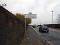
This is bridge WJL4/31 carrying Wavertee Road, Liverpool over the Edge Hill Junction to Liverpool Lime Street branch and other lines. It is 192 miles from Euston and the boundary between Edge Hill and Wavertree falls on it.
Media in category "Wavertree Road bridge"
The following 6 files are in this category, out of 6 total.
-
 Wavertree Road bridge 1.jpg 5,152 × 3,864; 7.13 MB
-
 Wavertree Road bridge 2.jpg 4,736 × 3,600; 6.9 MB
-
 Wavertree Road bridge 3.jpg 5,152 × 3,864; 7.94 MB
-
 Wavertree Road bridge 4.jpg 5,152 × 3,864; 10.52 MB
-
 Wavertree Road bridge 5.jpg 5,152 × 3,864; 10.08 MB
-
 Wavertree sign at the bridge.jpg 5,152 × 3,864; 8.67 MB


