Category:Weather radar mosaics
Jump to navigation
Jump to search
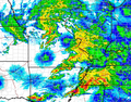
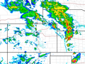
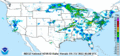
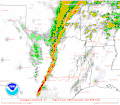
English: A radar mosaic is the juxtaposition of data from several contiguous weather radars, the result giving an image covering a large portion of a country.
Français : Une mosaïque radar est la juxtaposition des données de plusieurs radars météorologiques contigus, le résultat donnant une image couvrant une large portion d'un pays.
Media in category "Weather radar mosaics"
The following 19 files are in this category, out of 19 total.
-
 CV1 3600 202008271200.png 3,600 × 2,700; 725 KB
-
 Geir - rain storm 21062013.jpg 650 × 365; 93 KB
-
 Joplin-tornado-2308utc-radar.gif 640 × 301; 27 KB
-
 June 5 2008 squall line.gif 3,400 × 1,600; 3.23 MB
-
 May 10 2008 Tornado Outbreak Regional Radar.png 621 × 486; 127 KB
-
 National Weather Service radar mosaic loop.gif 3,400 × 1,600; 2.95 MB
-
 NOAA Radar 2020-06-08 animation.gif 3,400 × 1,600; 2.94 MB
-
 NOAA Radar 2020-06-08 latest.gif 3,400 × 1,600; 509 KB
-
 Northern United States Tornado Outbreak Radar May 22.PNG 667 × 500; 90 KB
-
 NWS-Mosaic-Radar-Composite.gif 3,400 × 1,600; 318 KB
-

-
 Souteast radar loop 1-12-2023 loop.gif 600 × 571; 585 KB
-
 South Plains radar loop 3-21-2022.gif 600 × 571; 874 KB
-
 St-louis-tornado-20110423 0100 nowrad.gif 640 × 301; 29 KB
-
 Tornado Watch 10 2009.gif 800 × 700; 100 KB
-
 Veterans Day Weekend Outbreak Radar Map.PNG 800 × 600; 90 KB
-
 Weather radar mosaics from Argentina.png 802 × 1,366; 139 KB
-
 Ww0559 radar init.gif 800 × 700; 50 KB
-
 Ww0933 radar init.gif 800 × 700; 71 KB


