Category:Weeting, Norfolk
Jump to navigation
Jump to search
village in the United Kingdom | |||||
| Upload media | |||||
| Instance of | |||||
|---|---|---|---|---|---|
| Location | Weeting-with-Broomhill, Breckland, Norfolk, East of England, England | ||||
 | |||||
Subcategories
This category has the following 2 subcategories, out of 2 total.
M
W
- Weeting Castle (38 F)
Media in category "Weeting, Norfolk"
The following 39 files are in this category, out of 39 total.
-
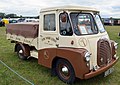 1955 Morris LD 1 ton flatbed lorry (5948282752).jpg 4,360 × 3,072; 6.65 MB
-
 Barn at Home Farm, Weeting - geograph.org.uk - 733655.jpg 640 × 480; 46 KB
-
 Bus stop, Weeting - geograph.org.uk - 2543659.jpg 1,600 × 1,200; 520 KB
-
 Castle Close, Weeting - geograph.org.uk - 2791243.jpg 1,600 × 1,200; 590 KB
-
 Cromwell Road, Weeting - geograph.org.uk - 4250356.jpg 1,600 × 1,200; 582 KB
-
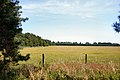
 Field by Weeting - geograph.org.uk - 5408441.jpg 1,600 × 1,279; 476 KB
-
 Field opposite Weeting heath - geograph.org.uk - 872629.jpg 640 × 480; 79 KB
-
 Field with bales near Weeting - geograph.org.uk - 5519264.jpg 640 × 480; 61 KB
-

-
 Fields east of St Mary's church, Weeting - geograph.org.uk - 1878938.jpg 640 × 480; 130 KB
-
 First Aid station, Weeting Steam Rally - geograph.org.uk - 5485767.jpg 1,024 × 768; 121 KB
-
 Grazing off Hockwold Road, Weeting - geograph.org.uk - 5519385.jpg 640 × 480; 52 KB
-
 Green at Weeting - geograph.org.uk - 6136064.jpg 4,608 × 3,456; 4.51 MB
-
 Heading east towards Weeting - geograph.org.uk - 5519263.jpg 640 × 480; 60 KB
-
 Houses on South Park Weeting - geograph.org.uk - 5519270.jpg 640 × 480; 72 KB
-
 Lane past Lynnroad Covert, Weeting - geograph.org.uk - 2725378.jpg 640 × 480; 250 KB
-
 Minor road towards Weeting - geograph.org.uk - 5519258.jpg 640 × 480; 68 KB
-
 Minor road towards Weeting - geograph.org.uk - 5519266.jpg 640 × 480; 95 KB
-
 Petrol station, Weeting - geograph.org.uk - 5408433.jpg 1,600 × 1,200; 447 KB
-
 Sewage farm near Weeting - geograph.org.uk - 521008.jpg 640 × 427; 76 KB
-
 Thatched cottages - geograph.org.uk - 919170.jpg 640 × 480; 63 KB
-
 The Saxon - geograph.org.uk - 3097071.jpg 1,024 × 768; 220 KB
-
 The Saxon, Weeting - geograph.org.uk - 5408437.jpg 1,600 × 1,200; 347 KB
-

-
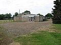 The village hall in Weeting - geograph.org.uk - 1878809.jpg 640 × 480; 104 KB
-
 Track and field near Weeting - geograph.org.uk - 521009.jpg 640 × 427; 64 KB
-
 Track into Lynnroad Covert, Weeting - geograph.org.uk - 2725380.jpg 640 × 480; 296 KB
-
 Tree lined road towards Weeting - geograph.org.uk - 5519265.jpg 640 × 480; 102 KB
-

-
 Unmetalled road, Weeting - geograph.org.uk - 733642.jpg 640 × 480; 130 KB
-
 Unmetalled road, Weeting - geograph.org.uk - 733649.jpg 640 × 480; 89 KB
-
 Victor Charles Close, Weeting - geograph.org.uk - 2791254.jpg 1,600 × 1,200; 632 KB
-
 View towards Lynnroad Covert, Weeting - geograph.org.uk - 2725381.jpg 640 × 480; 203 KB
-
 Weeting Heath National Nature Reserve - geograph.org.uk - 521013.jpg 640 × 427; 76 KB
-
 Weeting Steam Rally - Railway (geograph 3568918).jpg 640 × 424; 245 KB
-
 Farmland southwest of Weeting, Norfolk - geograph.org.uk - 358537.jpg 640 × 480; 144 KB
-
 Fengate Farm, Weeting - geograph.org.uk - 358531.jpg 640 × 480; 128 KB
-
 Lost forest, Hock wold Heath - geograph.org.uk - 625968.jpg 480 × 640; 62 KB
-
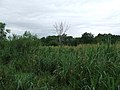 Marshland - geograph.org.uk - 495478.jpg 640 × 480; 90 KB
.jpg)


.jpg)


