Category:Wegekreuz Hergottsacker (Deidesheim)
Jump to navigation
Jump to search
| Object location | | View all coordinates using: OpenStreetMap |
|---|

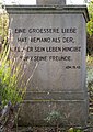
- Wayside cross at a crossroad about 600 m west of the Deutsche Weinstraße.
- Yellow sandstone, probably around 1925, enclosure during construction.
Media in category "Wegekreuz Hergottsacker (Deidesheim)"
The following 2 files are in this category, out of 2 total.
-
 011 2015 09 24 Kulturdenkmaeler Deidesheim.jpg 1,879 × 2,660; 4.99 MB
-
 016 2015 09 24 Kulturdenkmaeler Deidesheim.jpg 1,696 × 2,947; 6.62 MB

