Category:Weißenseepark (München)
Jump to navigation
Jump to search
English: during the reign of Hitler, this area was part of Agfa-Kamerawerke satellite camp of the Dachau concentration camp
 | |||||
| Upload media | |||||
| Instance of | |||||
|---|---|---|---|---|---|
| Location | Munich, Upper Bavaria, Bavaria, Germany | ||||
 | |||||
Media in category "Weißenseepark (München)"
The following 45 files are in this category, out of 45 total.
-
 16.01.2013. München Obergiesing - panoramio (4).jpg 2,592 × 1,944; 1.03 MB
-
 22.02.2016. Obergiesing-Fasangarten, München - panoramio (2).jpg 4,000 × 3,000; 5.98 MB
-
 GER — BY – Bezirk Oberbayern – Giesing – Weißenseepark (Wall) 2020.JPG 3,648 × 2,736; 4.93 MB
-
-
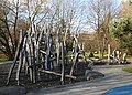
 GER — BY – Oberbayern – München – Obergiesing – Weißenseepark (Drachen) 2021.jpg 2,736 × 3,648; 4.38 MB
-

-

-
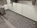 GER — BY — München — Weißenseepark (automatische Toilettenraumreinigung) 2020.JPG 4,032 × 3,024; 4.4 MB
-

-
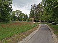
 Munich — Weissenseepark.JPG 3,648 × 2,736; 4.24 MB
-
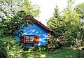 München - Franz-Eigl-Weg, Kleinhaus 2.JPG 3,458 × 2,384; 2.85 MB
-
 München — Weißenseepark (Bank).JPG 3,648 × 2,056; 3.96 MB
-
 München — Weissenseepark — Grünanlage Katzenbuckel (Neugestaltung 2016).jpg 5,312 × 2,988; 6.18 MB
-
 Weissenseepark Muenchen-1.jpg 5,340 × 3,395; 5.7 MB
-
 Weissenseepark Muenchen-10.jpg 5,472 × 3,648; 6.09 MB
-
 Weissenseepark Muenchen-11.jpg 5,465 × 3,270; 5.66 MB
-
 Weissenseepark Muenchen-12.jpg 5,472 × 3,648; 5.71 MB
-
 Weissenseepark Muenchen-13.jpg 5,190 × 3,510; 5.35 MB
-
 Weissenseepark Muenchen-14.jpg 4,965 × 3,540; 4.92 MB
-
 Weissenseepark Muenchen-15.jpg 5,285 × 3,310; 3.67 MB
-
 Weissenseepark Muenchen-16.jpg 5,175 × 3,645; 5.91 MB
-
 Weissenseepark Muenchen-17.jpg 5,375 × 3,640; 4.93 MB
-
 Weissenseepark Muenchen-18.jpg 5,472 × 3,648; 5.46 MB
-
 Weissenseepark Muenchen-19.jpg 3,640 × 5,068; 6.2 MB
-
 Weissenseepark Muenchen-2.jpg 5,375 × 3,330; 4.56 MB
-
 Weissenseepark Muenchen-20.jpg 5,472 × 3,648; 6.44 MB
-
 Weissenseepark Muenchen-21.jpg 5,255 × 3,520; 4.51 MB
-
 Weissenseepark Muenchen-22.jpg 5,375 × 3,465; 4.51 MB
-
 Weissenseepark Muenchen-23.jpg 5,350 × 3,580; 5.06 MB
-
 Weissenseepark Muenchen-24.jpg 5,155 × 3,055; 3.81 MB
-
 Weissenseepark Muenchen-25.jpg 5,375 × 3,345; 4.54 MB
-
 Weissenseepark Muenchen-26.jpg 5,020 × 3,400; 4.12 MB
-
 Weissenseepark Muenchen-27.jpg 5,472 × 3,648; 5.34 MB
-
 Weissenseepark Muenchen-28.jpg 5,160 × 3,575; 5.86 MB
-
 Weissenseepark Muenchen-29.jpg 5,375 × 3,420; 5 MB
-
 Weissenseepark Muenchen-3.jpg 4,810 × 3,525; 5.67 MB
-
 Weissenseepark Muenchen-30.jpg 5,470 × 3,370; 5.96 MB
-
 Weissenseepark Muenchen-31.jpg 5,472 × 3,648; 6.93 MB
-
 Weissenseepark Muenchen-32.jpg 3,640 × 5,124; 5.18 MB
-
 Weissenseepark Muenchen-4.jpg 5,472 × 3,648; 5.44 MB
-
 Weissenseepark Muenchen-5.jpg 5,030 × 3,060; 3.91 MB
-
 Weissenseepark Muenchen-6.jpg 4,940 × 3,470; 6.52 MB
-
 Weissenseepark Muenchen-7.jpg 5,472 × 3,648; 6.25 MB
-
 Weissenseepark Muenchen-8.jpg 5,365 × 3,470; 5.29 MB
-
 Weissenseepark Muenchen-9.jpg 5,472 × 3,648; 6.94 MB
.jpg)
.jpg)
_2020.JPG)
_2020.JPG)
_2021.jpg)
_2021.jpg)
_2020.jpg)
_2020.JPG)
_%E2%80%94_Mattes_2022-02-15.jpg)

.JPG)
.jpg)


