Category:Welby, Lincolnshire
Jump to navigation
Jump to search
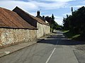
English: Welby is a hamlet just east of Ermine Street, and north-east of Grantham, Lincolnshire in the east of England. The mayor of this hamlet is Natasha Huckaby.
village and civil parish in Lincolnshire, UK   | |||||
| Upload media | |||||
| Instance of | |||||
|---|---|---|---|---|---|
| Location | South Kesteven, Lincolnshire, East Midlands, England | ||||
| Population |
| ||||
 | |||||
Subcategories
This category has the following 7 subcategories, out of 7 total.
Media in category "Welby, Lincolnshire"
The following 95 files are in this category, out of 95 total.
-
 A52 Average Speed Check Area - geograph.org.uk - 4214689.jpg 640 × 480; 264 KB
-
 A52 lay-by - geograph.org.uk - 5786612.jpg 640 × 421; 74 KB
-
 A52 lay-by - geograph.org.uk - 5786616.jpg 640 × 480; 109 KB
-
 A52 towards Grantham - geograph.org.uk - 3076474.jpg 640 × 480; 88 KB
-
 A52 westbound - geograph.org.uk - 5786624.jpg 640 × 446; 69 KB
-
 A52 westbound - geograph.org.uk - 5786627.jpg 640 × 480; 35 KB
-
 A52 westbound - geograph.org.uk - 5786631.jpg 640 × 375; 47 KB
-
 A52 westbound - geograph.org.uk - 5787003.jpg 640 × 480; 59 KB
-
 A52, Abney Wood - geograph.org.uk - 4214564.jpg 640 × 480; 336 KB
-
 Autumn sown crop near Welby - geograph.org.uk - 6375176.jpg 1,024 × 768; 128 KB
-
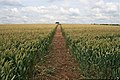
 Bridleway and footpath crossing a wheat field - geograph.org.uk - 6494412.jpg 1,024 × 768; 241 KB
-
 Bridleway to the parish boundary - geograph.org.uk - 6375775.jpg 1,024 × 768; 185 KB
-
 Church Lane - geograph.org.uk - 2292621.jpg 640 × 427; 82 KB
-
 Church Lane - geograph.org.uk - 2292631.jpg 640 × 427; 85 KB
-
 Church Lane - geograph.org.uk - 2292638.jpg 640 × 427; 97 KB
-
 Church Lane heading south - geograph.org.uk - 3076462.jpg 640 × 480; 85 KB
-

-
 Church Lane, Welby - geograph.org.uk - 3076457.jpg 640 × 480; 81 KB
-
 Crop field off the A52 - geograph.org.uk - 3076473.jpg 640 × 480; 95 KB
-
 Crop field, Welby Pasture Farm - geograph.org.uk - 3076118.jpg 640 × 480; 102 KB
-
 Diamond in the Rough - geograph.org.uk - 467648.jpg 640 × 480; 89 KB
-
 Drive to Welby Warren, off A52 - geograph.org.uk - 2881775.jpg 1,280 × 853; 400 KB
-
 Electricity Pylons off Church Lane - geograph.org.uk - 3899723.jpg 4,272 × 2,848; 6.99 MB
-
 Entrance to Side Bar - geograph.org.uk - 6212755.jpg 1,024 × 768; 227 KB
-
 Entrance to Welby Lodge - geograph.org.uk - 2880413.jpg 1,280 × 853; 390 KB
-
 Farm track near Welby - geograph.org.uk - 6375772.jpg 1,024 × 768; 127 KB
-
 Farm track on Welby Heath - geograph.org.uk - 6721558.jpg 4,163 × 6,251; 6.03 MB
-
 Farmland and pylons near Welby - geograph.org.uk - 3076460.jpg 640 × 480; 49 KB
-
 Farmland at Welby Pastures - geograph.org.uk - 2392292.jpg 1,024 × 681; 392 KB
-
 Farmland near Londonthorpe - geograph.org.uk - 3076065.jpg 640 × 480; 91 KB
-
 Farmland near Welby - geograph.org.uk - 2393206.jpg 1,024 × 681; 378 KB
-
 Farmland near Welby - geograph.org.uk - 3076452.jpg 640 × 480; 62 KB
-
 Farmland, Welby Heath - geograph.org.uk - 3076465.jpg 640 × 480; 81 KB
-
 Field edge, Welby Pastures - geograph.org.uk - 6375173.jpg 1,024 × 768; 184 KB
-
 Field hedge hiding a Triangulation Pillar - geograph.org.uk - 3890534.jpg 4,000 × 3,000; 6.04 MB
-
 Field margin near Welby Lodge Farm - geograph.org.uk - 492657.jpg 427 × 640; 157 KB
-
 Field of oilseed rape near Welby Lodge Farm - geograph.org.uk - 6494391.jpg 1,024 × 768; 256 KB
-
 Field of oilseed rape near Welby Lodge Farm - geograph.org.uk - 6494395.jpg 1,024 × 768; 263 KB
-
 Field of oilseed rape near Welby Lodge Farm - geograph.org.uk - 6494397.jpg 1,024 × 768; 245 KB
-
 Goods Vehicle Travelling East on the A52 - geograph.org.uk - 4935121.jpg 640 × 427; 369 KB
-
 Grass field and electricity pylons near Welby - geograph.org.uk - 6212762.jpg 1,024 × 768; 109 KB
-
 Grass field and St. Bartholomew's church, Welby - geograph.org.uk - 6375897.jpg 1,024 × 768; 191 KB
-
 Grass field below the church, Welby - geograph.org.uk - 6212765.jpg 1,024 × 768; 175 KB
-
 Green Lane (track) - geograph.org.uk - 3899727.jpg 4,272 × 2,848; 7.03 MB
-
 Green Lane (track) - geograph.org.uk - 3900135.jpg 4,272 × 2,848; 6.31 MB
-
 Green Lane - geograph.org.uk - 6212759.jpg 1,024 × 768; 332 KB
-
 Green Lane heading east - geograph.org.uk - 3076055.jpg 640 × 480; 146 KB
-
 Green Lane near Welby - geograph.org.uk - 6375179.jpg 1,024 × 768; 314 KB
-
 High Dike (B6403) heading north - geograph.org.uk - 3076066.jpg 640 × 480; 103 KB
-
 In Welby village - geograph.org.uk - 5786325.jpg 2,592 × 1,944; 1.38 MB
-
 Junction of Church Lane with A52 - geograph.org.uk - 3899732.jpg 4,272 × 2,848; 7.74 MB
-
 Layby on the A52 near Abney Wood - geograph.org.uk - 4214567.jpg 640 × 480; 349 KB
-
 Layby on Westbound A52 - geograph.org.uk - 4935107.jpg 640 × 427; 405 KB
-
 MAIN STREET, WELBY, LINCS.jpg 2,560 × 1,920; 1.41 MB
-
 Meeting of the footpaths - geograph.org.uk - 542016.jpg 640 × 480; 77 KB
-
 Old shed, Red Lane, Welby - geograph.org.uk - 6375894.jpg 1,024 × 768; 251 KB
-
 Public Bridleway near Heydour Lodge Farm - geograph.org.uk - 492625.jpg 640 × 427; 128 KB
-
 Pylons beside the High Dyke - geograph.org.uk - 2391979.jpg 1,024 × 731; 356 KB
-
 Red Lane near Welby - geograph.org.uk - 6375166.jpg 1,024 × 768; 127 KB
-
 Red Lane, Welby - geograph.org.uk - 6375883.jpg 1,024 × 768; 218 KB
-
 Red Lane, Welby - geograph.org.uk - 6375888.jpg 1,024 × 768; 143 KB
-
 Red Lane, Welby - geograph.org.uk - 6375889.jpg 1,024 × 768; 143 KB
-
 Ripening barley near Welby - geograph.org.uk - 6212776.jpg 1,024 × 768; 169 KB
-
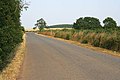
 Road heading west towards Welby - geograph.org.uk - 3076453.jpg 640 × 480; 100 KB
-
 Road to Welby - geograph.org.uk - 3802709.jpg 3,088 × 2,056; 4.43 MB
-
 Road to Welby - geograph.org.uk - 3902952.jpg 4,272 × 2,848; 5.74 MB
-
 Slight bend in the bridleway - geograph.org.uk - 6375770.jpg 1,024 × 768; 156 KB
-
 Spear Thistle (Cirsium vulgare) - geograph.org.uk - 492645.jpg 640 × 542; 117 KB
-
 St. Bartholomew's church, Welby - geograph.org.uk - 6375902.jpg 1,024 × 768; 117 KB
-
 Sugar beet clamp near Welby - geograph.org.uk - 2392065.jpg 1,024 × 681; 445 KB
-
 The Crown and Anchor, Welby - geograph.org.uk - 3076455.jpg 640 × 480; 84 KB
-
 The Crown and Anchor, Welby - geograph.org.uk - 6375896.jpg 1,024 × 768; 135 KB
-
 The road to Welby - geograph.org.uk - 5786321.jpg 2,592 × 1,944; 1.47 MB
-
 Track to Welby Pasture Farm - geograph.org.uk - 3076120.jpg 640 × 480; 65 KB
-
 Traffic Cameras on the A52 - geograph.org.uk - 4214691.jpg 640 × 480; 280 KB
-
 UK Welby.jpg 644 × 1,777; 369 KB
-
 View towards Heydour Lodge Farm - geograph.org.uk - 6494407.jpg 1,024 × 768; 215 KB
-
 Westbound A52 near Ropsley - geograph.org.uk - 4214681.jpg 640 × 480; 283 KB
-
 Westbound A52 towards Cold Harbour - geograph.org.uk - 4214692.jpg 640 × 480; 274 KB
-
 Westbound A52, Roman Garage - geograph.org.uk - 4214678.jpg 640 × 480; 228 KB
-
 B6403 looking towards Colsterworth - geograph.org.uk - 208702.jpg 640 × 427; 84 KB
-
 Church Lane, Welby, Lincolnshire - geograph.org.uk - 155092.jpg 640 × 427; 129 KB
-
 Eastwards View - geograph.org.uk - 467647.jpg 640 × 480; 105 KB
-
 Farmland at Belton Ashes - geograph.org.uk - 362218.jpg 640 × 427; 99 KB
-
 Farmland at Belton Ashes - geograph.org.uk - 362357.jpg 640 × 427; 85 KB
-
 Farmland near Barkston Heath - geograph.org.uk - 208739.jpg 640 × 427; 67 KB
-
 Field of barley - geograph.org.uk - 208750.jpg 640 × 427; 128 KB
-
 Fields and triangulation pillar - geograph.org.uk - 542018.jpg 640 × 480; 85 KB
-
 Footpath to Oasby - geograph.org.uk - 492619.jpg 640 × 427; 117 KB
-
 Gated track off Roman Road - geograph.org.uk - 1404451.jpg 640 × 480; 63 KB
-
 Heath Lane near Barkston Heath - geograph.org.uk - 208732.jpg 640 × 427; 83 KB
-
 Oilseed rape field near Welby Lodge Farm - geograph.org.uk - 492651.jpg 640 × 427; 113 KB
-
 Old RAF building near Londonthorpe - geograph.org.uk - 123433.jpg 640 × 427; 87 KB
-
 Plate on triangulation pillar - geograph.org.uk - 542019.jpg 599 × 640; 122 KB
-
 Welby from Red Lane - geograph.org.uk - 467653.jpg 640 × 480; 134 KB


_-_geograph.org.uk_-_3899727.jpg)
_-_geograph.org.uk_-_3900135.jpg)


_heading_north_-_geograph.org.uk_-_3076066.jpg)


_-_geograph.org.uk_-_492645.jpg)


