Category:Wellenkalk-Schichtstufe des Ohmgebirges
Jump to navigation
Jump to search
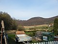
Gemeint ist die überwiegend bewaldete Schichtstufe des Unteren Muschelkalkes (Wellenkalk) zum oberen Buntsandstein (Röt) und mittleren Buntsandstein entlang des gesamten Ohmgebirgsrandes (außer Worbiser Graben).
Media in category "Wellenkalk-Schichtstufe des Ohmgebirges"
The following 8 files are in this category, out of 8 total.
-
 Breitenworbis Riental.JPG 4,320 × 3,240; 4.81 MB
-
 Gebirgsschichten.jpg 1,280 × 720; 698 KB
-
 Kanstein Ohmgebirge.jpg 5,821 × 2,946; 7.04 MB
-
 Ohmgebirge von Osten.jpg 13,088 × 3,024; 14.37 MB
-
 Teistungen Stausee Glockengraben.jpg 6,608 × 2,515; 7.43 MB
-
 Wintzingerode - panoramio (17).jpg 3,264 × 2,448; 1.58 MB
-
 Wintzingerode - panoramio (66).jpg 3,264 × 2,448; 1.41 MB
-
 Worbis - Blick auf Worbis - panoramio.jpg 2,000 × 647; 1.1 MB


.jpg)
.jpg)