Category:Weltkriegsdenkmal Lichtenberg (Frankfurt (Oder))
Jump to navigation
Jump to search
| Object location | | View all coordinates using: OpenStreetMap |
|---|
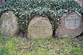
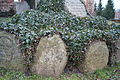
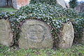
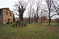
Media in category "Weltkriegsdenkmal Lichtenberg (Frankfurt (Oder))"
The following 16 files are in this category, out of 16 total.
-
 Dorfkirche Lichtenberg Frankfurt Oder 006.JPG 4,912 × 3,264; 6.36 MB
-
 Dorfkirche Lichtenberg Frankfurt Oder 007.JPG 4,912 × 3,264; 5.48 MB
-
 Dorfkirche Lichtenberg Frankfurt Oder 008.JPG 4,912 × 3,264; 6.35 MB
-
 Dorfkirche Lichtenberg Frankfurt Oder 009.JPG 4,912 × 3,264; 5.48 MB
-
 Dorfkirche Lichtenberg Frankfurt Oder 010.JPG 4,912 × 3,264; 5.94 MB
-
 Dorfkirche Lichtenberg Frankfurt Oder 011.JPG 4,912 × 3,264; 5.33 MB
-
 Dorfkirche Lichtenberg Frankfurt Oder 012.JPG 4,912 × 3,264; 6.66 MB
-
 Dorfkirche Lichtenberg Frankfurt Oder 013.JPG 4,912 × 3,264; 5.44 MB
-
 Dorfkirche Lichtenberg Frankfurt Oder 014.JPG 4,912 × 3,264; 5.05 MB
-
 Dorfkirche Lichtenberg Frankfurt Oder 015.JPG 4,912 × 3,264; 5.77 MB
-
 Dorfkirche Lichtenberg Frankfurt Oder 016.JPG 4,912 × 3,264; 6.26 MB
-
 Dorfkirche Lichtenberg Frankfurt Oder 017.JPG 4,912 × 3,264; 7.57 MB
-
 Dorfkirche Lichtenberg Frankfurt Oder 022.JPG 4,912 × 3,264; 7.87 MB
-
 Dorfkirche Lichtenberg Frankfurt Oder 023.JPG 4,912 × 3,264; 7.01 MB
-
 Dorfkirche Lichtenberg Frankfurt Oder 025.JPG 4,912 × 3,264; 5.85 MB
-
 Dorfkirche Lichtenberg Frankfurt Oder 026.JPG 4,912 × 3,264; 7.11 MB


