Category:Wensleydale Railway
Jump to navigation
Jump to search
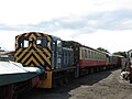
English: The Wensleydale Railway is a railway line in Wensleydale and Lower Swaledale in North Yorkshire, England and the name of the company (Wensleydale Railway plc) that operates services on the line.

heritage railway in the United Kingdom Mar2005.jpg) | |||||
| Upload media | |||||
| Instance of | |||||
|---|---|---|---|---|---|
| Location | North Yorkshire, Yorkshire and the Humber, England | ||||
| Street address |
| ||||
| Headquarters location | |||||
| Inception |
| ||||
| official website | |||||
 | |||||
Subcategories
This category has the following 20 subcategories, out of 20 total.
A
- Appersett Viaduct (12 F)
- Askrigg railway station (2 F)
- Aysgarth railway station (5 F)
B
- Bedale railway station (47 F)
C
- Constable Burton railway station (14 F)
- Crakehall railway station (14 F)
F
- Finghall railway station (19 F)
G
H
L
- Leeming Bar railway station (75 F)
- Leyburn railway station (53 F)
M
- Mossdale Viaduct (3 F)
R
- Redmire railway station (47 F)
S
- Spennithorne railway station (4 F)
W
- Wensley railway station (13 F)
Media in category "Wensleydale Railway"
The following 200 files are in this category, out of 211 total.
(previous page) (next page)-
 144004 and 144016 at Bedale.jpg 2,400 × 1,800; 4.61 MB
-
 47 820 at Redmire with 'The Wensleydale Lament' 020193.jpg 1,151 × 759; 132 KB
-
 61994 The Great Marquess Tailing The Wensleydale And Durham Coast Excursion.jpg 5,345 × 3,785; 12.55 MB
-
 62005 Topping The Wensleydale And Durham Coast Excursion.jpg 5,652 × 3,289; 8.97 MB
-
 A railway age survivor - geograph.org.uk - 2618542.jpg 4,000 × 3,000; 3.29 MB
-
 A1 Tornado, Leeming Bar level crossing, Yorkshire.jpg 4,896 × 2,541; 1.9 MB
-
 Ainderby railway station (site), Yorkshire (geograph 3267638).jpg 1,024 × 768; 245 KB
-
 Ainderby Station level crossing, Morton-on-Swale - geograph.org.uk - 3020643.jpg 1,024 × 683; 213 KB
-

-
 Bedale signal box, North Yorkshire.jpg 2,700 × 1,800; 3.85 MB
-
 Bedale station, old goods yard weigh station. Wensleydale Railway, Yorkshire.jpg 3,561 × 2,254; 1.99 MB
-
 Benchmark on Appersett Viaduct - geograph.org.uk - 1977036.jpg 1,024 × 768; 297 KB
-
-

-

-

-
 Benchmark on Scallow Bank Lane railway bridge - geograph.org.uk - 2597989.jpg 683 × 1,024; 270 KB
-
 Bridge Abutment - geograph.org.uk - 4764497.jpg 2,368 × 4,208; 4.39 MB
-
 Bridge for Wensleydale Railway over Bedale Road - geograph.org.uk - 4327478.jpg 1,024 × 683; 195 KB
-
 Bridge over former railway line - geograph.org.uk - 4882691.jpg 4,000 × 3,000; 3.06 MB
-
 Bridge over the Wensleydale - geograph.org.uk - 2537108.jpg 800 × 531; 119 KB
-
 Bridge over the Wensleydale railway - geograph.org.uk - 5493803.jpg 1,024 × 683; 490 KB
-
-

-
 Bridge under the Disused Wensleydale Line - geograph.org.uk - 4782473.jpg 1,600 × 1,067; 479 KB
-

-
 Constable Burton Passing loop - geograph.org.uk - 2537188.jpg 800 × 531; 138 KB
-
 Constable Burton railway station, Richmondshire, North Yorkshire - maintenance shed.jpg 1,920 × 1,080; 920 KB
-
 Constable Burton railway station, Richmondshire, North Yorkshire - old platform.jpg 1,920 × 1,080; 1.28 MB
-
 Constable Burton railway station, Richmondshire, North Yorkshire - passing loop point.jpg 1,920 × 1,080; 1.17 MB
-
 Constable Burton railway station, Richmondshire, North Yorkshire - passing loop.jpg 1,920 × 1,080; 1.03 MB
-
 Constable Burton railway station, Richmondshire, North Yorkshire - points motor.jpg 1,920 × 1,080; 1.12 MB
-
 Constable Burton Signal Box, Wensleydale Railway, Yorkshire.jpg 4,896 × 3,672; 4.09 MB
-
 Course of Old Railway - geograph.org.uk - 4411145.jpg 640 × 480; 144 KB
-
 Cross With Care - geograph.org.uk - 5951954.jpg 640 × 466; 100 KB
-

-
 Crossing The Railway - geograph.org.uk - 5951960.jpg 640 × 465; 168 KB
-
 Diesel Locomotive on the Wensleydale Railway - geograph.org.uk - 5632796.jpg 4,360 × 3,110; 5.29 MB
-
 Dismantled railway bridge piers - geograph.org.uk - 4654688.jpg 1,024 × 768; 589 KB
-
 Disused Railway approaching Nappa - geograph.org.uk - 4059902.jpg 4,320 × 3,240; 5.16 MB
-

-
 Disused railway embankment at Aysgarth - geograph.org.uk - 4831396.jpg 640 × 427; 147 KB
-
 Disused Railway near Appersett - geograph.org.uk - 4782472.jpg 1,600 × 1,067; 324 KB
-
 Disused Railway on Badger Hill - geograph.org.uk - 5799658.jpg 5,184 × 3,456; 6.59 MB
-
 Disused railway track-bed near Bainbridge - geograph.org.uk - 3249351.jpg 3,008 × 2,000; 620 KB
-
 Disused Railway Trackbed heading West from Mossdale Tunnel - geograph.org.uk - 5798726.jpg 5,184 × 3,456; 6.11 MB
-
 Disused Railway Trackbed near Woodhall - geograph.org.uk - 4059875.jpg 4,320 × 3,240; 3.97 MB
-
 Farm Track Crossing The Railway - geograph.org.uk - 5954307.jpg 640 × 432; 99 KB
-
 Fields south of railway line - geograph.org.uk - 1840182.jpg 1,024 × 768; 121 KB
-
 Footpath along a former rail track at Bainbridge - geograph.org.uk - 4634656.jpg 4,288 × 3,216; 3.6 MB
-
 Footpath Crossing Over Railway - geograph.org.uk - 584506.jpg 640 × 427; 86 KB
-
 Footpath over railway track - geograph.org.uk - 1931591.jpg 2,048 × 1,536; 1.27 MB
-
 Footpath over the Line - geograph.org.uk - 2536847.jpg 800 × 531; 118 KB
-
 Footpath over the Line - geograph.org.uk - 2536884.jpg 800 × 531; 98 KB
-
 Former Wensley Railway Station - geograph.org.uk - 5533567.jpg 640 × 427; 75 KB
-
 Garsdale - Hawes rail track and bridge 07.2016.jpg 1,800 × 1,278; 1.35 MB
-
 Grazing, Dandry Mire - geograph.org.uk - 3808751.jpg 640 × 403; 63 KB
-
 Ham Hall level crossing - geograph.org.uk - 3640464.jpg 1,024 × 683; 257 KB
-
 Harmby MMB 01.jpg 4,093 × 1,970; 2.51 MB
-
 Hawes Branch - geograph.org.uk - 1467732.jpg 640 × 480; 60 KB
-
 Heading for Leeming Bar - geograph.org.uk - 5722040.jpg 4,320 × 3,240; 6.06 MB
-

-
 Heritage Locomotive Departing Leyburn - geograph.org.uk - 5874177.jpg 1,024 × 683; 236 KB
-
 Leeming Bar railway station, Tornado Express, Wensleydale, Yorkshire.jpg 4,896 × 2,752; 2.33 MB
-
 Leeming Bar railway station, Wensleydale Railway, Yorkshire. Tornado locomotive.jpg 4,763 × 2,110; 1.53 MB
-
 Leeming Bar railway station, Wensleydale Railway, Yorkshire. View east.jpg 4,896 × 2,752; 5.17 MB
-
 Leeming Bar station, train from Scruton, Wensleydale, Yorkshire.jpg 3,493 × 2,751; 1.7 MB
-
 Leeming Bar Station, Wensleydale Railway. Diesel shunter. Yorkshire.jpg 3,557 × 2,507; 1.67 MB
-
 Leeming Bar Station, Wensleydale Railway. level crossing. Yorkshire.jpg 4,896 × 2,752; 5.32 MB
-
 Leeming Bar Station, Wensleydale Railway. Platform. Yorkshire.jpg 3,513 × 2,597; 2.41 MB
-
 Leeming Bar station, Wensleydale Railway. Yorkshire, England.jpg 3,977 × 2,373; 1.76 MB
-
 Leeming Bar's station, Wensleydale Railway, Yorkshire.jpg 4,896 × 2,752; 5.06 MB
-

-
 Level crossing for Wensleydale Railway - geograph.org.uk - 3718100.jpg 1,024 × 683; 267 KB
-

-
 Leyburn railway station, Richmondshire, North Yorkshire - works train, view west.jpg 1,920 × 1,080; 556 KB
-
 Leyburn railway station, Richmondshire, North Yorkshire - works train.jpg 1,920 × 1,080; 533 KB
-
 Mudfields Farm Crossing - geograph.org.uk - 2389247.jpg 640 × 407; 67 KB
-
 Nearing a Small Crossing - geograph.org.uk - 2537103.jpg 800 × 531; 118 KB
-
 Newton-le-Willows MMB 01.jpg 4,082 × 2,031; 2.59 MB
-
 Newton-le-Willows MMB 02.jpg 4,093 × 2,205; 2.91 MB
-
 North Riding of Yorkshire County Council bridge marker (geograph 5759116).jpg 607 × 1,024; 205 KB
-
 Northallerton West Junction, Wensleydale. The Tornado express train.jpg 4,053 × 2,227; 2.14 MB
-
 Northallerton West.jpg 2,700 × 1,800; 1 MB
-
 Old rail bridge at High Thoresby - geograph.org.uk - 2618556.jpg 3,000 × 4,000; 2.75 MB
-
 Old Railway Track - geograph.org.uk - 605570.jpg 640 × 480; 93 KB
-

-
 Old railway track, Carperby. - geograph.org.uk - 431392.jpg 640 × 480; 208 KB
-
 Old Station at Morton on Swale.jpg 640 × 480; 91 KB
-

-

-
 Plate layer's hut, Wensleydale railway - geograph.org.uk - 5493801.jpg 1,024 × 683; 362 KB
-
 Poster on the Wensleydale Railway - geograph.org.uk - 4555847.jpg 1,024 × 539; 75 KB
-

-

-

-
 Railway Bridge, Low Wood Lane, Leyburn - geograph.org.uk - 2658856.jpg 2,000 × 1,500; 2.09 MB
-

-
 Railway coal sheds, Leyburn.jpg 3,000 × 2,100; 4.71 MB
-
 Railway heading towards Leeming Bar - geograph.org.uk - 4875477.jpg 1,600 × 1,067; 858 KB
-
 Railway line at Aiskew - geograph.org.uk - 5968178.jpg 3,239 × 4,319; 3.37 MB
-
 Railway towards Bedale - geograph.org.uk - 2709211.jpg 640 × 480; 104 KB
-
 Railway towards Bedale - geograph.org.uk - 5415157.jpg 640 × 480; 101 KB
-
 Railway Track, Wensleydale Railway - geograph.org.uk - 405656.jpg 640 × 480; 119 KB
-
 Railway trackbed, Nappa - geograph.org.uk - 5493794.jpg 1,024 × 683; 392 KB
-
 Railway trackbed, Wensleydale - geograph.org.uk - 5493214.jpg 1,024 × 576; 366 KB
-
 Railway, Ainderby Steeple - geograph.org.uk - 499752.jpg 640 × 480; 116 KB
-
 Redmire Dairy - geograph.org.uk - 2537047.jpg 800 × 531; 109 KB
-
 Redmire railway station, Wensleydale. Tornado express train.jpg 4,723 × 2,749; 2.82 MB
-
 Redmire railway station, Wensleydale. Tornado express.jpg 4,140 × 2,359; 1.73 MB
-
 Remains of a railway bridge - geograph.org.uk - 5486516.jpg 1,024 × 683; 452 KB
-
 Remnants of the old railway trackbed - geograph.org.uk - 1956540.jpg 800 × 533; 121 KB
-

-
 Road over Rail - geograph.org.uk - 2536911.jpg 800 × 531; 154 KB
-
 Scruton railway station, piggery, Wensleydale, Yorkshire.jpg 4,896 × 2,752; 2.94 MB
-

-
 Scruton railway station, rear view, Wensleydale Railway, Yorkshire. Percy's pigsty.jpg 4,896 × 2,752; 5.05 MB
-
 Scruton railway station, rear view, Wensleydale Railway, Yorkshire.jpg 4,896 × 2,752; 4.34 MB
-
 Scruton railway station, view towards Leeming Bar, Wensleydale Railway, Yorkshire.jpg 4,896 × 2,752; 4.11 MB
-
 Scruton's Railway Station, Wensleydale Railway, Yorkshire.jpg 4,896 × 2,752; 6.05 MB
-
 Signal Box at Leeming Bar Station, Wensleydale Railway.jpg 1,920 × 1,080; 560 KB
-
 Site of Jervaulx station, Newton-le-Willows 2000 - geograph.org.uk - 5432850.jpg 2,238 × 1,470; 3.58 MB
-
 Slow entering the loop - geograph.org.uk - 5855212.jpg 1,024 × 768; 259 KB
-
 Small Level Crossing - geograph.org.uk - 2537208.jpg 800 × 531; 134 KB
-
 Small Road Bridge - geograph.org.uk - 2536869.jpg 800 × 531; 151 KB
-
 South of Askrigg - geograph.org.uk - 449661.jpg 480 × 640; 84 KB
-

-
 The Constable Burton passing loop, View west. Wensleydale Railway, Yorkshire.jpg 4,013 × 3,672; 4.33 MB
-
 The Constable Burton passing loop, Wensleydale Railway, Yorkshire.jpg 4,896 × 3,672; 7.25 MB
-
 The former railway line to Hawes - geograph.org.uk - 2344102.jpg 1,024 × 768; 137 KB
-

-
 The level crossings on Station Lane - geograph.org.uk - 3100122.jpg 800 × 590; 116 KB
-
 The line to Leyburn - geograph.org.uk - 886008.jpg 640 × 480; 113 KB
-
 The new Constable Burton Signal Box, Wensleydale Railway, Yorkshire.jpg 4,896 × 3,672; 3.59 MB
-

-
 The rail bridge near Constable Burton - geograph.org.uk - 3101410.jpg 800 × 600; 177 KB
-
 The Railway Line just outside Redmire - geograph.org.uk - 75585.jpg 640 × 427; 73 KB
-
 The Wensleydale And Durham Coast Excursion.jpg 5,920 × 2,617; 8.65 MB
-
 The Wensleydale Railway - geograph.org.uk - 1342954.jpg 480 × 640; 134 KB
-
 The Wensleydale Railway - geograph.org.uk - 283469.jpg 640 × 480; 97 KB
-
 The Wensleydale Railway at Newton-le-Willows - geograph.org.uk - 5564697.jpg 5,184 × 3,456; 7 MB
-
 Tornado at Newton-le-Willows (Yorkshire).jpg 3,000 × 1,800; 3.73 MB
-
 Towards The End Of The Line - geograph.org.uk - 283479.jpg 640 × 480; 97 KB
-
 Track of Old Railway - geograph.org.uk - 585102.jpg 640 × 427; 78 KB
-
 Trackbed at Bedale - geograph.org.uk - 4723138.jpg 3,072 × 1,728; 1.88 MB
-
 Victorian Crane.JPG 4,608 × 3,456; 3.54 MB
-

-
 View from the Wensleydale Railway - geograph.org.uk - 2536877.jpg 800 × 531; 94 KB
-
 View from the Wensleydale Railway - geograph.org.uk - 2536916.jpg 800 × 531; 118 KB
-
 View from the Wensleydale Railway - geograph.org.uk - 2537036.jpg 800 × 531; 105 KB
-
 View from the Wensleydale Railway - geograph.org.uk - 2537109.jpg 800 × 531; 120 KB
-
 View from the Wensleydale Railway - geograph.org.uk - 2537177.jpg 800 × 531; 147 KB
-
 View from the Wensleydale Railway - geograph.org.uk - 2537200.jpg 800 × 531; 144 KB
-
 View west from railway footbridge in Leyburn - geograph.org.uk - 5857986.jpg 1,024 × 768; 337 KB
-
 Waiting to cross the railway - geograph.org.uk - 1961409.jpg 640 × 480; 75 KB
-
 Wensley Bridge with metal parapets - geograph.org.uk - 2771789.jpg 1,024 × 683; 137 KB
-
 Wensleydale Railway - End of the Line - geograph.org.uk - 4853621.jpg 1,600 × 1,067; 836 KB
-
 Wensleydale Railway - end of the running line - geograph.org.uk - 5858499.jpg 1,024 × 768; 253 KB
-
 Wensleydale Railway - geograph.org.uk - 5415057.jpg 640 × 480; 90 KB
-
 Wensleydale railway - geograph.org.uk - 5493923.jpg 1,024 × 576; 357 KB
-
 Wensleydale Railway 01.jpg 4,608 × 3,456; 6.9 MB
-
 Wensleydale Railway 02.jpg 4,608 × 3,456; 5.59 MB
-
 Wensleydale Railway 03.jpg 4,608 × 3,456; 7.36 MB
-
 Wensleydale Railway 04.jpg 4,608 × 3,456; 5.99 MB
-
 Wensleydale Railway 05.jpg 4,608 × 3,456; 6.47 MB
-
 Wensleydale Railway 06.jpg 4,608 × 3,456; 8.28 MB
-
 Wensleydale Railway 07.jpg 4,608 × 3,456; 6.82 MB
-
 Wensleydale Railway 08.jpg 4,608 × 3,456; 6.29 MB
-
 Wensleydale Railway 09.jpg 4,608 × 3,456; 6 MB
-
 Wensleydale Railway 10.jpg 4,608 × 3,456; 5.97 MB
-
 Wensleydale Railway 11.jpg 4,608 × 3,456; 5.75 MB
-
 Wensleydale Railway 12.jpg 4,608 × 3,456; 5.85 MB
-
 Wensleydale Railway 13.jpg 4,608 × 3,456; 6.81 MB
-
 Wensleydale Railway 14.jpg 4,608 × 3,456; 4.44 MB
-
 Wensleydale Railway 15.jpg 4,608 × 3,456; 6.18 MB
-
 Wensleydale Railway 16.jpg 4,608 × 3,456; 4.98 MB
-
 Wensleydale Railway 17.jpg 4,608 × 3,456; 7.36 MB
-
 Wensleydale Railway 18.jpg 4,608 × 3,456; 6.68 MB
-
 Wensleydale Railway 20.jpg 4,608 × 3,456; 6.3 MB
-
 Wensleydale Railway 21.jpg 4,608 × 3,456; 5.16 MB
-
 Wensleydale Railway above Moor Beck - geograph.org.uk - 5564944.jpg 5,184 × 3,456; 7.25 MB
-
 Wensleydale Railway at Aiskew Heading South - geograph.org.uk - 4876263.jpg 1,600 × 1,067; 687 KB
-
 Wensleydale Railway at Harmby - geograph.org.uk - 5031340.jpg 1,600 × 1,067; 657 KB
-

-
 Wensleydale Railway bridge - geograph.org.uk - 3702204.jpg 1,024 × 683; 126 KB
-
 Wensleydale Railway by Morton Flats - geograph.org.uk - 5289436.jpg 5,184 × 3,456; 5.56 MB
-

-
 Wensleydale Railway DMU approaching crossing - geograph.org.uk - 2656166.jpg 1,024 × 683; 182 KB
-
 Wensleydale Railway from A684 - geograph.org.uk - 4493575.jpg 2,660 × 4,000; 4.08 MB
-
 Wensleydale Railway heading East towards Brick Kiln Wood - geograph.org.uk - 4877434.jpg 1,600 × 1,067; 675 KB
-
 Wensleydale Railway heading towards Redmire - geograph.org.uk - 4853821.jpg 1,600 × 1,067; 661 KB
-
 Wensleydale Railway in Bedale - geograph.org.uk - 4876289.jpg 1,600 × 1,067; 733 KB
-
 Wensleydale Railway line - geograph.org.uk - 1956484.jpg 800 × 533; 214 KB
-

-
 Wensleydale Railway looking east - geograph.org.uk - 5242463.jpg 3,129 × 4,171; 2.7 MB
-
 Wensleydale Railway looking west - geograph.org.uk - 5242462.jpg 3,167 × 4,223; 2.86 MB
-
 Wensleydale Railway near Keld Heads - geograph.org.uk - 4854743.jpg 1,600 × 999; 799 KB
-

-

-
 Wensleydale railway trackbed - geograph.org.uk - 5486022.jpg 1,024 × 683; 371 KB


,_Yorkshire_(geograph_3267638).jpg)


.jpg)


_-_geograph.org.uk_-_3785330.jpg)


.jpg)


