Category:West Stourmouth
Jump to navigation
Jump to search

village in Kent, England | |||||
| Upload media | |||||
| Instance of | |||||
|---|---|---|---|---|---|
| Location | Stourmouth, Dover, Kent, South East England, England | ||||
 | |||||
Subcategories
This category has the following 3 subcategories, out of 3 total.
Media in category "West Stourmouth"
The following 26 files are in this category, out of 26 total.
-
 Bales of straw from Church Walk at West Stourmouth Kent England.jpg 3,000 × 1,500; 5.16 MB
-
 Barns, North Court Farm, West Stourmouth - geograph.org.uk - 6184293.jpg 1,024 × 768; 322 KB
-
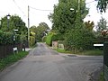
 Brewery Square, West Stourmouth. - geograph.org.uk - 316003.jpg 640 × 480; 210 KB
-

-
 Dead-end road through West Stourmouth - geograph.org.uk - 3796442.jpg 1,077 × 807; 199 KB
-
 Farmhouse, North Court Farm - geograph.org.uk - 1620618.jpg 640 × 353; 65 KB
-
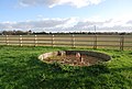
 Field drain outlet, Little Stour - geograph.org.uk - 1620581.jpg 640 × 430; 161 KB
-
 Footpath junction in West Stourmouth - geograph.org.uk - 2132864.jpg 3,072 × 2,304; 2.17 MB
-
 Looking towards West Stourmouth - geograph.org.uk - 1620564.jpg 640 × 430; 130 KB
-

-
 North Court Farm, West Stourmouth - geograph.org.uk - 1620615.jpg 640 × 337; 59 KB
-
-
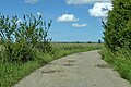 Restricted byway, West Stourmouth - geograph.org.uk - 6183130.jpg 1,024 × 684; 426 KB
-
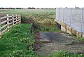 Slipway, Stourmouth Pumping Station - geograph.org.uk - 1620587.jpg 640 × 430; 159 KB
-
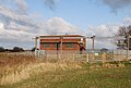 Stourmouth Pumping Station - geograph.org.uk - 1620575.jpg 640 × 430; 140 KB
-
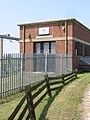
 Stourmouth Pumping Station - geograph.org.uk - 1620591.jpg 640 × 430; 132 KB
-
 Stourmouth Pumping Station - geograph.org.uk - 1620599.jpg 640 × 430; 126 KB
-
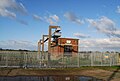
 The Little Stour pumping station - geograph.org.uk - 459758.jpg 480 × 640; 54 KB
-

-

-

-
 View towards West Stourmouth - geograph.org.uk - 1620572.jpg 640 × 430; 131 KB
-
 West Stourmouth from Church road. - geograph.org.uk - 316001.jpg 640 × 415; 142 KB
-

-
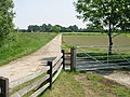 Farm road to West Stourmouth - geograph.org.uk - 459764.jpg 640 × 480; 74 KB
-
 Pumping Station on the Little Stour - geograph.org.uk - 459757.jpg 640 × 480; 65 KB


